
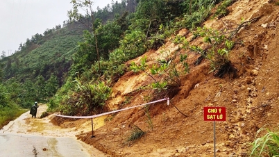
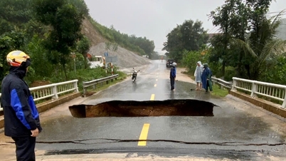
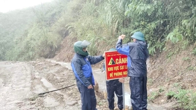
Specifically, in Tay Giang commune: Traffic routes at Km23+480 of DT.606 road experienced landslides on the roadbed and subsidence of the roadbed from Km23+454 - Km23+497 (about 43m long). The People's Committee of the commune issued a notice to inform people to be proactive when traveling through this road section and organized temporary repairs to ensure traffic.

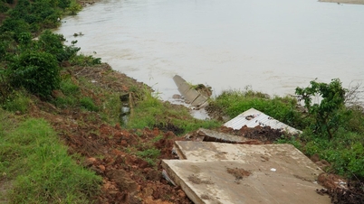
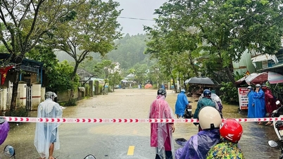
- In Hoi An Tay ward: Total length of landslide is more than 3 km of coastline, seawater intrusion is 7-10m deep, some sections are eroding nearly 25-30m deep, threatening the residential area inside.
Hoi An Tay Ward People's Committee reported to the City People's Committee to ask for direction on temporarily embanking the landslide area and plans to relocate about 30 business households and 1 affected household when the landslide situation becomes complicated.

- In Hoi An Dong ward: Coastal erosion (Phuoc Tan group): Section without soft embankment: 200m (3-5m wide); Section with soft embankment: 250m (3-5m wide). Damaged concrete road on De Vong dike (Thanh Tay group): 700m.
- In Phu Ninh commune: Road DH4 was damaged at some key locations: landslides, damage to the negative slope at 2 locations in Phuoc Bac village; subsidence at Vuc Voi bridge (An Lau village).
- In Ha Nha commune: Landslide of embankment at Truong An Memorial Temple, Truong An village, total landslide area 60m2
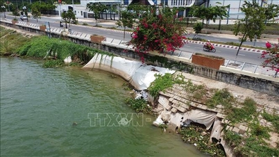
- In Que Son commune: 35m of embankment was eroded (stone embankment and concrete embankment of the drainage ditch around the lake of the Water Park); 100m of road from DT611 to TDC No. 6, Xuan Que village was eroded and damaged.
- In Thuong Duc commune: The right bank of the Con River was eroded, directly affecting 4 households in Group 5, Tan Ha village. The commune People's Committee has a plan to evacuate households from the danger zone when a natural disaster occurs.
- In Hai Chau ward: Some sections of the embankment on Nhu Nguyet street are damaged.
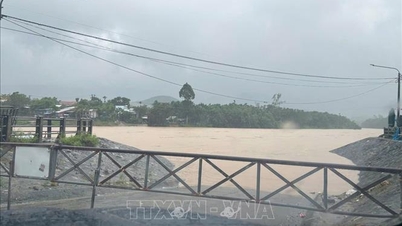
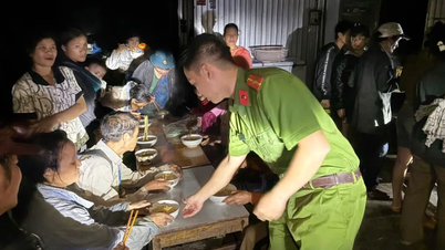
The City Department of Construction informed about damage on some traffic routes under its management.
National highways: National Highway 14B: Positive slope landslide at Km1+300 (left route) caused trench filling, volume of about 30m3
+ National Highway 40B: Subsidence, broken culvert segment downstream, damaged downstream culvert at Km72+585 and landslide of positive slope at Km121+850 (left route), volume of about 500m3

- Provincial roads: Provincial Road 606: Positive slope landslide at Km65+100 (second landslide), volume of about 600m3
- Inland waterway: West coastal route of Cu Lao Cham island: Broken warning signs, damaged foundation pits.
Source: https://baodanang.vn/nhieu-thiet-hai-do-mua-lon-tren-dia-ban-thanh-pho-da-nang-3308356.html


![[Photo] General Secretary To Lam received the delegation attending the international conference on Vietnam studies](https://vphoto.vietnam.vn/thumb/1200x675/vietnam/resource/IMAGE/2025/10/26/1761456527874_a1-bnd-5260-7947-jpg.webp)
![[Photo] Enjoy the Liuyang Fireworks Festival in Hunan, China](https://vphoto.vietnam.vn/thumb/1200x675/vietnam/resource/IMAGE/2025/10/26/1761463428882_ndo_br_02-1-my-1-jpg.webp)
![[Photo] Nhan Dan Newspaper displays and solicits comments on the Draft Documents of the 14th National Party Congress](https://vphoto.vietnam.vn/thumb/1200x675/vietnam/resource/IMAGE/2025/10/26/1761470328996_ndo_br_bao-long-171-8916-jpg.webp)


![[Photo] Prime Minister Pham Minh Chinh attends the opening of the 47th ASEAN Summit](https://vphoto.vietnam.vn/thumb/1200x675/vietnam/resource/IMAGE/2025/10/26/1761452925332_c2a-jpg.webp)


Comment (0)