
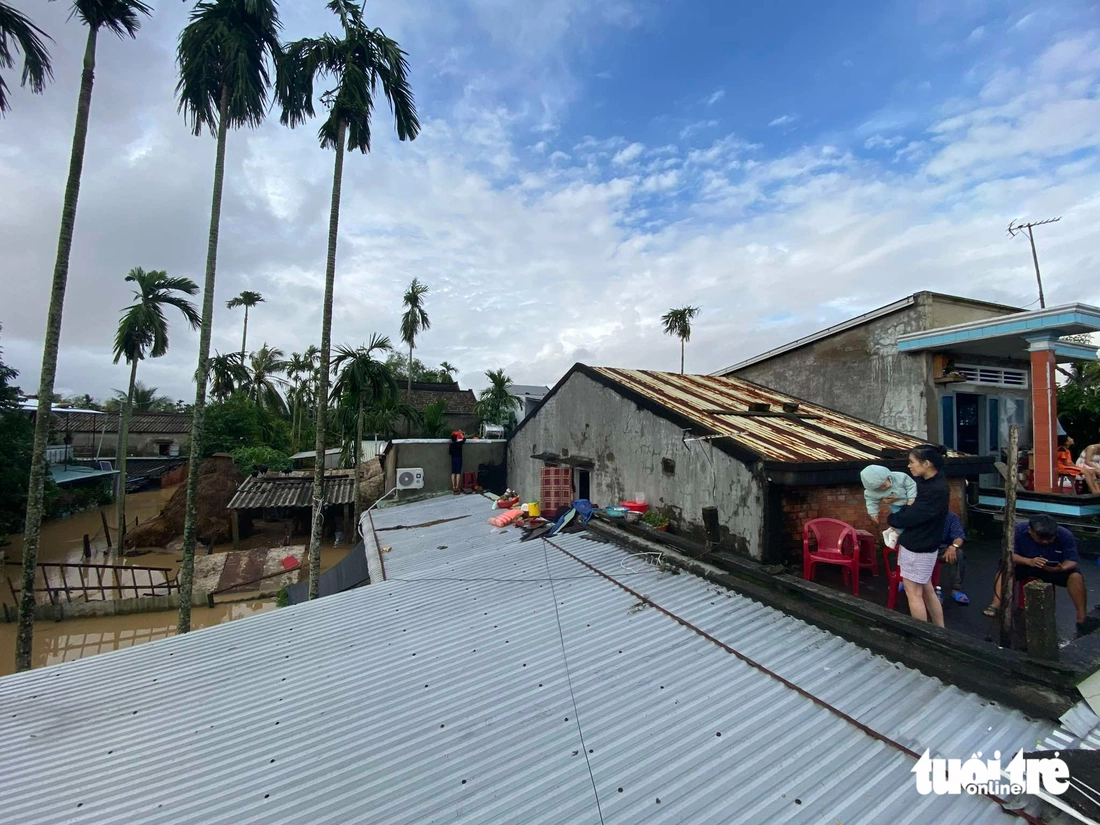
Authorities go to check and support people - Photo: LE TRUNG
1 person missing after boat capsized in Dien Ban Bac ward
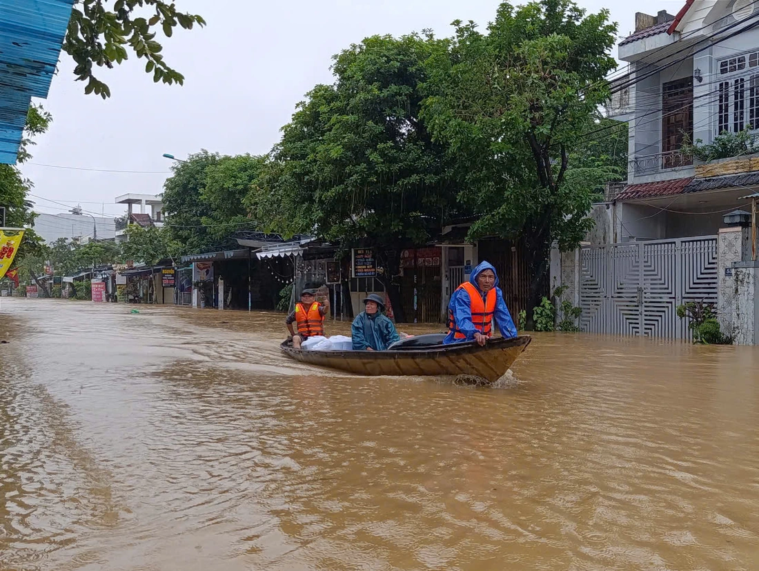
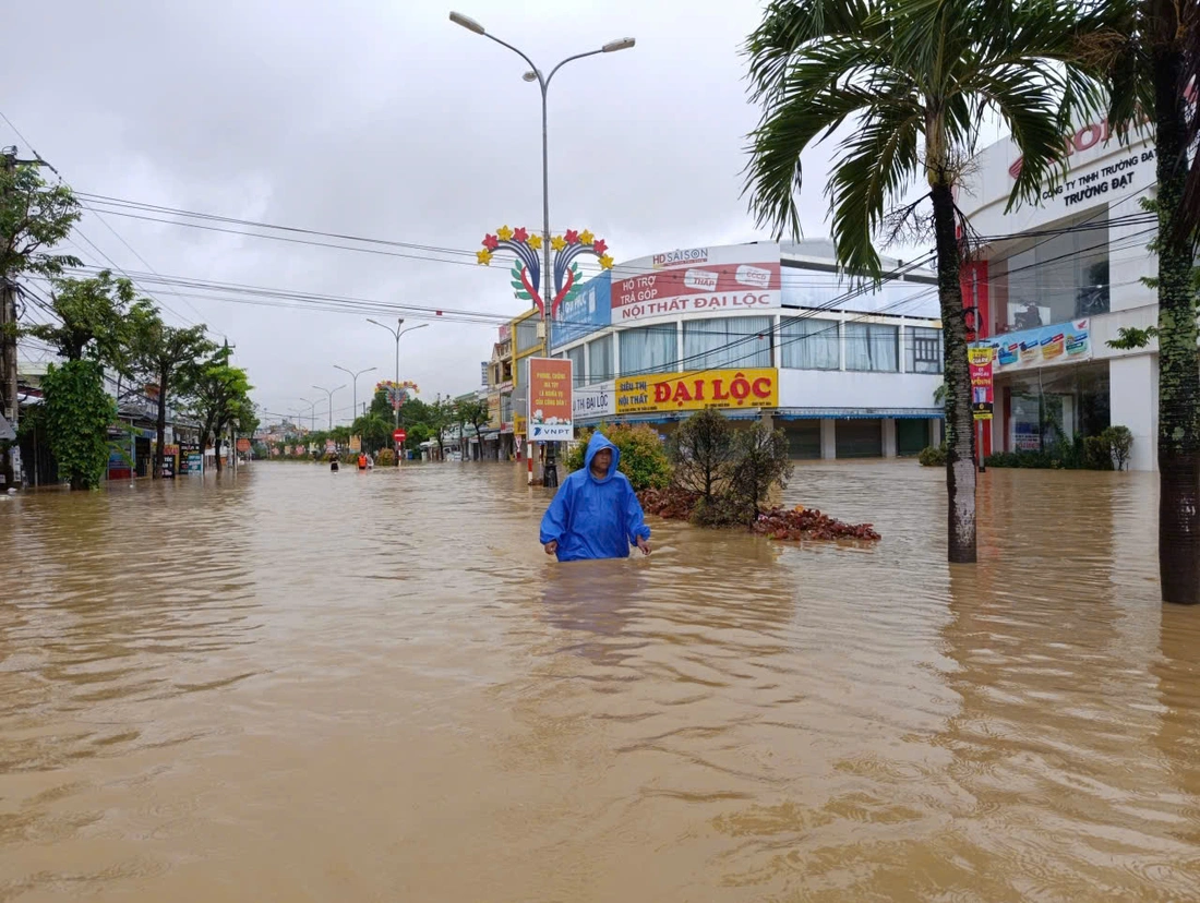
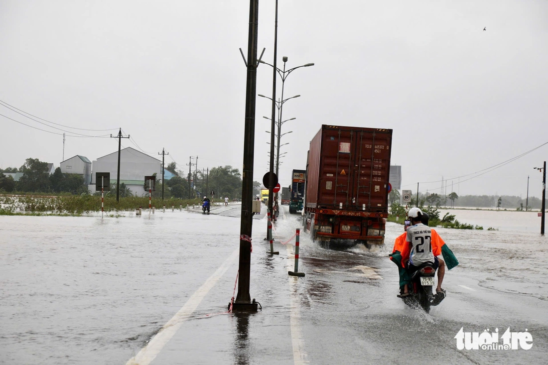
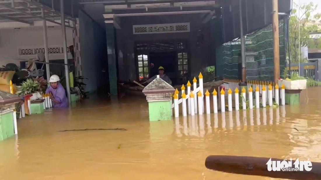
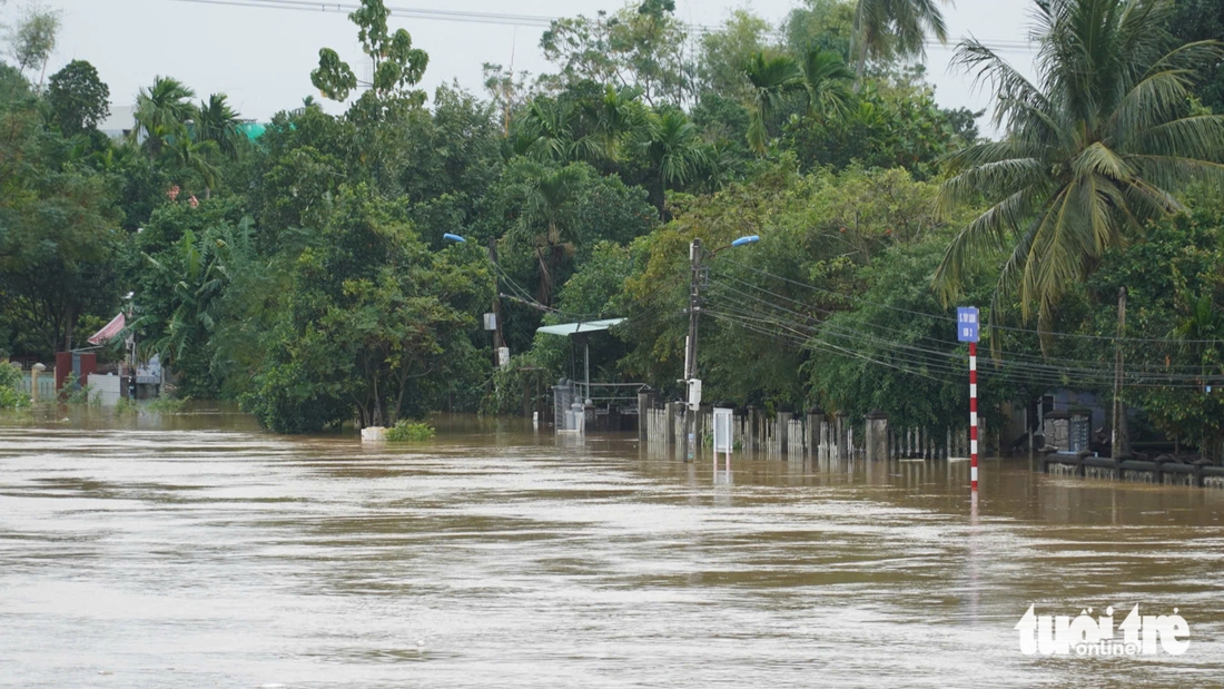
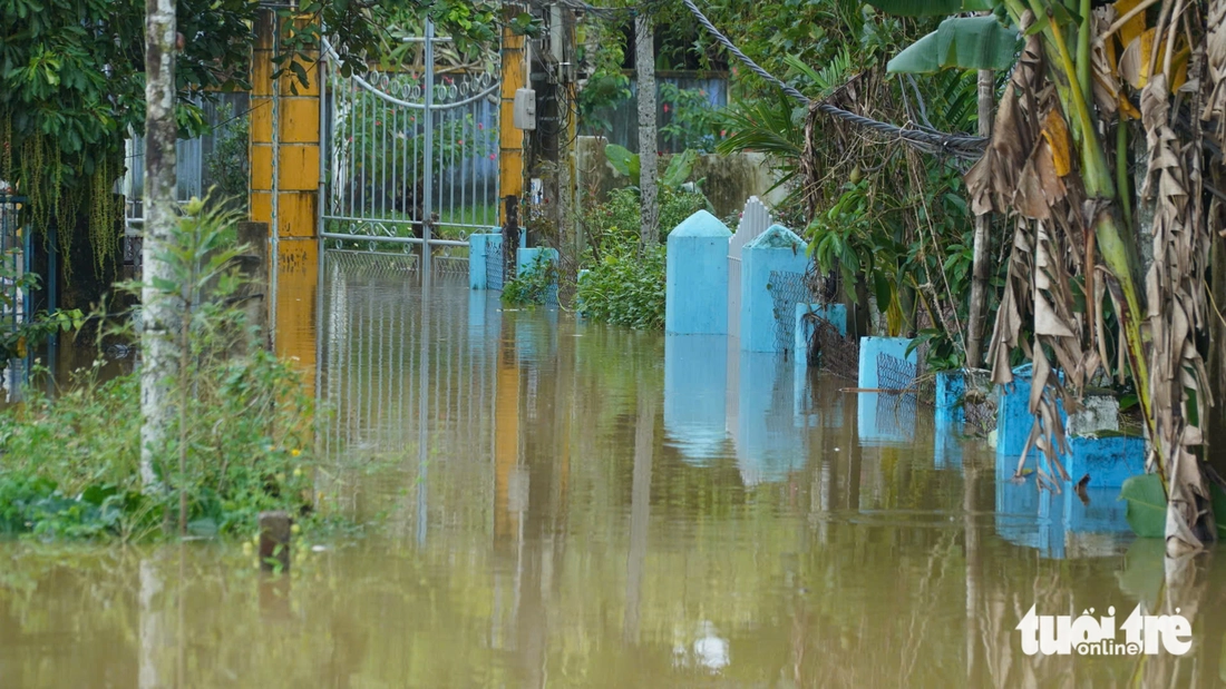
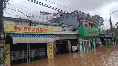
At 12:30 on the same day, although the flood water on Vu Gia River was receding, many areas in Dai Loc Commune, Da Nang City were still deeply flooded. It was raining heavily.
In the area of DT 609 road in the center of Dai Loc commune, the water is still nearly 1 meter deep, cutting off the road, people have to wade or use boats to move through the flood water. In some houses, the water has started to recede, people are taking the opportunity to clean up the mud and garbage that has washed up.
A woman with a broken leg was taken by police in a canoe to an ambulance and taken to the Northern Mountainous General Hospital of Quang Nam .
In Dien Ban Bac ward, a boat capsized, killing two elderly men. Authorities were able to rescue one person and are urgently coordinating a search for the remaining victim.
Accordingly, at about 9:30 a.m., Mr. Tang Van Hong (68 years old, residing in Ha Tay 2 village) and Mr. Tang Van Cuong (51 years old, residing in Ha Tay 1 village) were rowing a boat in a flooded field to catch fish and were capsized by waves.
Upon receiving the news, the ward's functional forces and local people quickly deployed rescue forces, promptly brought Mr. Hong to shore and transferred him to the ward's medical station for monitoring. Only Mr. Cuong was missing.
Search for victims is being carried out urgently.
Floodwaters are still deep in Dai Loc commune - Photo: LE TRUNG
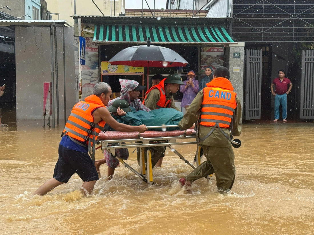
Commune police force took a woman with a broken leg to the hospital - Photo: LE TRUNG
n
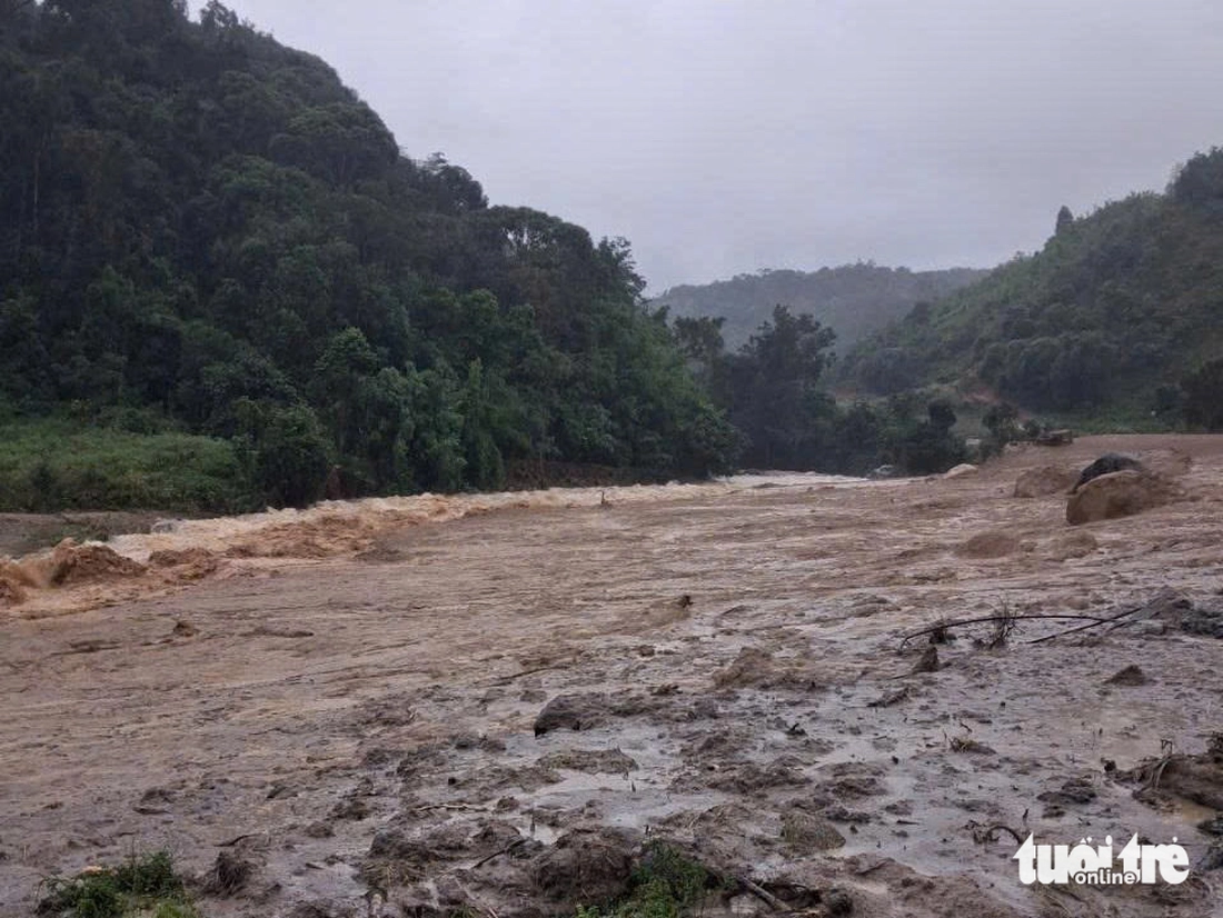
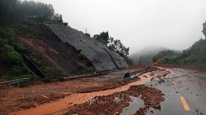
Landslide in Lang Moi village, Ngoc Linh commune, turned the area into a muddy field of rocks and strong flowing water - Photo: XUAN HOA
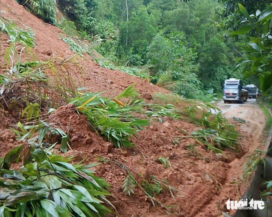
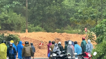
Quang Ngai: The only road in Ngoc Linh was completely eroded, isolating 5 villages.
On the morning of October 28, Mr. Dinh Xuan Hoa - Chairman of the People's Committee of Ngoc Linh Commune - said that the landslide had isolated 5 villages in the commune. The only road was completely destroyed.
Earlier, at around 1am, a hill in Lang Moi village (Ngoc Linh commune) was soaked with water due to continuous rain and collapsed. A huge amount of rock and soil collapsed, completely isolating the Lang Moi - Ngoc Ngang route.
The landslide completely damaged the drainage system and the road surface. Many nearby coffee and macadamia plantations were also wiped out.
Five completely isolated villages are Ngoc Nang, Ngoc Lang, Mo Po, Xa Ua and Tu Rang.
"The damage has not yet been estimated. Local authorities are currently calculating plans to support and provide supplies to isolated people," said Mr. Hoa. At the same time, he said that Ngoc Linh commune is still experiencing continuous heavy rain. With the "connection" broken, the risk of landslides in Lang Moi village will continue to expand.
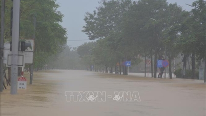
On the morning of October 28, Quang Ngai provincial capital and eastern communes also experienced prolonged heavy rain.
Water levels on Tra Khuc, Tra Cau, Song Ve, and Tra Bong rivers are at dangerous levels. Authorities are on duty and ready to handle natural disaster situations.
The only road in Ngoc Linh was eroded - Video: XUAN HOA
The only road was completely destroyed - Video: XUAN HOA
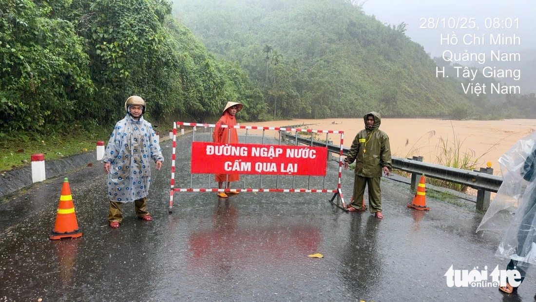
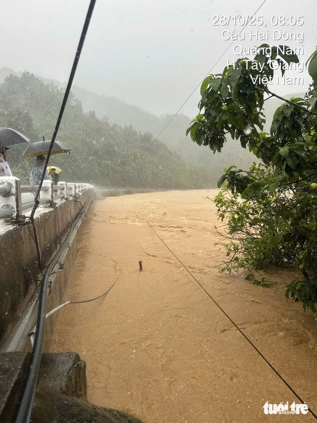
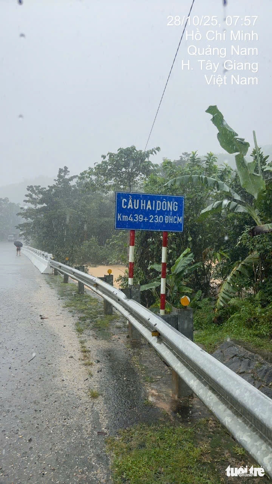
Close the West branch of Ho Chi Minh Trail
Road Management Area 3 said that at Km438+700- Km439+150 of the West branch of Ho Chi Minh road, the river water rose high and flooded the road, with some places being 1-1.5m deep.
The management unit had to close the road at 7:30 am.
The West branch of Ho Chi Minh Road has been closed - Photo: Provided by Road Management Area 3
Many deeply flooded sections cut off the West branch of Ho Chi Minh Road - Video: Provided by Road Management Area 3
Floodwaters rising on Ho Chi Minh road - Photo: Provided by Road Management Area 3
Ho Chi Minh road area still has heavy rain - Photo: Provided by Road Management Area 3
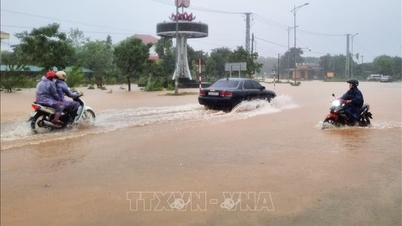
Heavy rains return
At 8:30 this morning, heavy rain continued to appear in the area north of Da Nang. Heavy rain and rising water level on Tuy Loan River brought many worries to the people.
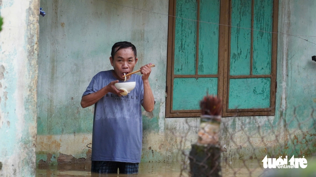
A quick meal in flood water - Photo: TRUONG TRUNG
National Highway 1 through Hue City has opened.
On the morning of October 28, National Highway 1 through Huong Tra ward, Hue city was opened.
According to Tuoi Tre Online 's observation , the road surface is still flooded 10 - 20cm but motorbikes, cars and other vehicles can still move.
Previously, on October 27, due to heavy rain, Highway 1 through this section was flooded 65cm deep, allowing only tractor-trailers and high-chassis trucks to pass. Other vehicles were directed to go onto the North-South Expressway.
Vehicles pass through National Highway 1 in Huong Tra Ward, Hue City, on the morning of October 28 - Photo: HOANG TAO
Quang Ngai Chairman: The land is 'full' of water, stick to the area, ready to respond
Mr. Nguyen Hoang Giang - Chairman of Quang Ngai Provincial People's Committee - said that after continuous heavy rains, the ground and underground were "full" of water. At this time, the risk of landslides, flash floods and flash floods is more serious than in previous days. Therefore, the People's Committees of the delta communes closely monitor the low-lying areas, continuously grasp information on rain and the regulation of reservoirs to proactively respond to floods.
For mountainous areas, the risk of landslides, flash floods and flash floods is at an alarming level. It is necessary to prepare forces, check high-risk areas and immediately have early and effective response plans. Members of the Provincial Civil Defense Command proactively monitor the developments of rain and floods, strengthen close contact with the area, prepare plans, mobilize resources for emergency response and search and rescue.
"We must stick to the area and be ready. Any situation can happen at any time, so as not to endanger people's lives," said Mr. Giang.
According to the Quang Ngai Provincial Hydrometeorological Station, the rainfall in Quang Ngai on October 28 will be very heavy. Meanwhile, the soil moisture model shows that some areas are nearly saturated, or have reached a state of near saturation of over 90%.

Chairman of Quang Ngai Provincial People's Committee Nguyen Hoang Giang requested all units to be ready and stay close to the area because the land is "full" of water, the risk of landslides and flash floods is very high - Photo: TRAN MAI
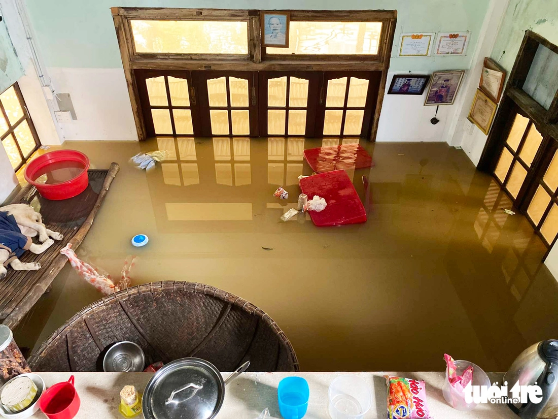
Hoi An houses flooded more than 2m
Speaking with Tuoi Tre Online on the morning of October 28, Mr. Huynh Cong Tam (resident of Dong Ha residential group, Hoi An ward, Da Nang city) said that this area is still very deeply flooded.
At his house, the flood water was 2 meters deep, and in some places on the street, it was nearly 2.5 meters deep. People had to go upstairs to avoid the flood.
Mr. Tam said the water started to flood into his house at noon on October 27, and by the afternoon of the same day, the water level rose very quickly. The water level was at its deepest late that day, with many houses flooded more than 2 meters.
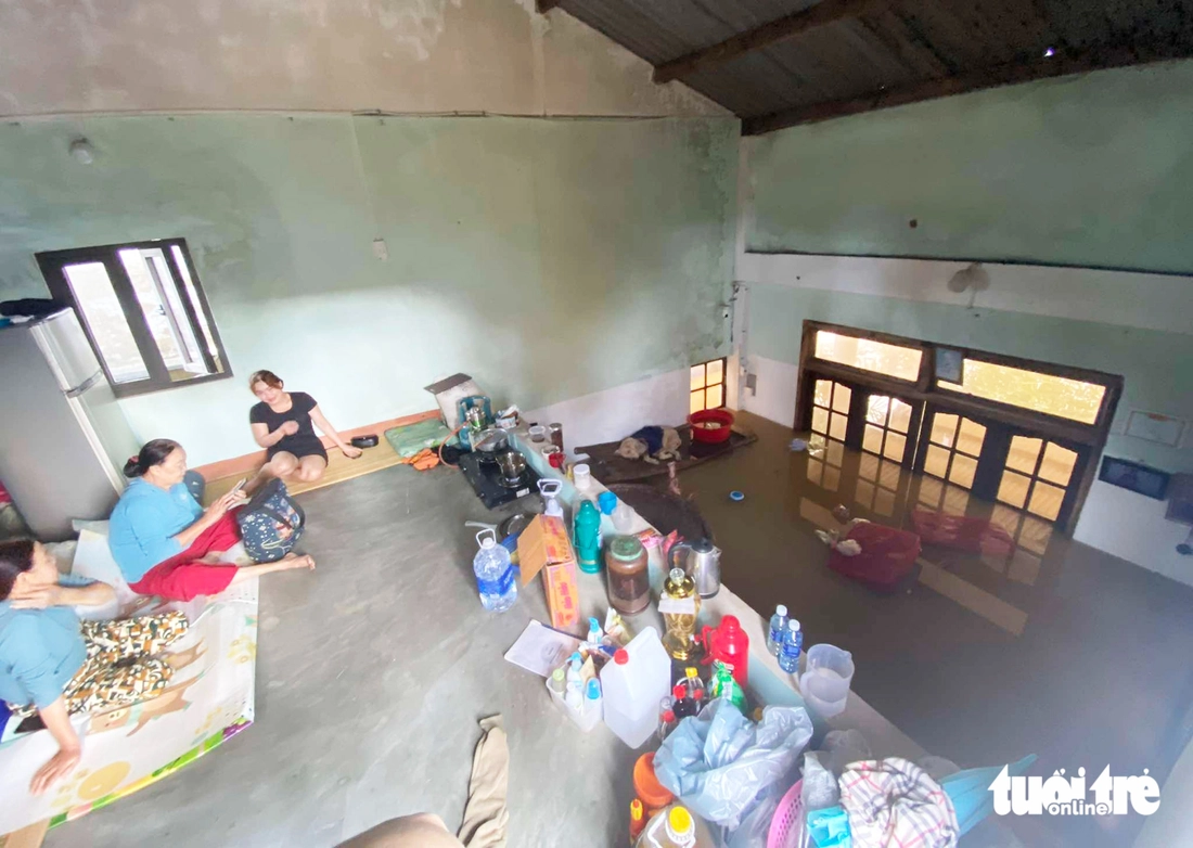
Everyone in the family had to pack up and move upstairs.
The water receded slowly this morning. Since last night, everyone in the house has been worried that the water will continue to rise and there will be no place to shelter when it reaches the attic.
"Most of the houses in this area have attics, so people move their belongings and belongings up there to stay overnight to avoid the flood. I have never seen such terrible floodwaters," said Mr. Tam.
Floodwaters deeply inundated Dong Ha residential area, Hoi An ward - Photo: CONG TAM
Floodwaters inundate houses - Photo: CONG TAM
A family went upstairs to avoid the flood - Photo: CONG TAM
People go to the attic to avoid the flood - Photo: CONG TAM
National Highway 14D serious landslide
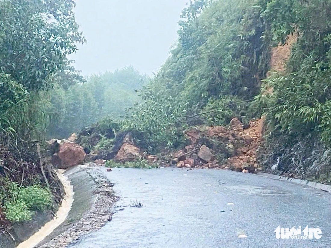
National Highway 14D to Nam Giang international border gate, Da Nang suffered serious landslides - Photo: PHUONG DONG
Rocks and soil spilled onto the road, traffic was cut off - Photo: PHUONG DONG
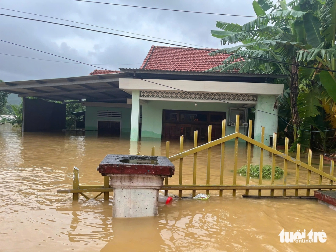
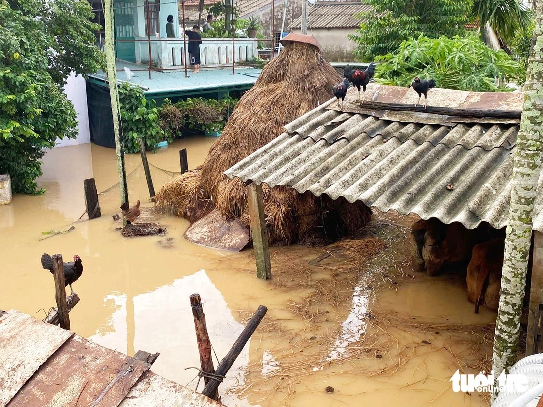
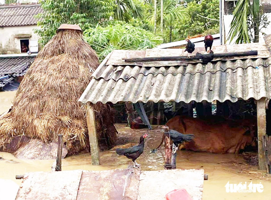
The flood center of Dai Loc along the Vu Gia river is still deeply flooded, many mountainous areas have landslides.
As of 8am this morning, floodwaters were still deep in Dai Loc commune, Da Nang city, known as the "flood center" of the old Quang Nam province.
In Nghia Trung village, Dai Loc commune, the flood water receded slowly that same morning, and people used boats to move through the flood water.
In Hoa Dong village, the floodwaters are still very deep, over 1.5 meters. Mr. Cao Viet Hung, a villager, said that the water level was at its highest on the night of October 27. People spent the whole night running from the flood and praying that the flood would stop.
Many mountain roads in Da Nang also suffered serious landslides. The Dong Truong Son road section passing through Phuoc Tra commune was covered with rocks and soil.
The road from Cot Buom village, Ben Hien commune to Thuong Duc commune has suffered heavy landslides. Some households are at risk of landslides, and the commune authorities have promptly evacuated residents to safety.
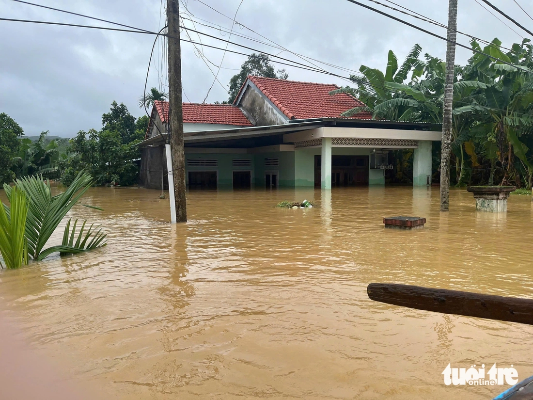
Floodwaters infiltrated Hoa Dong village, Dai Loc commune, Da Nang city - Photo: LE TRUNG
People find every way to cope in the flood - Photo: LE TRUNG
A house submerged in water - Photo: LE TRUNG
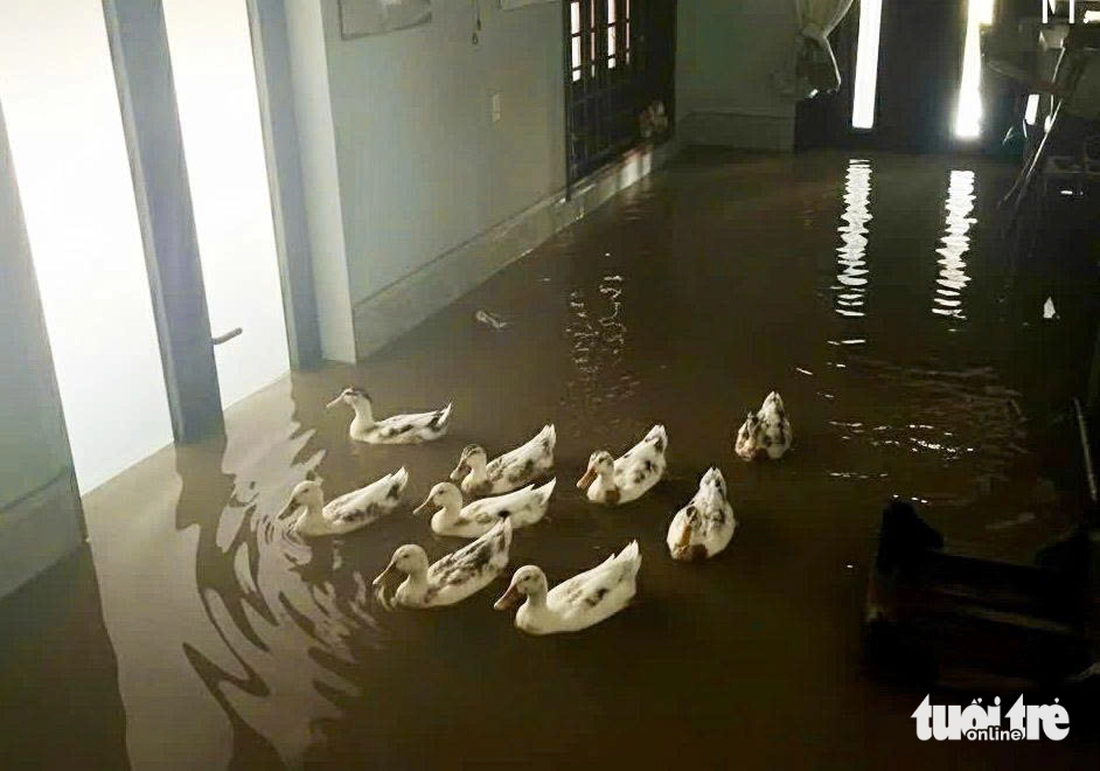
Ducks swimming indoors - Photo: LE TRUNG
The water level of Vu Gia River, the lower Thu Bon River and Tam Ky River is rising.
According to the Central Central Hydrometeorological Station bulletin released at 3:30 this morning, the water level on the Vu Gia River, the lower Thu Bon River and the Tam Ky River is rising. The upper Thu Bon River has peaked and is slowly falling.
The water level at dawn of the same day at Thu Bon River in Nong Son was at 17.84m - 2.84m above alarm level 3, in Hoi An it was 3.06m, 1.06m above alarm level 3.
In the next 6-12 hours, floods on Vu Gia River, downstream Thu Bon River, and Tam Ky River will peak and slowly recede.
Hoi An residents use boats to move around in the flood - Photo: CONG TAM
Livestock and poultry pens flooded in flood - Photo: CONG TAM

People living on the roof - Photo: CONG TAM

People carry baskets of bottles onto the roof to move through the flood - Photo: CONG TAM
A cowshed submerged in floodwaters - Photo: CONG TAM
Water level along Tuy Loan river rose, many houses in Hoa Vang commune, Da Nang were flooded 1-2m deep - Photo: TRUONG TRUNG

Many places in Hue City are still submerged in water - Photo: NHAT LINH
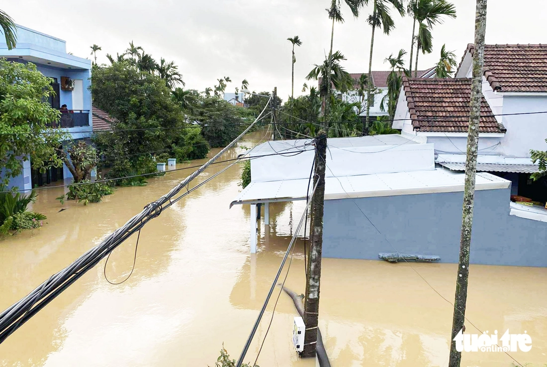
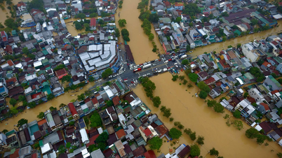
Many residential areas in Hue are still deeply flooded.
On the morning of October 28, the historic floodwaters in Hue began to recede. In many high places in Hue, people began to clear mud as the water receded.
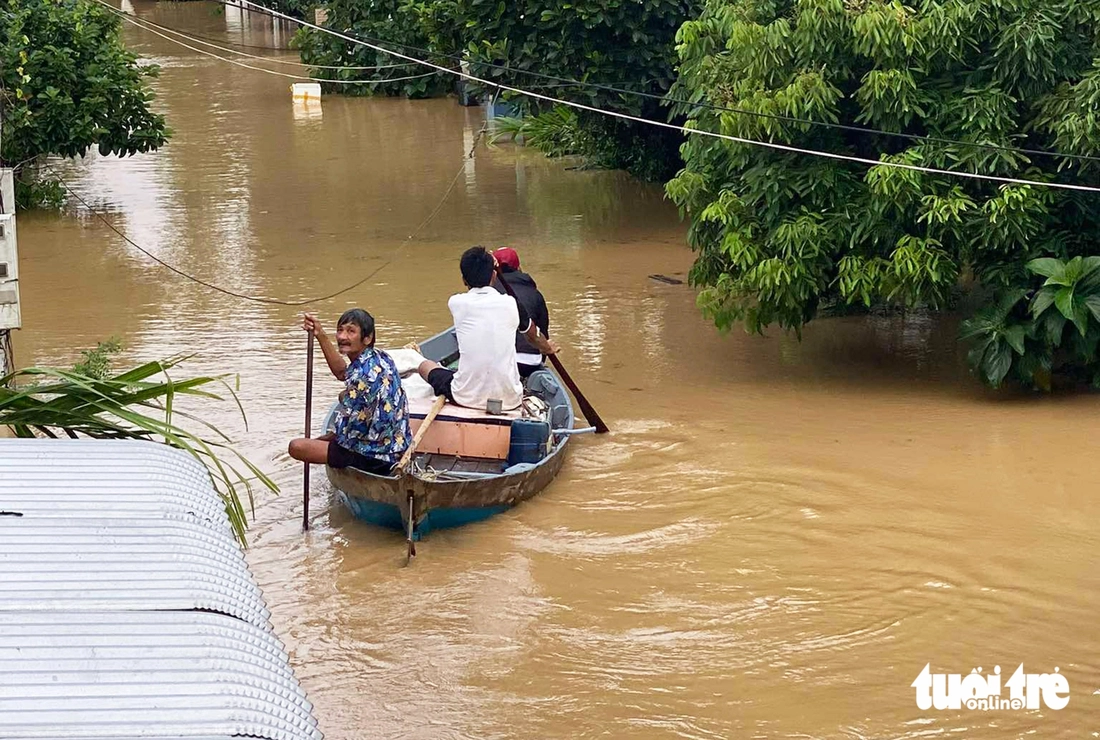
Although the water has receded considerably, many central roads and residential areas in Hue are still deeply submerged. People have to travel by boat to cross the floodwaters.
Many roads in Hue after the flood receded were left full of mud and rubbish. Many flooded cars and motorbikes were damaged and lying abandoned on the side of the road.
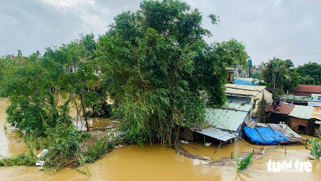
Flood water on Thu Bon and Vu Gia rivers is also slowly receding, however many residential areas are still deeply flooded.
Bo Ban village, Hoa Vang commune, Da Nang is submerged in floodwaters - Photo: TRUONG TRUNG
Most houses were flooded 1-2 meters deep since early this morning - Photo: TRUONG TRUNG

Isolated people have to travel by boat - Photo: TRUONG TRUNG
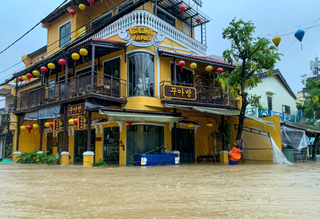
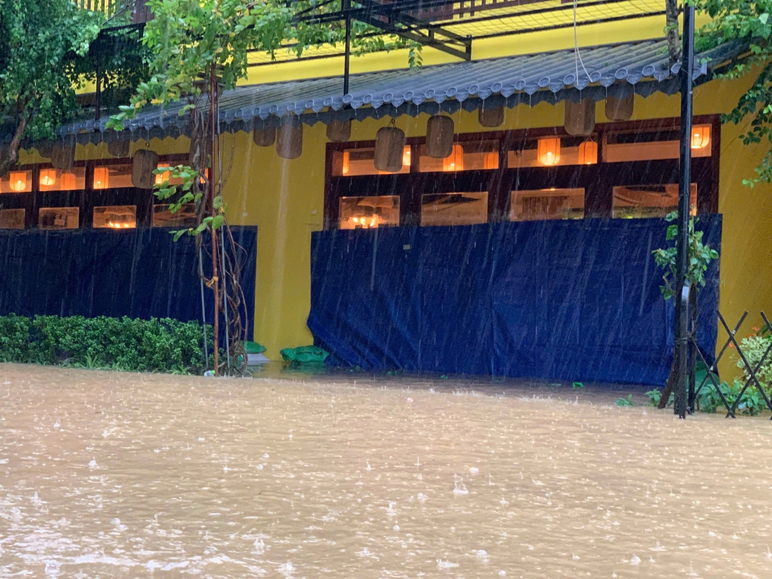
Hoi An residents flee flood through the night
From the night until the early morning of October 27, floodwaters continued to rise rapidly, causing many areas in Hoi An ancient town to be deeply submerged. Many households on central streets of Hoi An such as Bach Dang, Nguyen Thai Hoc, Nguyen Phuc Chu, etc. were flooded, some places reaching the second floor.
Rescue forces had to work all night using canoes to help people evacuate to safety.
Fearing that the water would continue to rise, a series of distress posts appeared on social media, calling for boats to help evacuate people from dangerous areas.
A representative of the SOS Cua Dai rescue team said his team received dozens of emergency calls from residents of the old town.
"In some places, the water rose almost to the second floor, so we had to use small canoes to go to each deep alley. Even though it was raining heavily and the water was flowing rapidly at night, everyone worked hard because they knew there were still many people trapped in the street," this person said.
As of the morning of October 28, water in many central areas of the old town had not yet receded, traffic was cut off, and people traveled mainly by boat or canoe.
Local authorities are coordinating with rescue teams to continue checking and assisting in evacuating people in deeply flooded areas.
On the morning of October 28, Hoi An ancient town was still submerged in water - Photo: THANH NGUYEN
Shops are closed and quiet - Photo: THANH NGUYEN
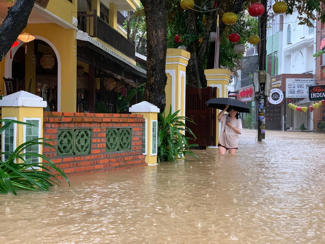
Tourists wade through water on the streets - Photo: THANH NGUYEN
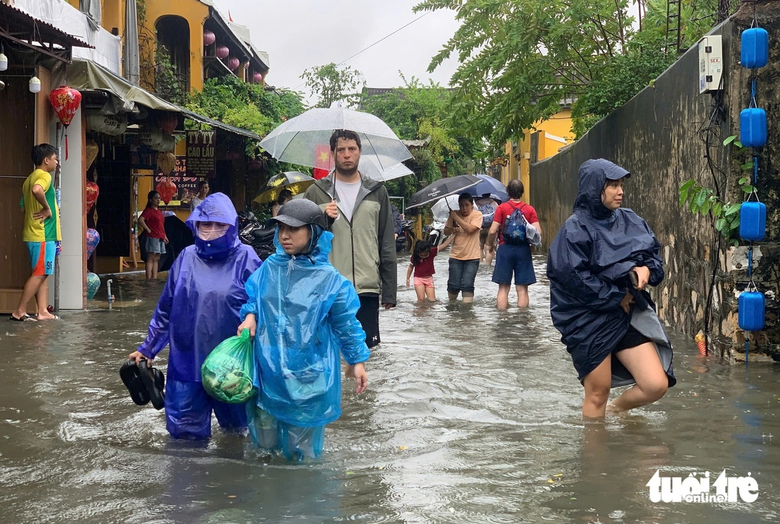
Tourists leave flooded areas in Hoi An - Photo: THANH NGUYEN
According to the report of the Department of Irrigation and Climate Change of Hue City, this morning the flood on the rivers has decreased a lot compared to yesterday.
Accordingly, Huong River at Kim Long station: 4.67 m, exceeding alarm level 3 by 1.17 m; Bo River at Phu Oc station: 4.64 m, exceeding alarm level 3 by 0.14 m; O Lau River at Phong Binh station: 2.54 m; Truoi River at Truoi station: 3.00 m; Ta Trach River at Thuong Nhat station: 60.84 m, below alarm level II by 0.16 m.
It is forecasted that in the next 12 hours, the flood will continue to recede slowly, but the Huong River will still be at a very high level above alert level 3, and the Bo River is forecast to fall below level 3.
Mr. Nguyen Dinh Duc - Director of the Department of Agriculture and Environment of Hue City - said that flood water in Hue will gradually recede but very slowly because the upstream of the rivers is still experiencing heavy rain and the tides at sea are still high.
It is forecasted that this morning the Bo River will drop below alert level 3, while the Huong River will have to wait until tonight to drop to alert level 3.
Currently, the flood risk level is at level 3. There is a high risk of widespread flooding in downstream, low-lying and urban areas. At the same time, flash floods and landslides can occur in mountainous and steep areas.
According to Colonel Phan Thang - Commander of Hue City Military Command, military and militia forces have been directed to be on standby, ready to support people in clearing mud with the motto "clean up as soon as the water recedes".
NHAT LINH - TRUONG TRUNG - LE TRUNG - THANH NGUYEN - TRAN MAI
Source: https://tuoitre.vn/troi-lai-mua-to-nhieu-khu-vuc-o-da-nang-van-con-ngap-sau-20251028082108159.htm


![[Photo] National Assembly Chairman Tran Thanh Man received a delegation of the Social Democratic Party of Germany](https://vphoto.vietnam.vn/thumb/1200x675/vietnam/resource/IMAGE/2025/10/28/1761652150406_ndo_br_cover-3345-jpg.webp)
![[Photo] Draft documents of the 14th Party Congress reach people at the Commune Cultural Post Offices](https://vphoto.vietnam.vn/thumb/1200x675/vietnam/resource/IMAGE/2025/10/28/1761642182616_du-thao-tai-tinh-hung-yen-4070-5235-jpg.webp)


![[Photo] President Luong Cuong attends the 80th Anniversary of the Traditional Day of the Armed Forces of Military Region 3](https://vphoto.vietnam.vn/thumb/1200x675/vietnam/resource/IMAGE/2025/10/28/1761635584312_ndo_br_1-jpg.webp)


Comment (0)