
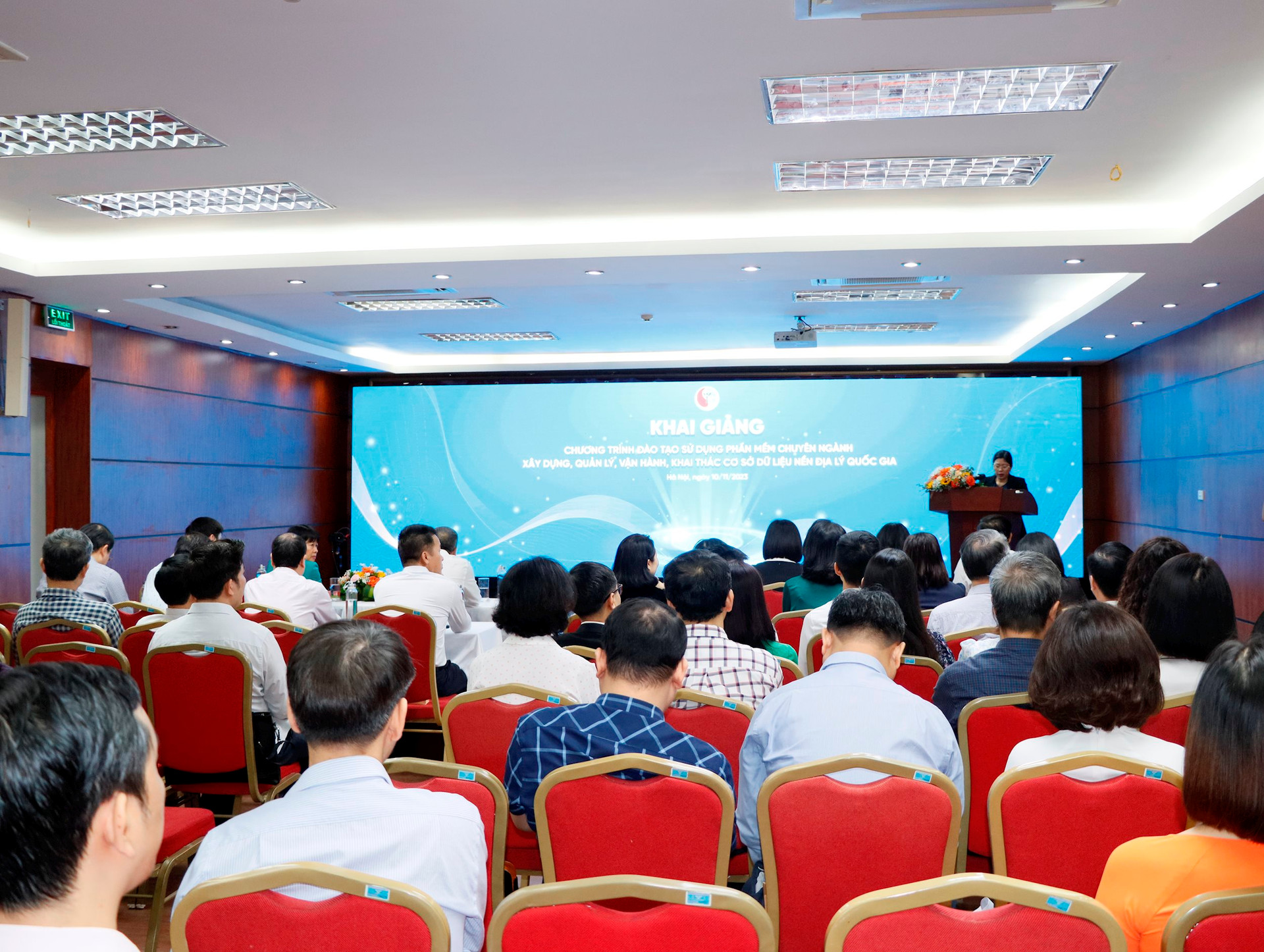
Attending the opening ceremony were Mr. Hoang Ngoc Lam, Director of the Department of Surveying and Geographic Information of Vietnam; Mr. Duong Van Hai, Deputy Director of the Department of Surveying, Mapping and Geographic Information of Vietnam; Mr. Hoang Ngoc Huy, Deputy Director of the Department of Surveying, Mapping and Geographic Information of Vietnam; Ms. Nguyen Thi Huyen, Deputy Director of the Department of Organization and Personnel; Ms. Vu Thi Hang, Deputy Director of the Department of Science and Technology; Leaders and representatives of units under the Ministry of Natural Resources and Environment ; leaders of the Department of Natural Resources and Environment of provinces and centrally run cities at 63 online bridges and nearly 3,000 students who are managers and technical staff of ministries, branches, localities and research institutes across the country.
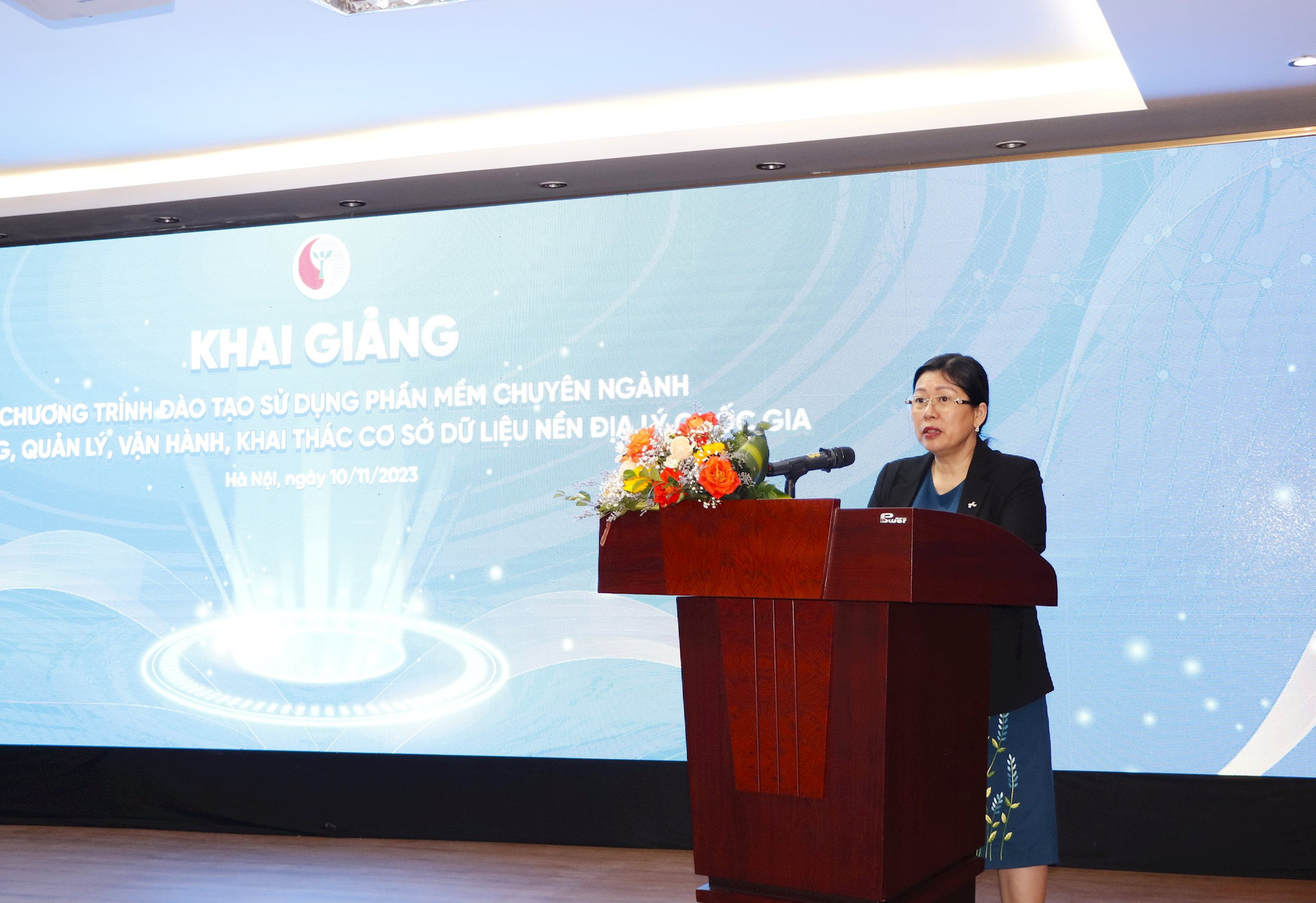
Speaking at the opening ceremony, Deputy Minister Nguyen Thi Phuong Hoa said that the national geographic database plays an important role in many fields, such as: planning, urban management, environmental resource management, security, national defense, scientific research and assistance in some emergency cases, such as: natural disasters, epidemics, etc., which is the basic data for all other specialized databases.
Therefore, realizing the important role of the national geographic database, on January 9, 2020, the Prime Minister approved the Project "Building and perfecting the national geographic database" in Decision No. 40/QD-TTg, assigning the Ministry of Natural Resources and Environment to implement. Carrying out the assigned tasks, up to now, the Ministry of Natural Resources and Environment has completed the construction of the national geographic database and established national topographic maps at scales of 1:25,000, 1:100,000, 1:250,000, 1:500,000, 1:1,000,000 for the mainland; Building a national geographic database on Vietnam's sea at scales of 1:10,000, 1:50,000, 1:100,000, 1:250,000, 1:500,000, 1:1,000,000 to serve planning and socio- economic development.
According to Deputy Minister Nguyen Thi Phuong Hoa, with national geographic data, in recent times, the Ministry of Natural Resources and Environment has promptly provided data to a number of ministries, branches and localities to exploit and use for urban planning and management as well as for local socio-economic development and direction.
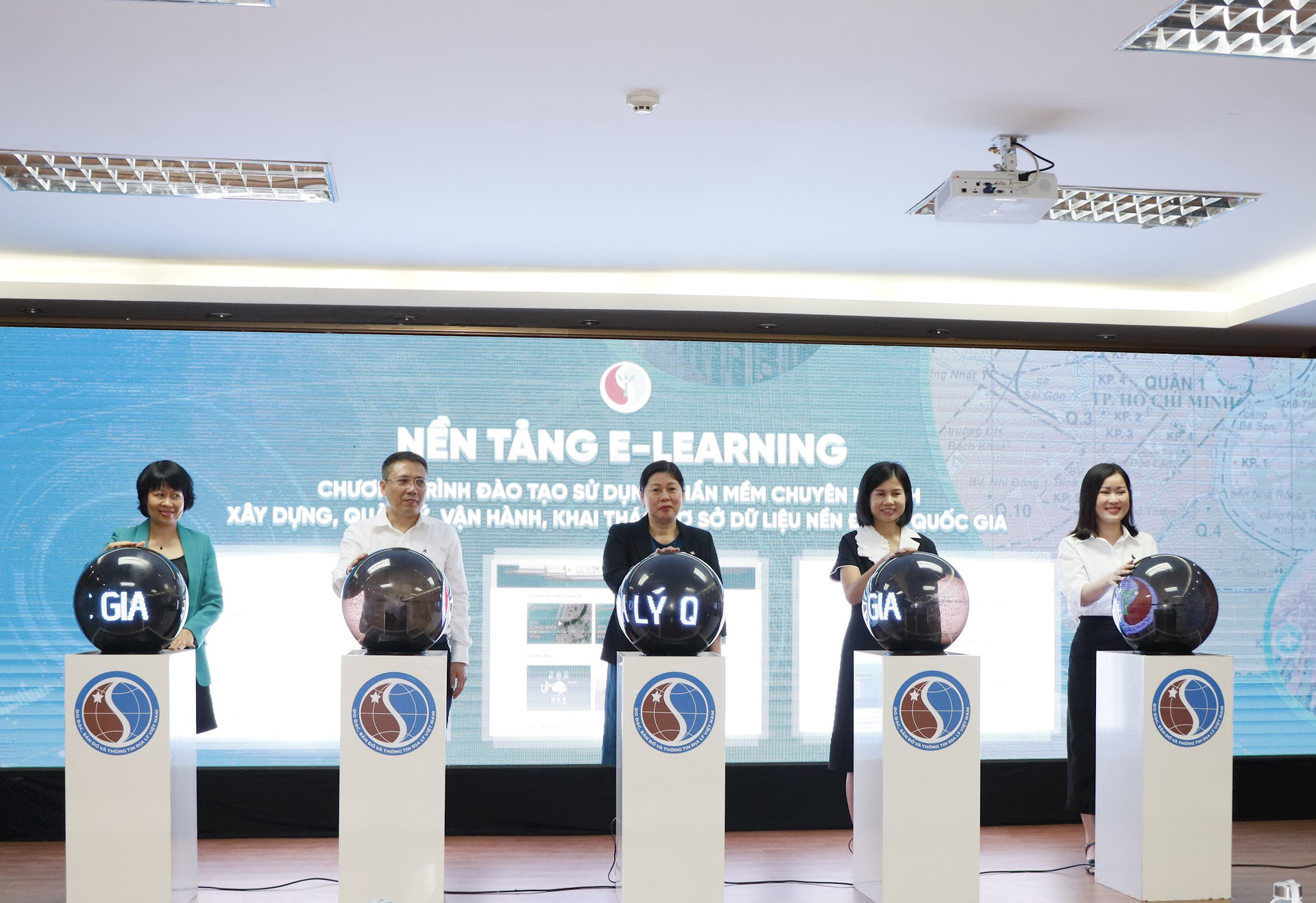
In particular, to effectively manage, exploit and use the national geographic database built, provided and handed over to ministries, branches and localities by the Ministry of Natural Resources and Environment. Today, the Ministry of Natural Resources and Environment organized the course "Training on the use of specialized software for building, managing and operating national geographic databases" in the form of online training via the E-Learning platform to help students easily grasp knowledge from basic to advanced in building and updating geographic databases in general and national geographic databases in particular in a proactive, unified and effective manner, responding to the country's digital transformation.
Along with that, after the course, the Ministry of Natural Resources and Environment will consider providing ArcGIS Desktop software based on the registration needs of ministries, branches and localities to serve the work of building and updating the national geographic database.
For the course to be effective, Deputy Minister Nguyen Thi Phuong Hoa suggested that lecturers and reporters need to convey concisely and succinctly, focusing on instructing students to proficiently use GIS software to build, update, manage and operate the national geographic database and train a large number of experts capable of processing and analyzing geographic data.
For serious students, focus on studying, exchange openly during the learning and practice process to achieve the best results in the class, and at the same time, for the Ministry of Natural Resources and Environment to continue researching and perfecting the national geographic database.
For the Department of Surveying, Mapping and Geographic Information of Vietnam - the unit organizing the course, it is necessary to closely coordinate with related units, perform well the work of organizing, managing, monitoring, evaluating teaching and learning results, and synthesizing reports to the Ministry according to regulations.
“I believe that after the course, each student will gain not only new knowledge about GIS but also confidence and passion in the field of geographic information; a source of encouragement and new strength to help them go further in their careers and contribute to the development of the country” – Deputy Minister Nguyen Thi Phuong Hoa affirmed.
According to Mr. Hoang Ngoc Lam, Director of the Department of Surveying, Mapping and Geographic Information of Vietnam, the development of a training program using specialized software training to build and manage the operation of the national geographic database aims to meet the needs of human resource training nationwide with the number of civil servants needing training of about 3,000 people. Therefore, the Department of Surveying, Mapping and Geographic Information of Vietnam has chosen to switch from direct training to online training on a digital platform (Elearning). This is a new and modern training approach, aiming to meet the requirements of the country's digital transformation, solving the problem of geographical distance, flexible time anytime, anywhere, proactive on a digital platform, through video lectures saving travel time, saving maximum learning costs for students.
Introducing the training program, Mr. Duong Van Hai, Deputy Director of the Department of Surveying, Mapping and Geographic Information of Vietnam, said that the program consists of 6 courses built with a smart pedagogical structure. Each course will focus on exploiting the features of a number of tools in the corresponding ArcGIS software suite to serve the work of updating, managing, exploiting and operating the national geographic database and the national topographic map system.
In each course, the lecture is built as a set of electronic learning materials (videos, animations and sounds combined with slide presentations with multimedia learning materials, etc.) with pedagogical structure so that students can self-study through choosing learning content, practicing, applying, self-testing and evaluating. This ensures the transmission of knowledge in an effective and intuitive way.

Along with that, the practical exercises in each course will help students apply the knowledge they have learned to create impressive finished products.
According to Mr. Duong Van Hai, after completing the entire training program, students will be granted a certificate of completion of the training course issued by the Department of Surveying, Mapping and Geographic Information of Vietnam.
After the Opening Ceremony, a discussion session was also held to clarify and answer any questions related to the training program.
Source


![[Photo] Cat Ba - Green island paradise](/_next/image?url=https%3A%2F%2Fvphoto.vietnam.vn%2Fthumb%2F1200x675%2Fvietnam%2Fresource%2FIMAGE%2F2025%2F12%2F04%2F1764821844074_ndo_br_1-dcbthienduongxanh638-jpg.webp&w=3840&q=75)


![[VIMC 40 days of lightning speed] Da Nang Port: Unity - Lightning speed - Breakthrough to the finish line](https://vphoto.vietnam.vn/thumb/402x226/vietnam/resource/IMAGE/2025/12/04/1764833540882_cdn_4-12-25.jpeg)


Comment (0)