

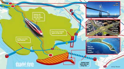
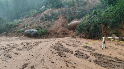
The sea-crossing bridge connecting Can Gio - Vung Tau has its starting point at the Can Gio sea-encroaching urban area (HCMC). Photo: Anh Tu
Vingroup Corporation has just submitted a document to the Ho Chi Minh City People's Committee on the appraisal of the Pre-Feasibility Study Report of the Investment Project to build a road and bridge connecting Can Gio - Vung Tau under the public-private partnership (PPP) method, BT contract (build - transfer).
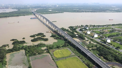
According to the design plan, the project has a total length of about 14.67 km, of which the sea-crossing bridge is nearly 11 km long, including 4 motor lanes and 2 mixed lanes, with a design speed of 60 km/h. The bridge uses a cable-stayed structure, with a main span of 600 m and a clearance of 55 m, allowing large seagoing vessels to pass through.
The approach road is nearly 3.8 km long, with a design speed of 80 km/h, and is synchronous in scale with existing and planned routes.
The starting point of the project is on Bien Dong 2 Street, in Can Gio Sea Reclamation Urban Area (Can Gio Commune). The end point is at the intersection between the planned road Mai Sao - Ben Dinh and 30/4 Street, in Tam Thang Ward (Vung Tau).
Regarding the route direction, from the starting point in Can Gio, the route goes to the Southeast, crossing Ghenh Rai Bay, mostly running on the sea, then connecting to the planned Mai Sao - Ben Dinh road axis and ending at the intersection of 30/4 Street.
MINH QUAN


![[Photo] Parade to celebrate the 50th anniversary of Laos' National Day](/_next/image?url=https%3A%2F%2Fvphoto.vietnam.vn%2Fthumb%2F1200x675%2Fvietnam%2Fresource%2FIMAGE%2F2025%2F12%2F02%2F1764691918289_ndo_br_0-jpg.webp&w=3840&q=75)
![[Photo] Worshiping the Tuyet Son statue - a nearly 400-year-old treasure at Keo Pagoda](/_next/image?url=https%3A%2F%2Fvphoto.vietnam.vn%2Fthumb%2F1200x675%2Fvietnam%2Fresource%2FIMAGE%2F2025%2F12%2F02%2F1764679323086_ndo_br_tempimageomw0hi-4884-jpg.webp&w=3840&q=75)


Comment (0)