
According to the National Center for Hydro-Meteorological Forecasting, at 1 p.m. on December 3, the center of the tropical depression was at about 12.9 degrees north latitude and 110.0 degrees east longitude, over the Dak Lak - Khanh Hoa sea area.
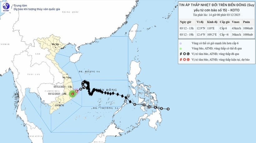
Strongest wind in the vicinity tropical depression level 6 wind (39-49km/h), gust level 8, moving west southwest, speed 15-20km/h.
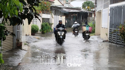
At sea, in the coastal areas of Dak Lak - Khanh Hoa provinces, there are strong winds of level 6, gusts of level 8; waves 2-4m high, rough seas.
Vessels operating in the above mentioned danger zones are susceptible to the effects of storms, whirlwinds, strong winds and large waves.
Forecast for the day and night of December 3 in the northern East Sea area (including Hoang Sa special zone) is that the northeast wind will gradually increase to level 6-7, gusting to level 8-9. The sea will be rough. Waves will be 3-5m high.
The Gulf of Tonkin has northeast winds gradually increasing to level 6, sometimes level 7, gusting to level 8. Rough seas. Waves 2-4m high.
The western sea area of the central East Sea, the sea area from southern Quang Tri to Ca Mau has scattered showers and thunderstorms.
Thunderstorms may produce tornadoes and strong gusts of wind.
The sea area from southern Quang Tri to Quang Ngai and the sea area north of the central East Sea has northeast wind gradually increasing to level 6, gusting to level 8. Rough sea. Waves 2-4m high.
Source: https://baolangson.vn/ap-thap-nhiet-doi-gay-bien-dong-tren-vung-bien-dak-lak-khanh-hoa-5066839.html


![[Photo] Parade to celebrate the 50th anniversary of Laos' National Day](/_next/image?url=https%3A%2F%2Fvphoto.vietnam.vn%2Fthumb%2F1200x675%2Fvietnam%2Fresource%2FIMAGE%2F2025%2F12%2F02%2F1764691918289_ndo_br_0-jpg.webp&w=3840&q=75)


![[Photo] Worshiping the Tuyet Son statue - a nearly 400-year-old treasure at Keo Pagoda](/_next/image?url=https%3A%2F%2Fvphoto.vietnam.vn%2Fthumb%2F1200x675%2Fvietnam%2Fresource%2FIMAGE%2F2025%2F12%2F02%2F1764679323086_ndo_br_tempimageomw0hi-4884-jpg.webp&w=3840&q=75)


Comment (0)