
 |
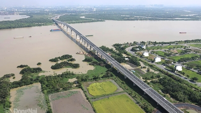
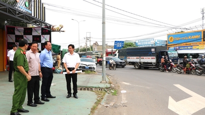
| In the lower reaches of the Dong Nai River, the peak water level is rising, near alert level 1 (1.8m). Photo: Dang Tung |
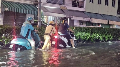
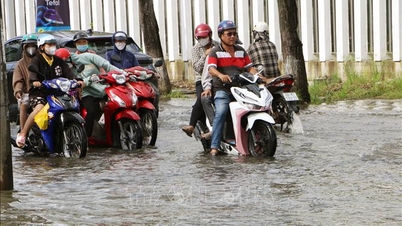
Currently, the water level on rivers and streams in the downstream of the Dong Nai river system is quite high, posing a risk of flooding low-lying areas along rivers and streams, adversely affecting waterway traffic, aquaculture, and agricultural production in rivers, streams, river banks, and stream banks.
Warning for the downstream area of Dong Nai River, in the wards and communes of Tri An, Tan An, Trang Dai, Tan Trieu, Bien Hoa, Tran Bien, Tam Hiep, Long Hung, Phuoc Tan, Tam Phuoc, An Phuoc, Nhon Trach, Dai Phuoc, Phuoc An in Dong Nai province and neighboring areas, there is a possibility of flooding.
The peak tide level is forecast to continue to rise, with the high tide likely to reach 1.95m to approximately level 2 alarm (2m) from December 5 to 7 (ie October 16 to 18 of the lunar calendar), then gradually decrease.
Flood warning level on Dong Nai River, downstream: Warning level 2.
Kim Lieu
Source: https://baodongnai.com.vn/xa-hoi/202512/canh-bao-lu-trieu-cuong-o-ha-luu-song-dong-nai-5d531ae/


![[Photo] Parade to celebrate the 50th anniversary of Laos' National Day](/_next/image?url=https%3A%2F%2Fvphoto.vietnam.vn%2Fthumb%2F1200x675%2Fvietnam%2Fresource%2FIMAGE%2F2025%2F12%2F02%2F1764691918289_ndo_br_0-jpg.webp&w=3840&q=75)


Comment (0)