
From early morning and tomorrow (October 27th), Typhoon No. 6 (Typhoon Tra Mi) will reach the coastal area from Quang Tri to Quang Nam with an intensity of level 8-9. Heavy and prolonged rainfall during the typhoon's circulation may cause flooding and flash floods.
WATCH VIDEO :
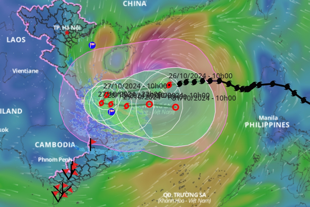
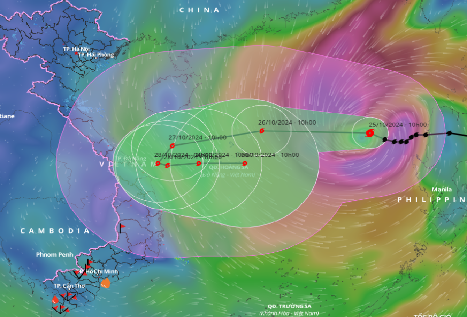
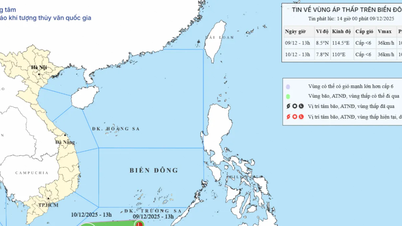
According to Mr. Nguyen Van Huong, Head of the Weather Forecasting Department at the National Center for Hydro-Meteorological Forecasting, this afternoon (October 26), Typhoon No. 6 (Typhoon Tra Mi) is currently located in the sea northwest of the Hoang Sa archipelago, about 370km east-northeast of Da Nang . The typhoon's intensity has reached level 11, with gusts of level 13-14. The typhoon has caused strong winds at Ly Son Island with an intensity of level 6, and gusts exceeding level 6.
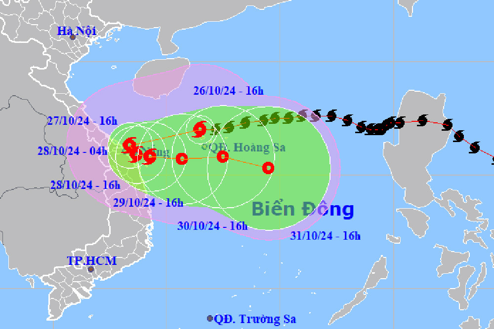
According to Mr. Huong, from 4:30 PM this afternoon, Typhoon No. 6 will cause strong winds of level 6-7 in most areas of the Central coastal region. As the typhoon moves closer to shore, these areas will experience increasingly strong winds of level 8-9, with winds near the center of the typhoon reaching level 9-10, and gusts of level 11-12.
"We also note that, due to the influence of the remnants of Typhoon No. 6 , the coastal and inland areas of Quang Tri - Quang Ngai provinces are beginning to experience showers and thunderstorms. Of particular note, from this afternoon onwards, the Central region will experience widespread heavy rain. Rainfall within the typhoon's remnants will occur with high intensity; rainfall in 3 hours could exceed 100mm, and in 6-12 hours could exceed 200mm."
"Heavy and prolonged rainfall could cause urban flooding, flash floods, and landslides in the Central region," Mr. Huong warned.
At the same time, Mr. Huong predicted that from early morning and tomorrow (October 27), the coastal area from Quang Tri to Quang Nam will experience strong winds of level 6-7, near the storm's center level 8-9, with the strongest winds occurring from morning to afternoon tomorrow.
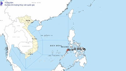
This afternoon's bulletin from the National Center for Hydro-Meteorological Forecasting also forecasts the storm's development (over the next 24 to 72 hours):
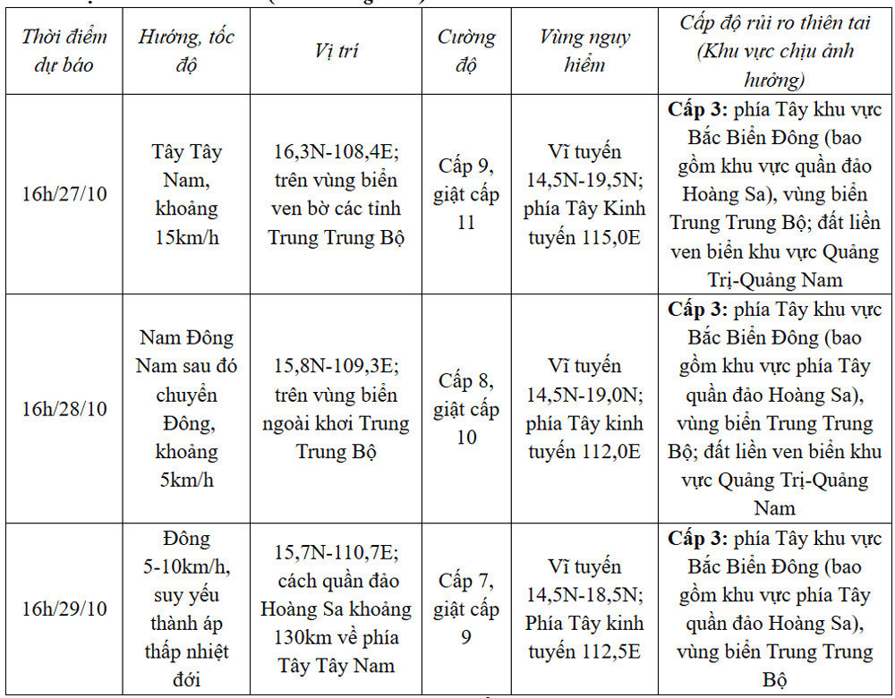
Over the next 72 to 120 hours, the tropical depression will move mainly eastward at a speed of 5-10 km per hour, and its intensity will continue to weaken.
Typhoon Tra Mi (Typhoon No. 6) will enter the central coastal region of Vietnam, bringing heavy rain to 6 provinces starting tonight.

Four airports will temporarily close to avoid Typhoon Tra Mi (Typhoon No. 6) from October 27th.
Why did Typhoon No. 6 take such a 'strange' path?
Source: https://vietnamnet.vn/bao-so-6-ap-sat-ven-bien-mien-trung-mua-cuong-suat-rat-lon-va-keo-dai-2335877.html

![[Photo] Closing Ceremony of the 10th Session of the 15th National Assembly](/_next/image?url=https%3A%2F%2Fvphoto.vietnam.vn%2Fthumb%2F1200x675%2Fvietnam%2Fresource%2FIMAGE%2F2025%2F12%2F11%2F1765448959967_image-1437-jpg.webp&w=3840&q=75)


![[Photo] Prime Minister Pham Minh Chinh holds a phone call with the CEO of Russia's Rosatom Corporation.](/_next/image?url=https%3A%2F%2Fvphoto.vietnam.vn%2Fthumb%2F1200x675%2Fvietnam%2Fresource%2FIMAGE%2F2025%2F12%2F11%2F1765464552365_dsc-5295-jpg.webp&w=3840&q=75)


Comment (0)