
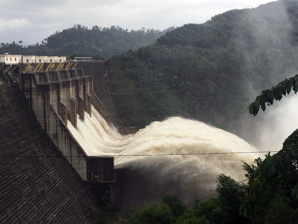
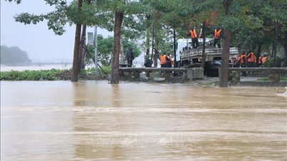
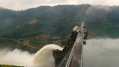
Accordingly, the Head of the Da Nang City Civil Defense Command requested the following units: Dak Mi Hydropower Joint Stock Company, Song Bung Hydropower Company, A Vuong Hydropower Joint Stock Company, Song Tranh Hydropower Company to calculate and organize the operation and regulation to gradually lower the water level of Song Bung 2 reservoir to 597m; A Vuong reservoir to 372m before 9:00 a.m. on October 19; the start of operation is from 9:00 a.m. on October 17. Switch the operation mode according to the regulations of Procedure 1865 (Procedure for operating inter-reservoirs on the Vu Gia - Thu Bon river basin).
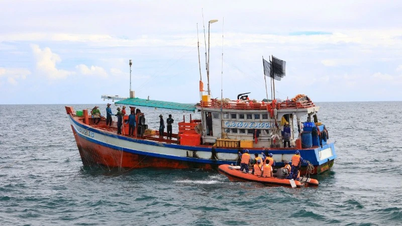
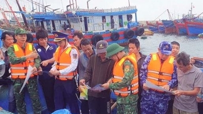
Calculate and operate to ensure that the water level of Song Tranh 2, Dak Mi 4, and Song Bung 4 hydropower reservoirs is not higher than the lowest flood level. Switch the operating mode according to the regulations of Procedure 1865. The City Civil Defense Command notes that the organization of operations must ensure the operating principles and avoid sudden changes according to regulations. Proactively inform and notify the authorities and people in the downstream area about the operation and regulation of the reservoirs.
Regularly provide flood forecast bulletins on the lake and rainfall data from measuring stations in the lake basin to the Command Board, Department of Agriculture and Environment, Department of Industry and Trade and related units and localities to serve the monitoring and consulting work.
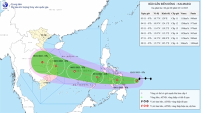
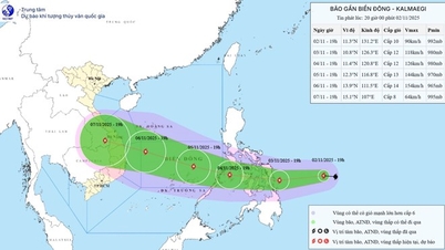
According to the forecast, from October 19 to 21 and October 24 to 25, there is a possibility of moderate rain, heavy rain, very heavy rain and thunderstorms. Heavy rain and localized heavy rain can cause flooding in low-lying areas; flash floods on small rivers and streams, landslides on steep slopes; during thunderstorms, be on guard against tornadoes, lightning, hail and strong gusts of wind.
According to updated information, at 4:00 p.m. on October 16, the water levels of hydroelectric reservoirs were recorded as follows: Bung 2 River at elevation 599.71m; Bung 4 River: 216.16m; A Vuong: 375.72m; Dak Mi 4: 251.54m; Tranh 2 River: 157.17m. Water levels at the hydrological stations Hoi Khach, Ai Nghia, Nong Son and Cau Lau are all below alert level I.
Source: https://baotintuc.vn/kinh-te/da-nang-yeu-cau-dieu-tiet-muc-nuoc-tai-cac-ho-thuy-dien-20251017122745254.htm


![[Photo] Lam Dong: Images of damage after a suspected lake burst in Tuy Phong](https://vphoto.vietnam.vn/thumb/1200x675/vietnam/resource/IMAGE/2025/11/02/1762078736805_8e7f5424f473782d2162-5118-jpg.webp)
![[Photo] President Luong Cuong receives US Secretary of War Pete Hegseth](https://vphoto.vietnam.vn/thumb/1200x675/vietnam/resource/IMAGE/2025/11/02/1762089839868_ndo_br_1-jpg.webp)


Comment (0)