
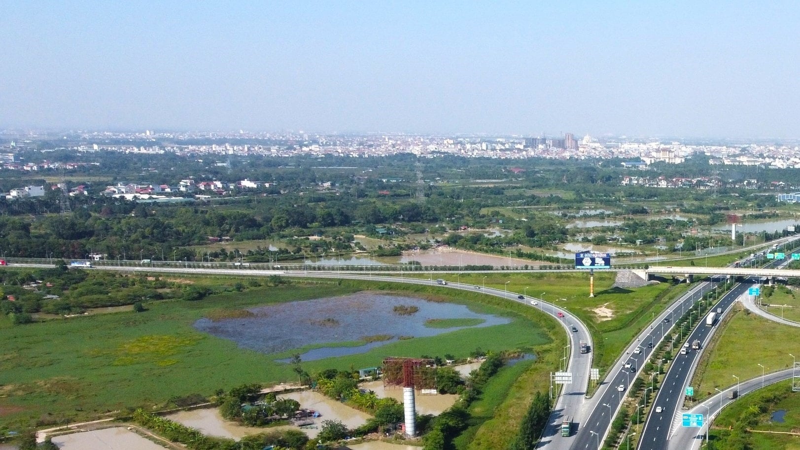
The investment project to build the route connecting Gia Binh airport with Hanoi capital, the section passing through the city, will be implemented under the public-private partnership (PPP) method, Build-Transfer (BT) contract with a total preliminary investment of nearly 33,000 billion VND. The construction period is expected to be in the period 2025-2026.

Project overview and location
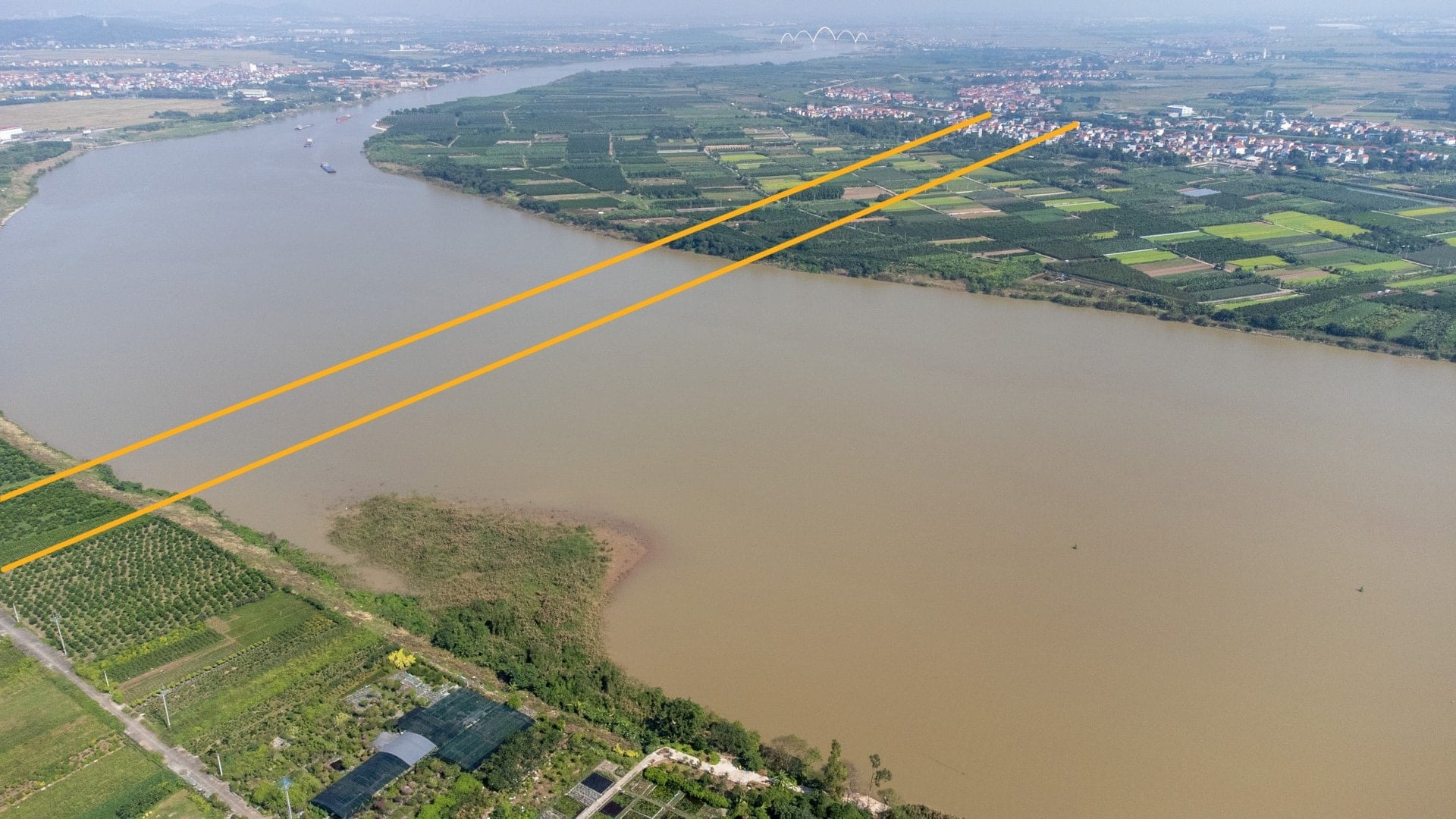
In Hanoi, the route is more than 10 km long, passing through Phu Dong and Thuan An communes of the old Gia Lam district. The starting point of the route is located in Thuan An commune, bordering Bac Ninh province. The end point connects to the intersection with Hanoi - Thai Nguyen expressway, Ring Road 3 and Tu Lien bridge approach project, located in the border area between Phu Dong commune, Dong Anh commune and Thu Lam commune.
Detailed route
From the starting point, the line will cross the Duong River, following a new direction towards VSIP Industrial Park, running close to the border between Hanoi and Bac Ninh. The line will go south of the Trung Mau station planning area on the Lao Cai – Hanoi – Hai Phong railway line.
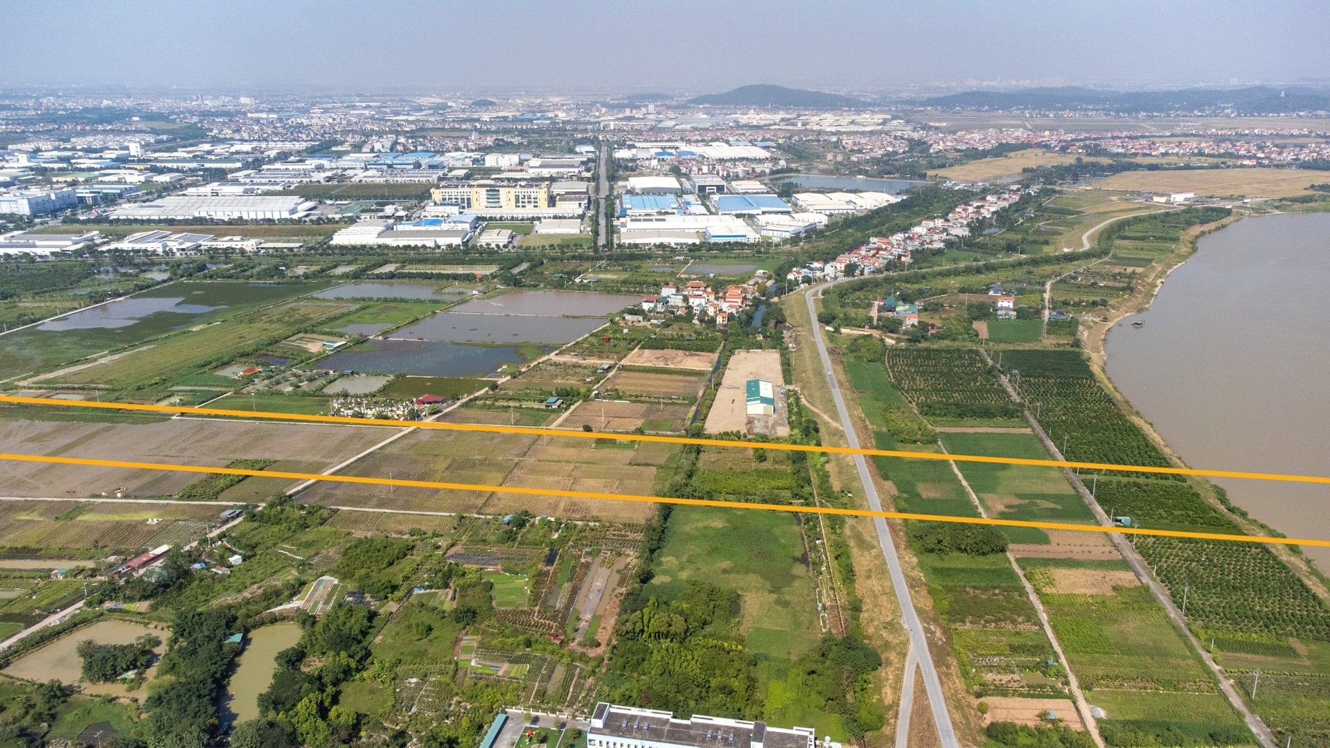
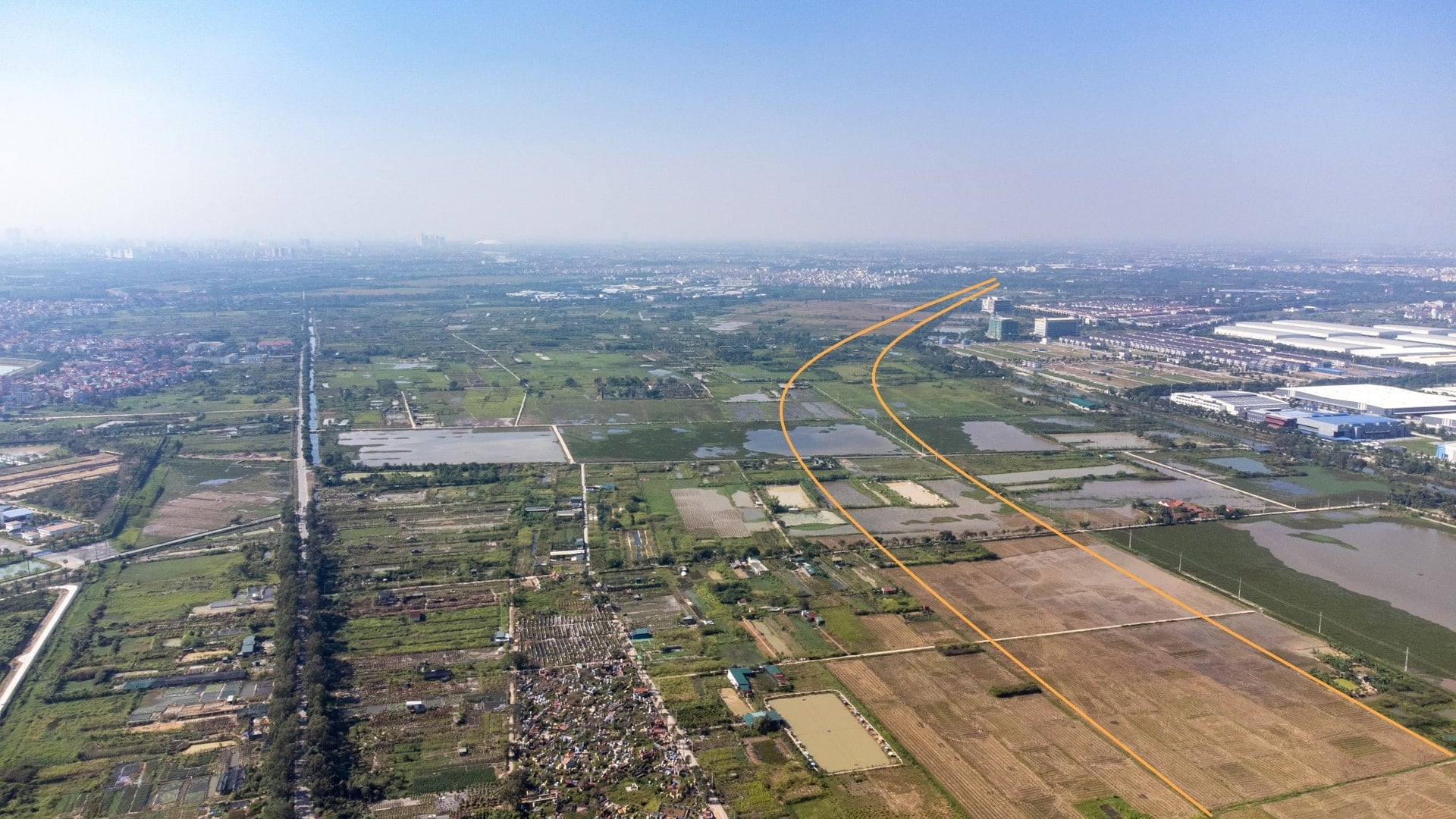
After passing Trung Mau station, the route continues towards Ninh Hiep intersection with Hanoi - Lang Son highway (the existing intersection will be renovated). From here, the route coincides with the direction of Ring Road 3/Hanoi - Thai Nguyen highway, passes through Yen Vien station area, Yen Thuong station, crosses Ngu Huyen Khe river and ends at the intersection with the road connecting Tu Lien bridge.
Scale and technical design
The route is designed according to expressway standards, with a maximum speed of 120 km/h and 10 lanes. The main route is about 13.55 km long. In addition, there is a route connecting to the Tu Lien bridge approach road, about 2.5 km long in Dong Anh commune, including a Y-shaped intersection.
Main segment
The section from the starting point to the intersection with the Hanoi – Ha Long Expressway and the Hanoi – Thai Nguyen Expressway/Ring Road 3 is about 7 km long. On this section, a bridge over the Duong River about 1.9 km long will be built for both road and rail.
The typical cross-section west of the Duong River Bridge is 120 m wide, including a 10-lane elevated expressway section (49.5 m wide viaduct) and parallel service roads on both sides, each side with 3 low lanes. The clearance of the elevated section is expected to be 7.5 m.
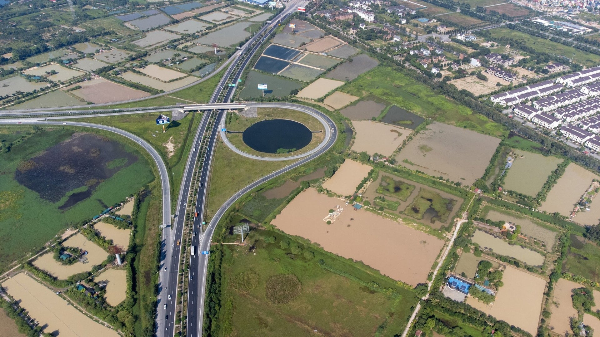
Section coinciding with Ring Road 3
The section coinciding with the Hanoi – Thai Nguyen/Ring 3 Expressway is approximately 6.55 km long (of which 1.62 km is in Bac Ninh province). This section will be expanded on the basis of the existing route, reaching a scale of 120 m, including a 10-lane expressway and two parallel service roads.
Important intersections and connections
The project will have two main intersections and direct intersections. Ninh Hiep intersection will connect with Hanoi – Lang Son expressway and Giang Bien bridge connecting route. Y-shaped intersection will connect the route with Tu Lien bridge approach project to Hanoi – Thai Nguyen expressway.
The branch connecting from Hanoi – Thai Nguyen Expressway/Ring 3 to Tu Lien Bridge approach road includes 2 separate branches: one branch from Gia Binh direction to Tu Lien Bridge and one branch from Tu Lien Bridge towards Gia Binh. Each branch has 3 lanes, 14 m wide and about 2.5 km long.
Source: https://baolamdong.vn/ha-noi-quy-hoach-cao-toc-33000-ty-dong-noi-san-bay-gia-binh-408374.html


![[Photo] Cat Ba - Green island paradise](/_next/image?url=https%3A%2F%2Fvphoto.vietnam.vn%2Fthumb%2F1200x675%2Fvietnam%2Fresource%2FIMAGE%2F2025%2F12%2F04%2F1764821844074_ndo_br_1-dcbthienduongxanh638-jpg.webp&w=3840&q=75)


Comment (0)