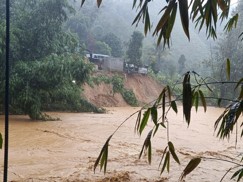
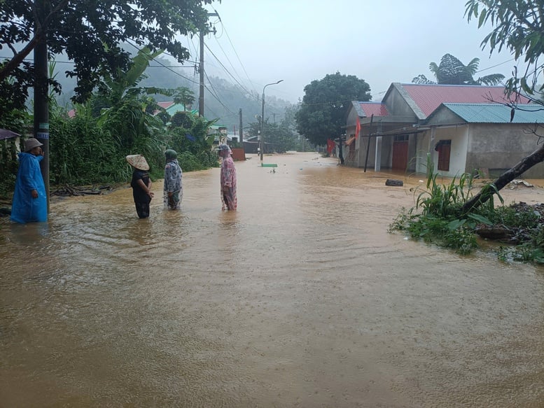
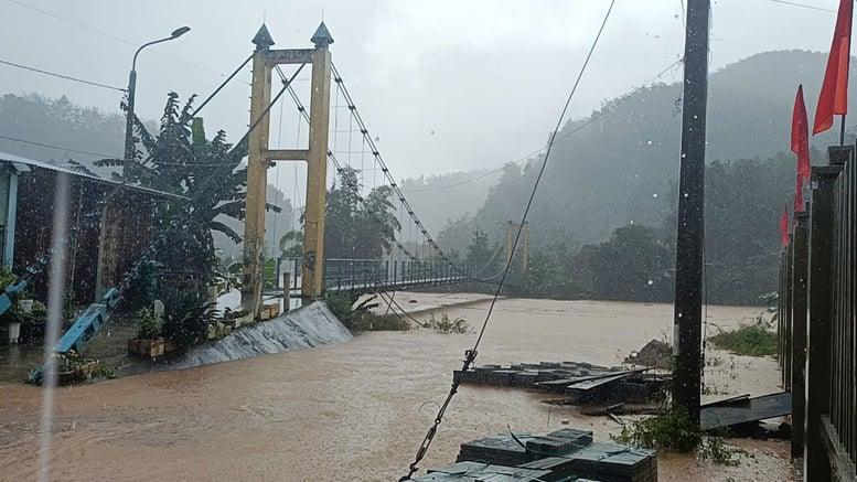
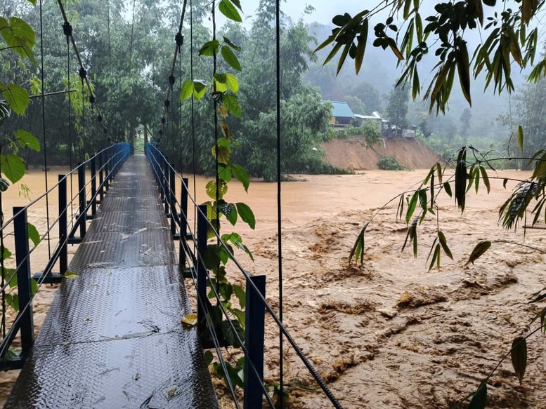
Floodwaters on the A Vuong River, A Vuong commune, on the morning of October 28th.
According to initial damage statistics, in Da Nang City, one person is missing, eight people were injured, 10 houses completely collapsed, 44 houses were damaged, and tens of thousands of houses were severely flooded. Large areas of crops and rice fields were submerged and swept away by the water.
Regarding transportation, heavy rains and floods have caused landslides, flooding, and road closures on many national and provincial roads such as QL40B, QL14B, 14G, 14H, DT601, DT606, DT615…
The coastal areas of West Hoi An and East Hoi An, stretching over 3.4km, are experiencing erosion of 25–30m inland, threatening residential areas.
Floods inundated 65,097 households, mainly concentrated in the communes of Ha Nha (8,370 households), Nam Phuoc (14,150 households), Dai Loc (15,000 households), Vu Gia (5,600 households), Hoa Tien (2,581 households), etc.
Authorities have evacuated 1,429 households/5,674 people to safe areas, mainly in landslide-prone areas (Tra Doc, Tra Linh, Tra Leng, etc.) and in heavily flooded communes (Duy Nghia, Ha Nha, Vu Gia, Dai Loc, Nam Phuoc, Hiep Duc, Thang An, etc.).

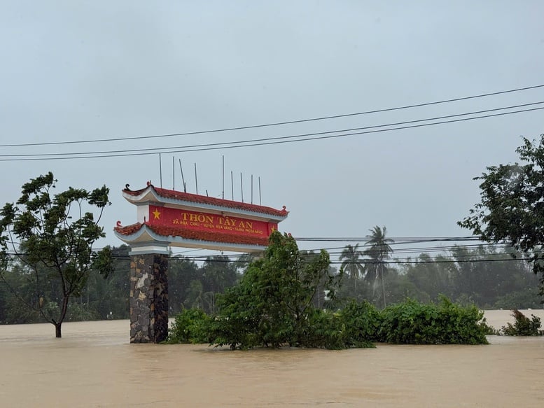
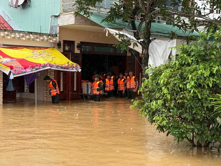
Armed forces of Military Region 5 are conducting surveys, inspections, and evacuating residents in Tay An village, Hoa Vang commune.
Water levels in the upper reaches of the Vu Gia-Thu Bon River are rising again.
According to the flood warning bulletin issued at 3:30 PM on October 28th by the Central Vietnam Regional Hydrometeorological Station, the water level in the upper reaches of the Vu Gia-Thu Bon River is currently rising again, while the water level in the lower reaches is fluctuating at a high level above Warning Level 3 on the Han River, and fluctuating above Warning Level 2 on the Tam Ky River.
Forecast for the next 24 hours: Floods on the Vu Gia - Thu Bon rivers are likely to rise again; the flood peak on the Vu Gia river will be 1-1.5m above Flood Level 3; on the Thu Bon river, the flood peak is likely to exceed historical flood levels by 0.1-0.4m (Maximum flood level at Cau Lau: 5.48m, Maximum flood level at Hoi An: 3.40m); the Han river will continue to rise above Flood Level 3 by about 0.2m; and the Tam Ky river will rise to approximately Flood Level 3.
Widespread and severe flooding continues in low-lying riverside areas, and in urban areas, especially in the communes of: Que Phuoc, Nong Son, Duy Xuyen, Thu Bon, Xuan Phu, Thanh My, Thuong Duc, Ha Nha, Phu Thuan, Vu Gia, Dai Loc, Go Noi, Dien Ban Tay, Dien Ban Bac, Hoa Tien, Hoi An, Hoi An Tay, Hoi An Dong, Nam Phuoc, Duy Nghia, An Thang, Ban Thach Ward, Huong Tra Ward, Quang Phu Ward, Tay Ho Commune, Thang Dien, Thang Truong, Que Xuan, Hoa Xuan, Ngu Hanh Son, Cam Le...
There is a very high risk of flash floods and landslides on the slopes of the mountainous areas of Da Nang city.
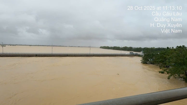
The floodwaters on the Thu Bon River are approximately at the bottom of the Cau Lau bridge girder. Currently, the river water level is rising again.
Heavy rain continues across the city.
According to the Central Vietnam Regional Hydrometeorological Station, heavy to very heavy rain and thunderstorms are forecast for the entire night of October 29th in the communes and wards of Da Nang city. Total rainfall in the lowland communes and wards will generally range from 120-250mm, with some areas exceeding 300mm; mountainous communes and wards will generally receive 150-300mm, with some areas exceeding 400mm. A warning is issued regarding the risk of heavy rainfall exceeding 150 mm/3h in mountainous areas.
From October 30th onwards, rainfall is expected to gradually decrease, but moderate to heavy rain is still possible in some areas, with common rainfall amounts of 20-40mm, and over 70mm in some places.
The Phong
Source: https://baochinhphu.vn/hon-65000-ho-dan-tai-tp-da-nang-bi-ngap-do-mua-lu-102251028163022666.htm


![[Photo] Two flights successfully landed and took off at Long Thanh Airport.](/_next/image?url=https%3A%2F%2Fvphoto.vietnam.vn%2Fthumb%2F1200x675%2Fvietnam%2Fresource%2FIMAGE%2F2025%2F12%2F15%2F1765808718882_ndo_br_img-8897-resize-5807-jpg.webp&w=3840&q=75)










Comment (0)