
Besides, although the downstream of Ngan Sau River ( Ha Tinh ) and Tra Khuc River (Quang Ngai) are decreasing, from now until November 5, it is forecasted that floods on rivers in Ha Tinh, Quang Tri, and Quang Ngai are likely to rise again.
According to the National Center for Hydro-Meteorological Forecasting, in Hue , at 8:00 a.m. on November 3, the water level on the Huong River at Kim Long station was 3.89 m, on BĐ3 was 0.39 m. The water level on the Bo River at Phu Oc station was 4.81 m, on BĐ3 was 0.31 m.
In Da Nang , the water level on Vu Gia river at Ai Nghia station is 9.74m, on BĐ3 is 0.74m. The water level on Thu Bon river at Cau Lau station is 4.23m, on BĐ3 is 0.23m;
In Quang Ngai, Tra Khuc River at Tra Khuc station is on BĐ1 and in Ha Tinh, Ngan Sau River at Hoa Duyet station is also on BĐ1.

At 9am on November 3, the water level of the Perfume River rose and flooded Dong Ba market. Photo: Van Dinh.
It is forecasted that from the morning of November 3 to the end of November 4, the area from Ha Tinh to Hue City will have heavy to very heavy rain with common rainfall of 150-250mm, locally over 400mm.
Da Nang City area has heavy rain with common rainfall of 100-200mm, locally very heavy over 250mm. Risk of heavy rain over 200mm within 3 hours.
In the next 12-24 hours, floods on Huong River, Bo River, Vu Gia - Thu Bon River will continue to fluctuate at high levels from BĐ3 to above BĐ3.
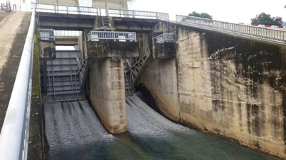
Specifically, by the morning of November 4, the water level of Bo River at Phuc Oc could rise to 4.9m - 0.4m above BĐ 3 (with Huong Dien Lake expected to discharge from 3,000-4,000m3/s).
The water level of the Huong River at Kim Long rose to 4.6m - on level 3 it was 1.1m (with Tra Trach and Binh Dien lakes expected to discharge from 4,000-5,000m3/s).
The water level of Vu Gia River at Ai Nghia has decreased to 9m, equivalent to BĐ 3 (with the expected discharge of A Vuong Lake, Bung 4 River and DakMi 4 from 2,500-3,500m3/s).
The water level of Thu Bon River at Cau Lau is 4.1m - 0.1m above BĐ 3 (with expected discharge from Tranh River reservoir from 800-1,200m3/s).
 is from Ha Tinh to Da Nang city. Photo: NCHMF.")
Forecast from the morning of November 3 to the morning of November 4, the heaviest rain area (red) is from Ha Tinh to Da Nang city. Photo: NCHMF .
In the next 24 hours, floods on Ngan Sau and Tra Khuc rivers will fluctuate at level BĐ1 to above BĐ1. It is forecasted that from now until November 5, floods on rivers in Ha Tinh, Quang Tri, and Quang Ngai will likely rise again. During this flood, peak water levels on Ngan Sau and Ngan Pho rivers (Ha Tinh), Gianh, Kien Giang, and Thach Han rivers (Quang Tri) will reach level BĐ2-BĐ3, with some rivers above BĐ3. The hydrometeorological agency warns of the risk of flooding in low-lying areas along rivers, urban areas, and residential areas in provinces from Ha Tinh to Quang Ngai; there is a high risk of flash floods on rivers and streams and landslides on steep slopes.
Deeply flooded communes/wards
In the next 24 hours, low-lying areas along the river will continue to be maintained and at risk of increasing flooding depth and area. Specifically:
In Ha Tinh, there are the following communes/wards: Huong Do, Huong Pho, Ha Linh, Phuc Trach, Huong Khe, Huong Xuan, Vung Ang, Song Tri, Hoanh Son, Ky Anh, Ky Xuan, Ky Thuong, Ky Van Due, Cam Lac, Tran Phu, Ha Huy Tap, Cam Binh, Thach Xuan.
Hue City includes the following communes/wards: Phong Dinh, Phong Phu, Phong Quang, Phong Thai, Dan Dien, Quang Dien, Hoa Chau, Duong No, Thuan An, Huong Tra, Huong An, Kim Tra, My Thuong, Phu Ho, Kim Long, Thuan Hoa, Phu Xuan, Thuy Xuan, Huong Thuy, Vy Da, An Cuu, Thanh Thuy, Phu Vinh, Phu Vang, Vinh Loc, Phu Bai, Loc An, Hung Loc, Phu Loc.
Da Nang City includes the following communes/wards: Go Noi, Thuong Duc, Vu Gia, Ha Nha, Dai Loc, Nong Son, Que Phuoc, Duy Xuyen, Thu Bon, Phu Thuan, Hai Van, Hoa Xuan, Hoa Tien, Lien Chieu, Ngu Hanh Son, Hoa Vang, Ba Na, Duy Xuyen, Thanh My, Phuoc Tra; Viet An, Son Cam Ha; Xuan Phu, Thang An, Thang Dien, Thang Binh, Thang Phu, Dong Duong, Quang Phu, Tay Ho, Phu Ninh; Dien Ban Tay, Nam Phuoc, An Thang Ward, Hoi An, Hoi An Tay, Hoi An Dong, Duy Nghia, Dien Ban, Dien Ban Bac.
With flood forecast in Quang Tri, in the next 24 hours, low-lying areas along Kien Giang river will continue to be maintained and at risk of increasing flood depth and area, including the communes: Quang Ninh, Ninh Chau, Truong Ninh, Cam Hong, Sen Ngu, Le Ninh, Le Thuy, Sen Thuy, Tan My.
Widespread flooding in low-lying areas downstream of the O Lau River, including the communes of Dien Sanh, Hai Lang, Nam Hai Lang, My Thuy, and Vinh Dinh, has increased again.
Low-lying areas at risk of widespread flooding include the following communes and wards: Tuyen Phu, Tuyen Binh, Tuyen Hoa, Tan Gianh, Nam Ba Don, Nam Gianh, Bo Trach, Bac Trach, Ba Don, Bac Gianh (Gianh River basin); Vinh Linh, Cua Tung, Vinh Hoang, Vinh Thuy (Ben Hai River basin); Hieu Giang, Cam Lo, Dong Ha (Hieu River basin); Trieu Co, Quang Tri, Ai Tu, Trieu Binh, Nam Cua Viet, Trieu Phong (Thach Han River basin).
Source: https://nongnghiepmoitruong.vn/lu-cac-song-o-hue-da-nang-vuot-bao-dong-3-d782015.html

![[Photo] Panorama of the Patriotic Emulation Congress of Nhan Dan Newspaper for the period 2025-2030](https://vphoto.vietnam.vn/thumb/1200x675/vietnam/resource/IMAGE/2025/11/04/1762252775462_ndo_br_dhthiduayeuncbaond-6125-jpg.webp)
![[Photo] Ho Chi Minh City Youth Take Action for a Cleaner Environment](https://vphoto.vietnam.vn/thumb/1200x675/vietnam/resource/IMAGE/2025/11/04/1762233574890_550816358-1108586934787014-6430522970717297480-n-1-jpg.webp)

![[Photo] The road connecting Dong Nai with Ho Chi Minh City is still unfinished after 5 years of construction.](https://vphoto.vietnam.vn/thumb/1200x675/vietnam/resource/IMAGE/2025/11/04/1762241675985_ndo_br_dji-20251104104418-0635-d-resize-1295-jpg.webp)
![[Photo] Ca Mau "struggling" to cope with the highest tide of the year, forecast to exceed alert level 3](https://vphoto.vietnam.vn/thumb/1200x675/vietnam/resource/IMAGE/2025/11/04/1762235371445_ndo_br_trieu-cuong-2-6486-jpg.webp)


Comment (0)