
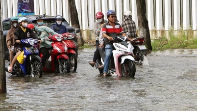
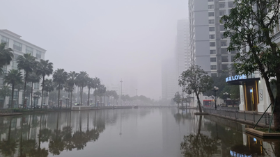
At the seminar, speakers provided an overview of the flooding situation in Ho Chi Minh City. According to them, due to its location downstream of the Dong Nai - Saigon River, Ho Chi Minh City is affected by several sources of flooding. Firstly, heavy rainfall has led to a rapid increase in the number of widespread flooding events (rainfall exceeding 60mm), reaching 3.6 events per year compared to 1.5 events before 2009. Rainfall has also seen a significant increase of 22mm per year.
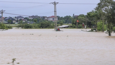
Secondly, there are tidal surges and rising sea levels due to climate change. Water levels in rivers and canals are rising rapidly at a rate of 1.5 cm/year. The frequency of tidal surges exceeding alarm levels has increased in the Ho Chi Minh City area, with many instances approaching or exceeding historical water levels, especially at the Phu An station (Saigon River).
And finally, there is the risk of flooding due to river overflow. In the Saigon River area, flooding will occur when the discharge from upstream reservoirs (Dau Tieng, Tri An) exceeds 200 m³ /second on high tide days.

Meanwhile, the existing flood control infrastructure has only focused on developing the central wards with the left and right bank dikes of the Saigon River and tidal gates according to Decision 1547/QD-TTg of 2008 (referred to as Planning 1547). The drainage system according to Decision 752/QD-TTg of 2001 (Planning 752) is no longer suitable due to design factors with low water levels and rainfall, and does not take into account the impact of climate change and sea level rise.
To address the flooding situation, the Ho Chi Minh City government has been implementing a comprehensive strategy, including both structural and non-structural solutions. Based on the characteristics of the existing infrastructure and flood risk zoning, a four-zone, three-layer flood control strategy has been developed.
According to Mr. Pham Hoai Trung, Deputy Head of the Technical Infrastructure Planning Department (Ho Chi Minh City Department of Planning and Architecture), the protection layer focuses on completing the system of dikes and embankments to prevent tidal surges and floods according to Planning 1547 to protect low-lying areas from high tides and water levels. The flood protection elevation is planned to be between 2.5 and 3.2 meters. For areas outside the dikes, the development of ecological urban areas with good flood adaptation capabilities is planned.
The adaptation layer will include nature-based solutions and green infrastructure (BGI) along with the application of "sponge city" concepts, as introduced by German speaker Frank Pogade, Director of Water Solutions South-East Asia Co.ltd. These solutions include retention ponds, riverside parks with flood storage capabilities, rain gardens, permeable sidewalks, underground reservoirs, etc.
Finally, the focus is on solutions to mitigate damage from extreme flooding events that exceed design standards, such as implementing a real-time flood risk warning system. In addition, solutions related to drainage, technology application, regional connectivity, and supplementary policies to attract investment are also discussed.
Speaking at the seminar, the German Consul General in Ho Chi Minh City, Ms. Andrea Maria Suhl, emphasized that Ho Chi Minh City, like many rapidly developing urban centers, faces increasing challenges from extreme weather events and rising sea levels. Effective water management is not simply an environmental issue; it is fundamental to economic stability, public health, and the overall quality of life in the city.
Source: https://www.sggp.org.vn/phat-develop-urban-sustainable-climate-change-adaptation-post828010.html


![[Video] The craft of making Dong Ho folk paintings has been inscribed by UNESCO on the List of Crafts in Need of Urgent Safeguarding.](https://vphoto.vietnam.vn/thumb/402x226/vietnam/resource/IMAGE/2025/12/10/1765350246533_tranh-dong-ho-734-jpg.webp)


Comment (0)