
Over the past years, the Department of Natural Resources and Environment (DONRE) has proactively coordinated with units and localities to carry out many practical activities to enhance the task of building, managing, protecting and sustainably developing marine and island resources in the province.
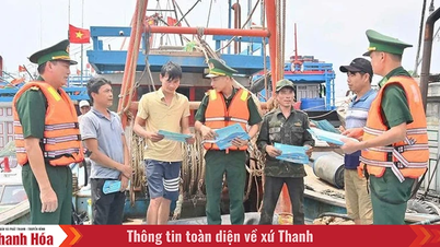
One of the tasks that the sector is interested in implementing to improve the effectiveness of State management, protection and sustainable development of marine and island resources is propaganda and dissemination to raise awareness of all classes of people about the position and role of the sea and islands and the importance of protecting and sustainably developing marine and island resources; organizing activities in response to "Vietnam Sea and Islands Week and World Oceans Day" attracting the participation of many classes of people. In addition, during the implementation process, the Department of Natural Resources and Environment has coordinated with press and media agencies to organize propaganda activities on management and protection of marine and island resources and provide information on activities to information and propaganda units.
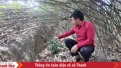
According to Mr. Trinh Ngoc Dung, Deputy Head of the Department of Sea and Islands, Department of Natural Resources and Environment, the propaganda to improve the effectiveness of State management of marine and island resources in the province has achieved certain results. Through propaganda work, awareness of the importance of environmental protection of the authorities and people of coastal districts has been raised, coastal people have become aware of protecting marine resources, thereby having plans to exploit marine resources reasonably. In addition, coastal people have also had correct perceptions of the role and importance of mangrove forests and are willing to contribute their efforts to care for and protect mangrove forests, contributing to solving the problem of coastal erosion and landslides.
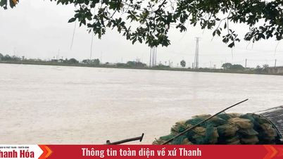
In addition to propaganda work, the Department of Natural Resources and Environment has effectively implemented the Comprehensive Marine Environmental Monitoring Program; Control of Marine Environmental Pollution... Accordingly, every year, the Department of Natural Resources and Environment coordinates with relevant units to conduct investigations, surveys, and collect information and data on the current environmental status and environmental protection activities at river mouths, seaports, fishing ports, storm shelters, fishing logistics service facilities, concentrated seafood farming areas, and coastal and marine tourism areas. The scope of survey and sampling for analysis is at concentrated seafood farming areas, river mouths, seaports, fishing ports, fishing wharves, and storm shelters in the districts of Nga Son, Hau Loc, Hoang Hoa, Quang Xuong, Nghi Son town and Sam Son city. According to the plan, in 2023, marine environmental samples will be taken at 28 locations in seaport areas, fishing ports, fishing wharves, and storm shelters such as Nghi Son Port, Lach Bang Fishing Port, Lach Hoi Fishing Port, etc. The frequency of monitoring is 2-3 times/year depending on each sample. For environmental samples of coastal tourist areas, monitoring will be done at 9 locations, including: Sam Son Tourist Area, Sam Son City; Hai Hoa Tourist Area, Nghi Son Town; Hai Tien Tourist Area, Hoang Hoa District. The frequency of monitoring is 3 times/year (before, during and after the tourist season)... Through monitoring activities, management agencies will grasp the current status and trends of marine environmental quality, promptly detect and warn of environmental pollution incidents as well as propose solutions, contributing to improving the efficiency of management, exploitation, use of resources and protection of the marine environment.
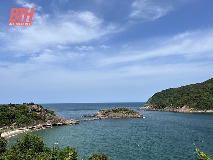
Thanh Hoa has 102 km of coastline and a territorial sea of 17,000 km2, with large seafood reserves. Along the coast, there are 5 large estuaries, convenient for fishing boats and ships to enter and exit. In the estuary area, there are thousands of hectares of mud and sand flats, convenient for aquaculture, wave-blocking trees and salt production... In particular, Thanh Hoa also has Hon Me and Hon Ne island clusters with important positions and roles in both political security and economic development. In order to promote advantages, effectively exploit and protect marine and island resources in the province, along with the above tasks, since 2019, the Department of Natural Resources and Environment has also coordinated with functional units to establish and manage island resource records in the province. Up to now, 24 island resource records (Hon Me island cluster with 23 large and small islands; Hon Ne island) have been approved. According to Deputy Head of the Department of Sea and Islands, Department of Natural Resources and Environment Trinh Ngoc Dung, the establishment of island resource profiles aims to closely assess the current status of the province's island resources, thereby proposing solutions and strategies to exploit these resources, contributing to improving the management and effective exploitation of the province's marine potential.
Article and photos: Le Phong
Source


![[Photo] Cat Ba - Green island paradise](/_next/image?url=https%3A%2F%2Fvphoto.vietnam.vn%2Fthumb%2F1200x675%2Fvietnam%2Fresource%2FIMAGE%2F2025%2F12%2F04%2F1764821844074_ndo_br_1-dcbthienduongxanh638-jpg.webp&w=3840&q=75)


![[VIMC 40 days of lightning speed] Da Nang Port: Unity - Lightning speed - Breakthrough to the finish line](https://vphoto.vietnam.vn/thumb/402x226/vietnam/resource/IMAGE/2025/12/04/1764833540882_cdn_4-12-25.jpeg)


Comment (0)