
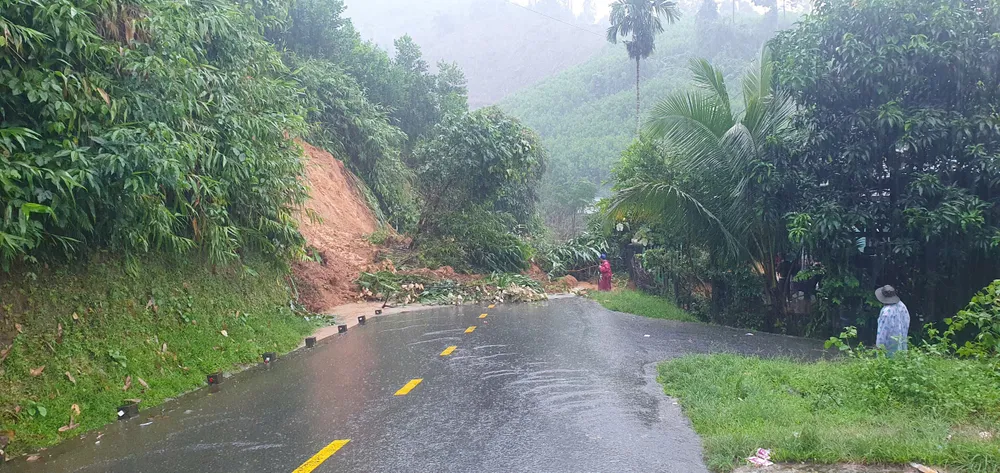
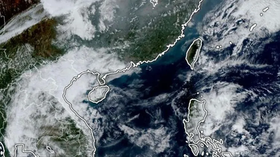
According to the 9am bulletin of the same day from the Central Hydrometeorological Station, from October 26 to 29, Da Nang City will have heavy to very heavy rain, with total rainfall ranging from 150-350mm, in some places over 500mm.
It is forecasted that rivers in the area may experience a flood, with the flood peak on Vu Gia - Thu Bon River and Tam Ky River at alert level 1 to alert level 2, with some places above alert level 2. There is a high risk of flooding in low-lying areas and urban areas, along with flash floods and landslides in mountainous areas.

Along with that, on the night of October 26, the cold air will strengthen and affect Da Nang City. Northeast wind will gradually increase to level 4-5, gusting to level 6-7 in coastal areas; at sea, especially in the Hoang Sa special zone, strong wind will increase to level 6-7, gusting to level 8-9, rough seas, waves 3-5m high. The lowest temperature is commonly 22-24°C, in mountainous areas, some places below 22°C.
Faced with complicated weather developments, the Da Nang City Civil Defense Command has issued a document requesting departments, branches, armed forces, People's Committees of districts, communes, wards, special zones and reservoir management units to proactively deploy response measures.
")
Specifically, units are required to be on duty seriously, closely monitor disaster forecasts and warnings, promptly notify people; deploy plans to prevent and combat heavy rain, flooding, and landslides to ensure safety for people, vehicles, and constructions.
Localities must check high-risk areas, arrange guards and checkpoints at deep flooded areas with fast-flowing water, and prepare evacuation plans when necessary.
The Department of Construction is assigned to preside over inspection and timely handling of flooding and landslides on traffic routes; the Department of Agriculture and Environment inspects and ensures safety of agricultural production activities.
The Department of Culture, Sports and Tourism and localities require tourist areas and outdoor entertainment areas to ensure safety for visitors and infrastructure.
The City Military Command, Border Guards and coastal localities are required to closely monitor weather conditions at sea, notify ships to proactively take precautions and not go out to sea when the weather is bad.
Reservoir management units must strengthen monitoring, timely reporting, and proactively regulate to ensure downstream safety.
At noon of the same day, A Vuong Hydropower Joint Stock Company announced that from 2:00 p.m. on October 26, it will operate the reservoir spillway to cut and reduce flooding downstream.
At 12:30 on October 26, the water flow into the lake reached 636.38m³/s, exceeding the threshold of 600m³/s - the level that activates the inter-lake operation process (according to Decision 1865/QD-TTg). The lake water level was at 371.97m, close to the normal water level. The expected discharge flow is 25-900m³/s, regulated lower than the water flow into the lake to limit flooding in downstream areas.
Source: https://www.sggp.org.vn/da-nang-chu-dong-ung-pho-voi-thoi-tiet-bat-loi-post820043.html

![[Photo] Prime Minister Pham Minh Chinh holds a phone call with the CEO of Russia's Rosatom Corporation.](/_next/image?url=https%3A%2F%2Fvphoto.vietnam.vn%2Fthumb%2F1200x675%2Fvietnam%2Fresource%2FIMAGE%2F2025%2F12%2F11%2F1765464552365_dsc-5295-jpg.webp&w=3840&q=75)


![[Photo] Closing Ceremony of the 10th Session of the 15th National Assembly](/_next/image?url=https%3A%2F%2Fvphoto.vietnam.vn%2Fthumb%2F1200x675%2Fvietnam%2Fresource%2FIMAGE%2F2025%2F12%2F11%2F1765448959967_image-1437-jpg.webp&w=3840&q=75)


![[Infographic] Preventing students from making their own firecrackers: 7 things parents need to know](https://vphoto.vietnam.vn/thumb/402x226/vietnam/resource/IMAGE/2025/12/11/1765466656703_img_0320_20251211183542.jpeg)


![[OFFICIAL] MISA GROUP ANNOUNCES ITS PIONEERING BRAND POSITIONING IN BUILDING AGENTIC AI FOR BUSINESSES, HOUSEHOLDS, AND THE GOVERNMENT](https://vphoto.vietnam.vn/thumb/402x226/vietnam/resource/IMAGE/2025/12/11/1765444754256_agentic-ai_postfb-scaled.png)


Comment (0)