
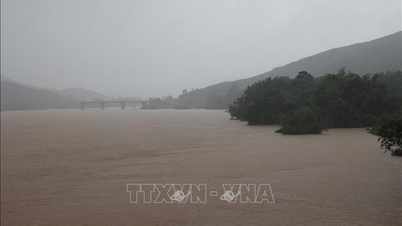
Due to the influence of low pressure circulation combined with cold air, heavy rains appeared in the city and neighboring areas, water levels on Vu Gia, Tuy Loan, Cu De, Cam Le rivers... rose, some places above alert level 3.
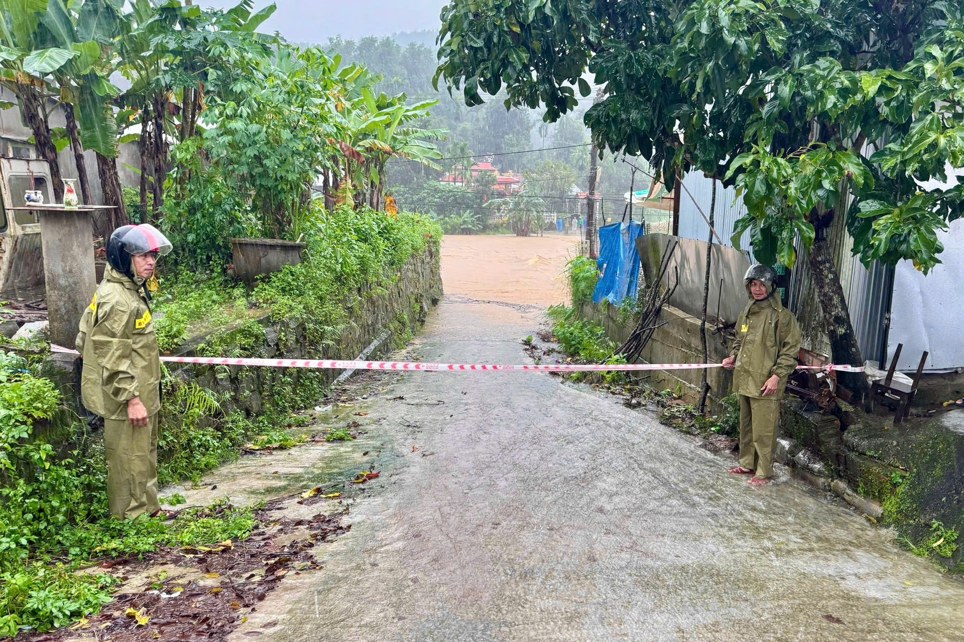
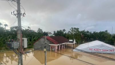
Many roads and residential areas are deeply flooded and partially isolated. The risk of landslides in mountainous communes in the city is complicated.
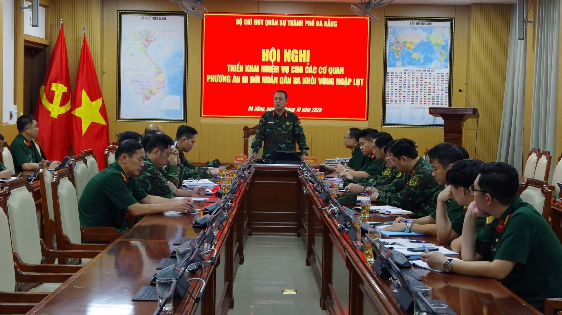
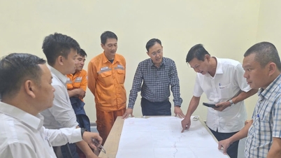
Faced with that situation, the City Military Command directed agencies and units on duty for natural disaster prevention, control, search and rescue to grasp the situation and proactively advise local Party committees and authorities to deploy response plans.
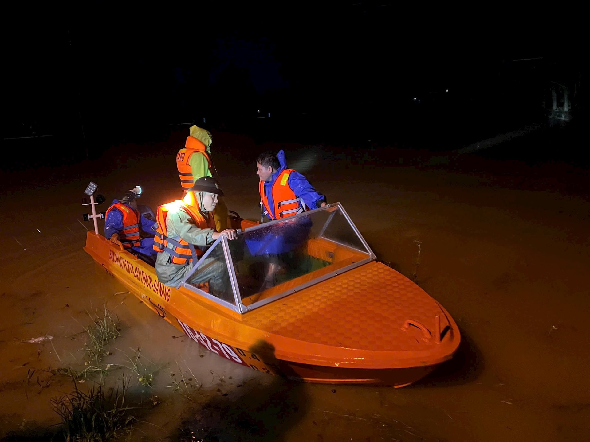
The City Military Command mobilized nearly 6,300 officers, soldiers and militiamen, along with 19 motor vehicles, rescue boats, and canoes ready to move in case of emergency.
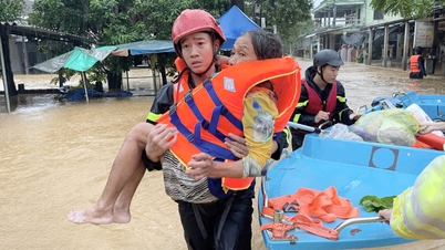
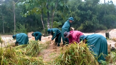
As of the morning of October 28, the city's armed forces coordinated with localities to evacuate more than 4,200 households with more than 11,400 people out of deep flooded areas at risk of landslides.
The relocation work was carried out urgently and safely, ensuring temporary accommodation for people; especially supporting the elderly, children and policy households.
After the flood receded, the City Military Command closely coordinated with units of Military Region 5 stationed in the area to help people overcome the consequences and stabilize their lives.
* According to a quick report from the Department of Water Resources and Irrigation Management (under the Department of Agriculture and Environment), as of 5:00 a.m. on October 28, the entire city of Da Nang had evacuated 1,101 households with 3,572 people in mountainous and low-lying areas to safety.
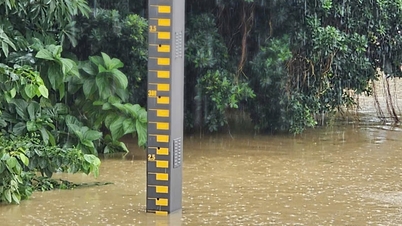
At 5:00 a.m. on October 28, the water levels of the Vu Gia, Thu Bon, and Tam Ky rivers all rose. At Ai Nghia, the Vu Gia River reached 10.3m (0.19m higher than in 2017); the Thu Bon River at Cau Lau reached 5.35m, and at Hoi An 3.25m. It is forecasted that in the next 6-12 hours, the flood will peak and recede slowly, with the risk of deep flooding continuing in low-lying areas and along the river.
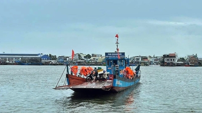
Flooding was recorded in many localities such as Que Phuoc, Nong Son, Duy Xuyen, Xuan Phu, Ha Nha, Vu Gia, Dai Loc, Dien Ban Tay, Hoa Tien, Nam Phuoc, Hoi An...
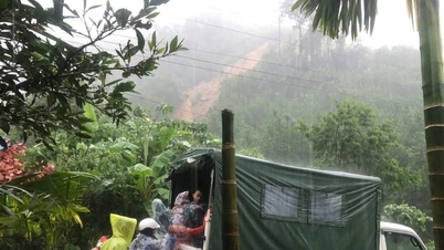
Mountainous areas face a very high risk of flash floods and landslides. Large reservoirs such as Hoa Trung, Dong Nghe, A Vuong, Song Bung, Dak Mi 4… are operating to cut and reduce floods according to regulations to ensure safety for downstream areas.
By the morning of October 28, mountainous communes had evacuated thousands of people to safety. According to preliminary statistics, Tra Doc commune evacuated 141 households/620 people; Tra Leng 51 households/265 people; Phuoc Thanh 45 households/136 people; and many households in Phuoc Chanh, Tra Giap, Duy Nghia, Ha Nha, Vu Gia, Tra Van...
At Tra Leng 1 Secondary School, 35 students were arranged to stay at school, with teachers on duty 24/7.

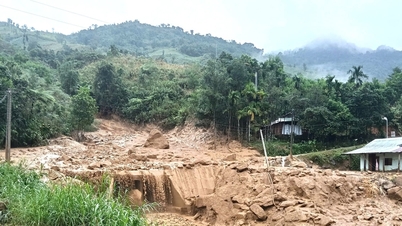
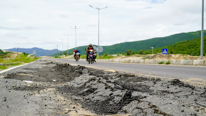
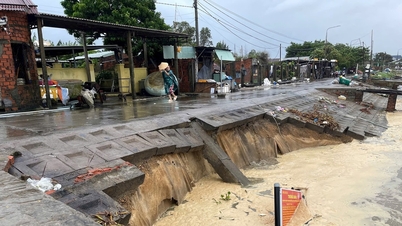
Prolonged heavy rains caused damage in many localities. In particular, Hoi An Tay ward suffered landslides along more than 3km of coastline, with some sections of seawater eroding 25-30m deep; Hoi An Dong damaged 700m of De Vong dike.
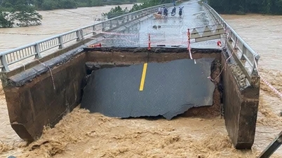
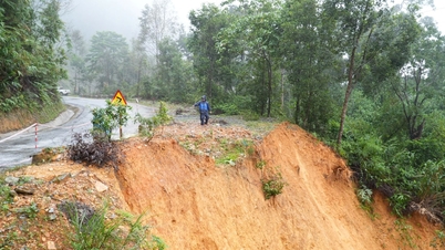
In the mountainous areas, traffic routes DH1, DH3, DH7 and National Highway 40B suffered dozens of landslides, many sections were completely cut off. National Highway 40B alone recorded more than 20 landslides with a volume of earth and rock of about 20,000m³, many areas were isolated.
Source: https://baodanang.vn/da-nang-yeu-cau-tiep-tuc-di-doi-nguoi-dan-ra-khoi-vung-ngap-lut-3308496.html


![[Photo] National Assembly Chairman Tran Thanh Man received a delegation of the Social Democratic Party of Germany](https://vphoto.vietnam.vn/thumb/1200x675/vietnam/resource/IMAGE/2025/10/28/1761652150406_ndo_br_cover-3345-jpg.webp)
![[Photo] Prime Minister Pham Minh Chinh chaired a meeting to discuss solutions to overcome the consequences of floods in the central provinces.](https://vphoto.vietnam.vn/thumb/1200x675/vietnam/resource/IMAGE/2025/10/29/1761716305524_dsc-7735-jpg.webp)
![[Photo] Flooding on the right side of the gate, entrance to Hue Citadel](https://vphoto.vietnam.vn/thumb/1200x675/vietnam/resource/IMAGE/2025/10/28/1761660788143_ndo_br_gen-h-z7165069467254-74c71c36d0cb396744b678cec80552f0-2-jpg.webp)


![[Photo] Draft documents of the 14th Party Congress reach people at the Commune Cultural Post Offices](https://vphoto.vietnam.vn/thumb/1200x675/vietnam/resource/IMAGE/2025/10/28/1761642182616_du-thao-tai-tinh-hung-yen-4070-5235-jpg.webp)
![[Photo] President Luong Cuong attends the 80th Anniversary of the Traditional Day of the Armed Forces of Military Region 3](https://vphoto.vietnam.vn/thumb/1200x675/vietnam/resource/IMAGE/2025/10/28/1761635584312_ndo_br_1-jpg.webp)


Comment (0)