
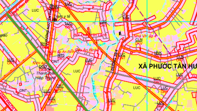
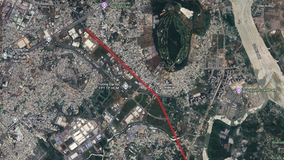
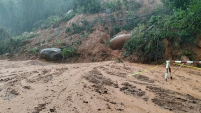
According to the land use planning adjustment map for the period 2021 - 2030 of Can Duoc district, Long An province, My Le commune will have a number of important new roads opened to complete the traffic network and promote socio-economic development.
My Le commune has an important connecting position, bordering Long Cang, Rach Kien and My Loc communes to the north; Phuoc Vinh Tay commune to the east; Tan Lan, Can Duoc, Vam Co and Tan Tru communes to the south; Nhat Tao commune to the west.
1. Provincial Road 830E
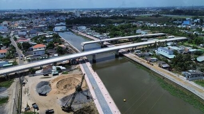
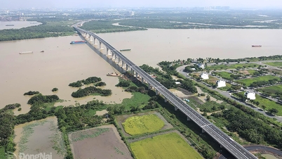
This is one of the most prominent traffic infrastructure projects in the commune's planning. Provincial Road 830E is expected to be about 4.1 km long within My Le commune. The route of the route will intersect existing traffic axes including Provincial Road 827D, Provincial Road 826 and Provincial Road 830. One end of the route is planned to cross the Doi Ma River, creating a new and smooth connection for the area.


2. Connecting route to Provincial Road 827D
A new connecting route is planned to be built, crossing Provincial Road 827D and Provincial Road 826. This road section is about 1.1 km long in My Le commune. The goal of the route is to enhance connectivity between provincial roads, reduce traffic pressure and facilitate the movement and transportation of goods in the area.


3. New route across the Doi Ma River
The plan also includes a short but important route, about 700 m long, crossing the Doi Ma River. This project, once completed, will help connect the two banks of the river, significantly shortening the travel distance for people and vehicles, contributing to the completion of the local traffic infrastructure of the commune.

Note: The diagrams in the article are drawn relatively based on the Land Use Planning Adjustment Map for the period 2021 - 2030 of Can Duoc district, Long An province. Planning information may change during the actual implementation process.
Source: https://baolamdong.vn/long-an-ba-tuyen-duong-trong-diem-sap-mo-tai-xa-my-le-406878.html


![[Photo] Parade to celebrate the 50th anniversary of Laos' National Day](/_next/image?url=https%3A%2F%2Fvphoto.vietnam.vn%2Fthumb%2F1200x675%2Fvietnam%2Fresource%2FIMAGE%2F2025%2F12%2F02%2F1764691918289_ndo_br_0-jpg.webp&w=3840&q=75)
![[Photo] Worshiping the Tuyet Son statue - a nearly 400-year-old treasure at Keo Pagoda](/_next/image?url=https%3A%2F%2Fvphoto.vietnam.vn%2Fthumb%2F1200x675%2Fvietnam%2Fresource%2FIMAGE%2F2025%2F12%2F02%2F1764679323086_ndo_br_tempimageomw0hi-4884-jpg.webp&w=3840&q=75)


Comment (0)