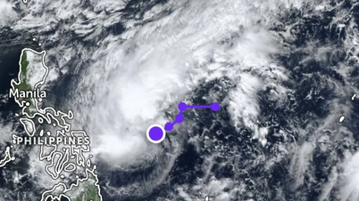
Early this morning, the center of the storm was at about 13.7 degrees North latitude and 122.7 degrees East longitude, in the sea area east of the central Philippines. At this time, the storm is still strong at level 8 (62-74 km/h), gusting to level 10 and moving steadily in the West Northwest direction at a speed of about 20 km/h.
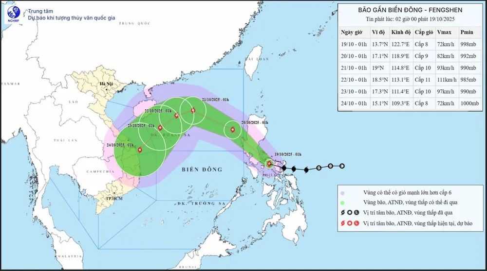
The National Center for Hydro-Meteorological Forecasting said that from October 20 to 22, the North East Sea area (including Hoang Sa special zone) is likely to be affected by strong winds of level 10-11, gusting to level 13.
According to meteorological experts, storm No. 12 initially moved rapidly in a northwest direction at a speed of 20-25km/h, towards the northeastern waters of the East Sea. The storm then slowed down to about 10km/h and turned west-southwest, approaching the Hoang Sa archipelago.
The storm's trajectory was bent southwards due to the impact of cold air mass moving down from the North and subtropical high pressure pushing the storm to the central East Sea area.
Although the possibility of this storm making landfall in Vietnam is not considered high, due to the influence of storm circulation and strengthening cold air, from October 23 to 26, the mainland area from Ha Tinh to Quang Ngai is at risk of moderate to very heavy rain.
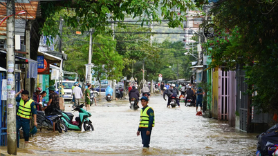
Meteorological experts warn that the mainland central region needs to be on guard against heavy rain causing flooding and landslides due to storm circulation combined with cold air.
At sea, the eye of the storm is unlikely to approach the Gulf of Tonkin but will move south. Especially in the central and southern East Sea, winds may be strong at level 10 to 11, accompanied by waves of 4-5m high, posing a danger to ships operating in this area in the next few days.
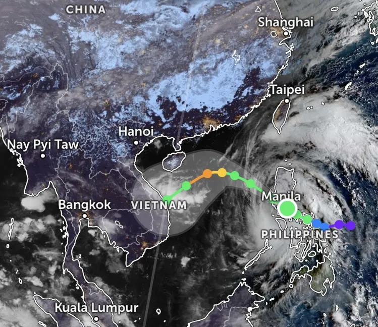
According to information from the Joint Typhoon Warning Center (JTWC - USA), at 4:00 a.m. on October 19, Vietnam time, storm Fengshen (Philippine name is Ramil and storm number 24 according to Japanese name) was about 190km east-southeast of Manila, the capital of the Philippines, moving west-northwest at a speed of about 22km/hour.
The JTWC warned that in the next 12 hours, the storm will pass Luzon Island, then continue moving northwest. After about 2 days, the storm will encounter a weak area of subtropical high pressure, slowing down and possibly temporarily standing still, before turning west-southwest due to a new subtropical high pressure forming over Southeast Asia.
At the same time, a strong cold air mass from the Taiwan Strait (China) will flow down, causing the storm to increase in intensity in the next 2-3 days, possibly reaching a maximum of level 13 (equivalent to 130km/h). After that, when changing direction and being clearly affected by the dry cold air mass, the storm will weaken rapidly.
Source: https://www.sggp.org.vn/hom-nay-19-10-bao-so-12-vao-bien-dong-post818790.html


![[Photo] Cat Ba - Green island paradise](/_next/image?url=https%3A%2F%2Fvphoto.vietnam.vn%2Fthumb%2F1200x675%2Fvietnam%2Fresource%2FIMAGE%2F2025%2F12%2F04%2F1764821844074_ndo_br_1-dcbthienduongxanh638-jpg.webp&w=3840&q=75)












![[VIMC 40 days of lightning speed] Hai Phong Port determined to break through, reaching the target of 2 million TEUs by 2025](https://vphoto.vietnam.vn/thumb/402x226/vietnam/resource/IMAGE/2025/12/04/1764816441820_chp_4-12-25.jpeg)


![[Photo series] Panorama of Long Thanh Airport before inauguration day](https://vphoto.vietnam.vn/thumb/402x226/vietnam/resource/IMAGE/2025/12/04/1764822152985_anh_8_20251204103350_20251204110421.jpeg)


Comment (0)