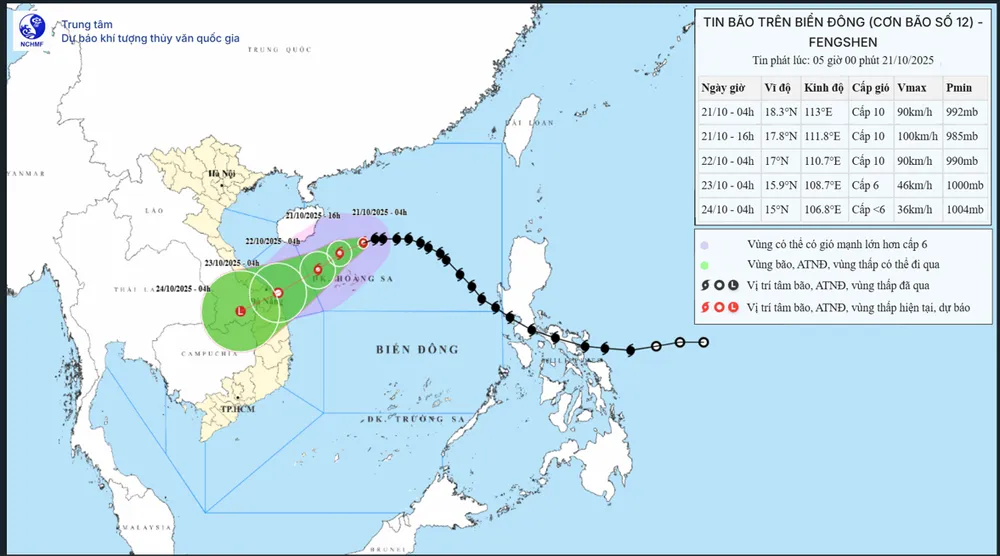
This morning, the National Center for Meteorological and Hydrological Forecasting announced that at 4:00 AM, the center of Typhoon No. 12 was located at approximately 18.3 degrees North latitude and 113 degrees East longitude, about 200km north-northeast of the Hoang Sa Special Economic Zone. The strongest winds near the center of the typhoon were at level 9 to 10 (75-102 km/hour), with gusts up to level 12.
According to the National Center for Meteorological and Hydrological Forecasting's model, Typhoon No. 12 is showing signs of changing direction. It is predicted that in the next 12 hours, the typhoon will move westward (at a speed of approximately 20 km per hour) towards the central coast of Vietnam.
However, in the next 24 to 72 hours, Typhoon No. 12 will change direction to the West-Southwest with gradually decreasing speed. It is forecast that by tomorrow morning, October 22nd, the typhoon's center will be northwest of the Hoang Sa archipelago (with intensity remaining stable at level 9-10), gusting to level 12.
From October 22nd to 23rd, the storm moved southwest at a speed of approximately 10 km/hour, approaching the coastal waters from Hue to Quang Ngai and weakening into a tropical depression. From October 23rd to the morning of October 24th, the low-pressure system moved further inland and continued to weaken into a low-pressure area (in southern Laos).
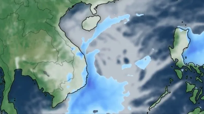
The National Center for Meteorological and Hydrological Forecasting continues to warn of prolonged heavy rain in Central Vietnam. Specifically, from the night of October 22nd to October 26th, due to the storm's circulation combined with cold air and easterly winds, the area from Ha Tinh to Quang Ngai will experience widespread heavy rain. Rainfall amounts will generally range from 200-400mm in Ha Tinh, northern Quang Tri, and Quang Ngai, with some areas exceeding 500mm; particularly in southern Quang Tri to Da Nang , rainfall will reach 500-700mm, with localized areas exceeding 900mm.
Heavy rains are expected to continue until the end of October 2025, posing a risk of flash floods and landslides in mountainous areas, and flooding in low-lying areas and urban centers. The National Center for Meteorological and Hydrological Forecasting recommends that localities ensure the safety of hydroelectric and irrigation reservoirs and proactively respond when floods on rivers from Quang Tri to Quang Ngai are likely to reach and exceed alarm level 3.
Source: https://www.sggp.org.vn/hom-nay-21-10-bao-so-12-chuyen-huong-post819105.html


![[Photo] Prime Minister Pham Minh Chinh holds a phone call with the CEO of Russia's Rosatom Corporation.](/_next/image?url=https%3A%2F%2Fvphoto.vietnam.vn%2Fthumb%2F1200x675%2Fvietnam%2Fresource%2FIMAGE%2F2025%2F12%2F11%2F1765464552365_dsc-5295-jpg.webp&w=3840&q=75)


Comment (0)