
- Bac Lieu responds to the campaign "500 days and nights to complete 3,000km of expressways".
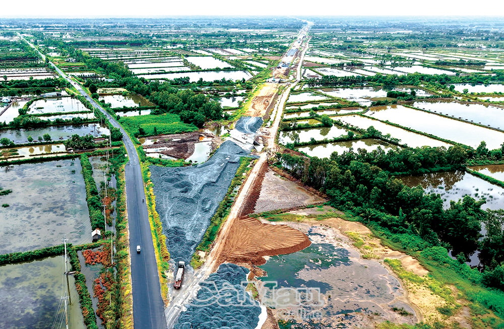
- The Ca Mau - Dat Mui expressway project requires urgent progress.
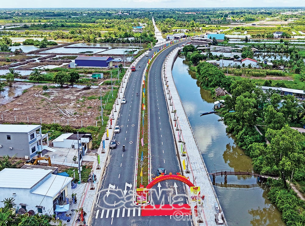
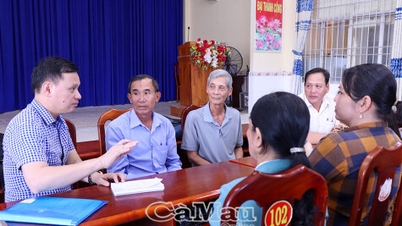
- Ca Mau simultaneously commenced and inaugurated construction projects and initiatives to celebrate the August Revolution and National Day on September 2nd.
A time of difficult transportation.
In the early 2000s, Ca Mau province underwent a dramatic transformation, navigating the intermingling of saltwater and freshwater, with the shrimp-rice farming story becoming a topical issue. Investment capital was limited and fragmented, primarily focused on irrigation infrastructure; transportation remained heavily reliant on waterways. The province was remote, still poor, and further hampered by its isolation.
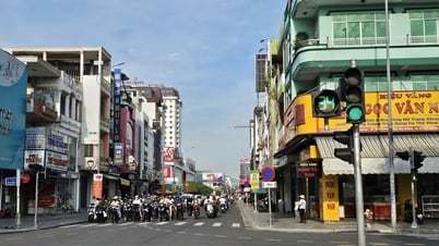
At that time, in the former Ca Mau province, only National Highway 1, running from the center of Ca Mau city towards the province, was still considered passable, although it was quite bumpy due to its dilapidated condition and narrow width. Tran Hung Dao Street, now one of the busiest streets, was then just a short, muddy road, connected by small side roads built by residents leading to dilapidated houses.
To reach the districts, most people had to travel by waterway, dividing Ca Mau into two distinct regions: North and South. From Pier A in Ward 1 (now An Xuyen Ward), going to the Tac Thu intersection, one could head straight to the U Minh brackish water mangrove area with its endless green melaleuca trees; upstream to the Thoi Binh freshwater area with its sugarcane and rice fields; and downstream along the Ong Doc River to the West Sea, teeming with shrimp and fish in Tran Van Thoi District. Pier B (formerly in Ward 7, at the intersection of the Ca Mau - Bac Lieu canal and Ganh Hao, in what is now Tan Thanh Ward; later moved to Ward 8, now Ly Van Lam Ward) was bustling with all kinds of watercraft. From here, one could follow the Ganh Hao River to Dam Doi and the East Sea; follow the Bay Hap River to Cai Nuoc and then to Phu Tan; take a shortcut across the East bank to Nam Can; or cross the Cua Lon River to Ngoc Hien and Dat Mui in the far reaches of the alluvial plain.
The remoteness and isolation of the area, lacking roads and requiring travel by ferry, is often remembered with memorable humorous anecdotes. The story goes that in 2004, Ngoc Hien was divided into two districts: Nam Can and Ngoc Hien. The new Ngoc Hien district headquarters was located in Kien Vang, formerly the headquarters of a forestry company. Every day, a "official ferry" would take staff to Ngoc Hien for work, departing from Nam Can at dawn; by 4:30 PM, they had to be brought back to Nam Can because of the long distance and the need to quickly cross the "Lao Lang Bay" before dusk. Even so, by the time they reached the Cua Lon River, it was already twilight, truly a case of "coming from the forest" as the city of Nam Can was already lit up on the other side. At that time, Ngoc Hien only had a single road, just over 1 meter wide, from Kien Vang to Rach Goc, with no streetlights at night. Those who missed the ferry had no choice but to go to bed early, as soon as darkness fell, in the communal housing complexes deep in the forest...
I remember back when Ca Mau town was still a small town, there was only a narrow road to Tac Thu. To cross to Ong Doc and Cai Tau, the only way was via a small iron bridge, originally only for motorbikes; four-wheeled vehicles could only go in one direction. During a time of economic hardship, this bridge was considered one of the most massive and modern in the rural area at the time, a testament to the great determination of Mr. Doan Thanh Vi, former Secretary of the Minh Hai Provincial Party Committee. After the devastating U Minh Ha forest fire in 2002, the province opened a road along the Nong Truong canal to Coi 6, extending all the way to the coast at the Hon Da Bac National Historical Site.
Landmark buildings
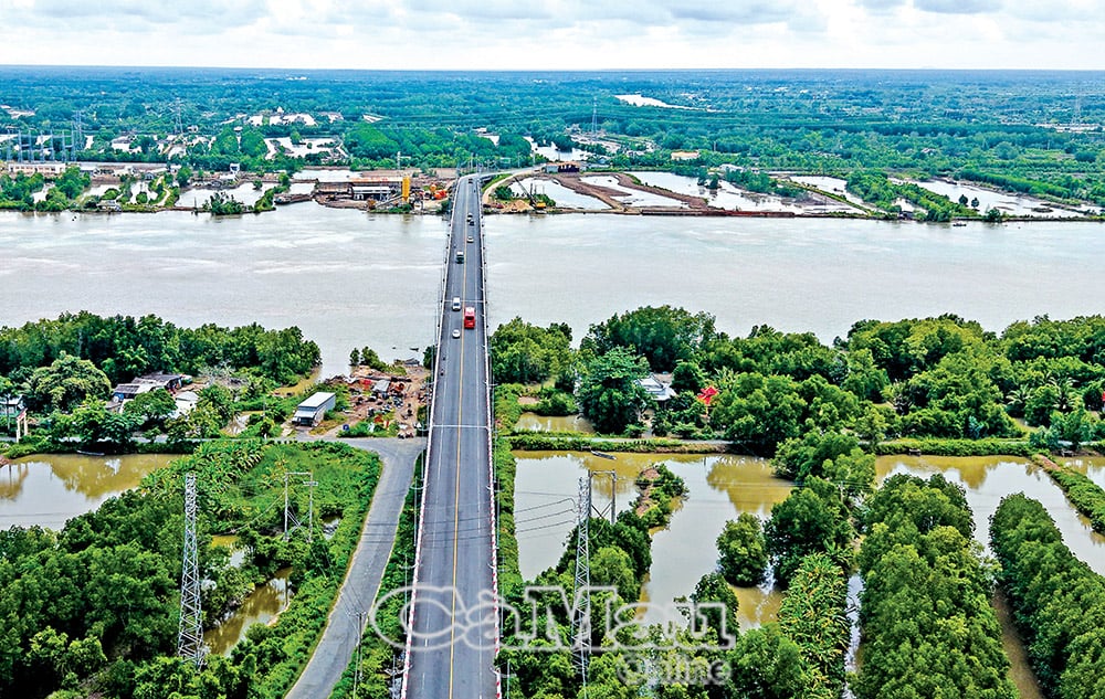
With the strong political determination of the Party and Government leaders, aiming to overcome difficulties so that Ca Mau in particular, and the Mekong Delta region in general, can reach out to the open sea, key transportation projects are gradually being built with all the responsibility and affection for this revolutionary base area that suffered so much pain and destruction during the war. As Mr. Ngo Thinh Duc, when he was still the Deputy Minister of Transport, once said with heartfelt sincerity that he would only be able to retire with peace of mind and a sense of belonging to this land, which is so deeply indebted to him, once the Ganh Hao 2 bridge on National Highway 1 connecting Ward 7 and Ward 8 is completed.
I still remember the days when I accompanied Mr. Ngo Thinh Duc and Mr. Bui Cong Buu, then Chairman of the Provincial People's Committee, to the arduous journey to attend the groundbreaking ceremonies for the construction packages on National Highway 1 to Nam Can, including the Dam Cung bridge; or during the time when Mr. Pham Thanh Tuoi was Chairman of the Provincial People's Committee, I had the opportunity to accompany him along the swirling Cua Lon river, the group venturing into the forest edges, parting vines, digging through layers of alluvial soil to find the location for the Nam Can bridge on the Ho Chi Minh Trail to Dat Mui... so much hardship but also so much pride and excitement. The sweat of the members of the working group mingled with the salty soil, reflecting a sweet aspiration: to erase the "isolated island" of Ngoc Hien, awaken the potential of this sacred land at the southernmost tip of the country, connect the entire nation, and fulfill the longing of the people of the whole country for Dat Mui.
At that time, realizing that Dam Doi was still an "isolated island" needing a connecting bridge, the then Prime Minister, Mr. Nguyen Tan Dung, speaking at an event in Khai Long, asked: "Should we build a floating bridge?". The question was also a command. The transportation sector urgently implemented the Hoa Trung bridge construction project (crossing the Ganh Hao river, connecting to the Ca Mau - Dam Doi road to link Ca Mau city to Dam Doi district), under an unprecedented mechanism. And in a very short time, on January 16, 2016, the Hoa Trung bridge was opened for technical traffic, simultaneously with the opening of the Ho Chi Minh Highway from Nam Can to Dat Mui. These two projects are of significant importance in the socio-economic development and strengthening of national defense and security of Ca Mau province in particular, and the Mekong Delta in general. On that occasion, former General Secretary Le Kha Phieu joined the celebration in Ca Mau.
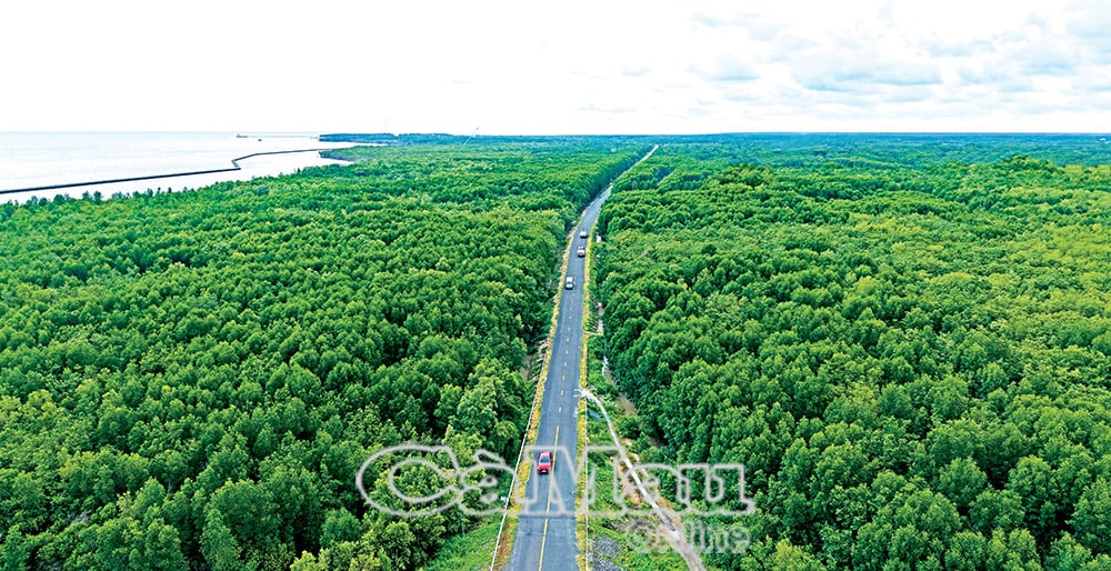
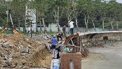
Mentioning the Ho Chi Minh Trail leading to the very tip of the peninsula evokes strong emotions. It reminds us of the early days, when those who ventured through the jungle to lay the groundwork often got separated amidst the vast, deep forests and intricate network of rivers and canals. Boats and barges carrying massive loads of sand and stone from far away had to be "transferred" to smaller vessels, navigating through narrow waterways to reach the construction site. They frequently had to stop at "rest stops," as the tides rose and fell daily, and during low tide, the river was reduced to a narrow channel. The hardships were even greater in the coastal areas, through the narrow inlets and bays, making the journey incredibly difficult and dangerous. Recalling the image of the early construction site in that remote, swampy land, and then looking at the trail winding through the jungle like a thread, a lifeline today, makes us deeply appreciate the immense power of unity and determination in pioneering this project...
Even more moving was the day the road was officially opened for technical traffic. Groups of simple, honest people gathered behind the fields and at the edge of the forest, waiting to see for the first time the first car rolling into this land. Adults and children alike were joyful and excited, creating a festive atmosphere. How could they not be thrilled? From now on, with the road, the people who had lived in the forest for generations, navigating canals and ditches by boat, could finally "move ashore," no longer facing the insecurity of crossing deep rivers or getting lost in the dense forests...
Aspirations to reach the forefront of the South
Above all, the value and significance of the road named after President Ho Chi Minh leading to Ca Mau Cape lies not only in its construction fulfilling the long-held dreams of the local people, but also in its expression of national unity, connecting the North and South, and the aspiration for a strong nation reaching out to the open sea.
A glorious past - a beautiful present - a bright future. With its back against the forest and its front facing the sea, the landmark at Ca Mau Cape, bearing the inscription "Ho Chi Minh Trail - Ca Mau End Point KM 2436," serves as an affirmation that this land will continue to expand with the alluvial soil.
With a special affection for this sacred land of the nation, during his visit to Ca Mau Cape in November 2024, General Secretary To Lam expressed his heartfelt desire to expand the southernmost "continent" of the country. And now, realizing this aspiration with the insightful vision of the Party leader, what could be more wonderful than the project to build a highway all the way to Ca Mau Cape, a bridge to Hon Khoai Island, and a dual-use port on Hon Khoai Island taking shape? These projects were launched on August 19th, coinciding with the commencement and inauguration of several other key projects in the province, as well as in many other provinces and cities nationwide, to celebrate the 80th anniversary of the August Revolution and National Day on September 2nd this year.
Airports, seaports, highways, and connecting roads along both horizontal and vertical axes have been, are being, and will be developed in the Ca Mau Peninsula, transforming Ca Mau from a name associated with the southernmost tip of the country into a proud landmark at the southernmost point.
Ca Mau – still the tip of the nation's peninsula, but now it's no longer far away, but closer each day through connecting and spreading routes. During his working trip to Ca Mau, meeting with the people of Ca Mau at the end of 2024's National Unity Day, General Secretary To Lam shared many heartfelt thoughts with the people about preserving forests and land. He also affirmed that, with the spirit of unity and determination in all revolutionary movements, Ca Mau will certainly achieve great accomplishments.
Now, with the expanded development space following the provincial merger, Ca Mau has doubled its strength, multiplied its confidence, and become even more steadfast in continuing its journey towards greater aspirations in this era of national progress.
Tran Nguyen
Source: https://baocamau.vn/nhung-con-duong-mang-khat-vong-vuon-xa-a121779.html


![[Image] Close-up of the newly discovered "sacred road" at My Son Sanctuary](/_next/image?url=https%3A%2F%2Fvphoto.vietnam.vn%2Fthumb%2F1200x675%2Fvietnam%2Fresource%2FIMAGE%2F2025%2F12%2F13%2F1765587881240_ndo_br_ms5-jpg.webp&w=3840&q=75)


Comment (0)