
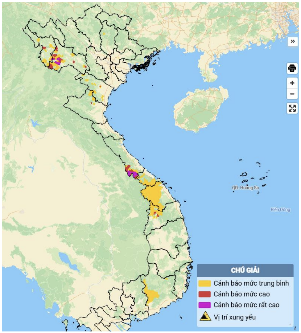
Map showing the risk of flash floods and landslides in various areas.
According to the National Center for Hydro-Meteorological Forecasting, from 1:50 PM to 8:50 PM on July 27th, the provinces and cities of Dien Bien , Son La, Thanh Hoa, Nghe An, Quang Tri, Hue, Quang Ngai, and Lam Dong will continue to experience rain with accumulated rainfall generally ranging from 10-30 mm, with some areas exceeding 60 mm. Nghe An and Ha Tinh provinces will receive 20-50 mm of rain, with some areas exceeding 80 mm.
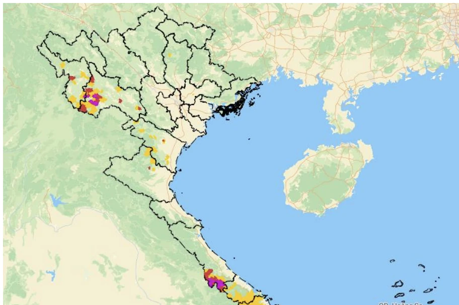
There is a risk of flash floods on small rivers and streams, and landslides on slopes in many communes and wards. In Thanh Hoa province alone, the communes under warning include: Ngoc Lien, Cam Van, Dong Luong, Mau Lam, Muong Ly, Nhu Thanh, Thien Phu, Van Nho, Van Phu, Van Xuan, Yen Phu, and Yen Tho.
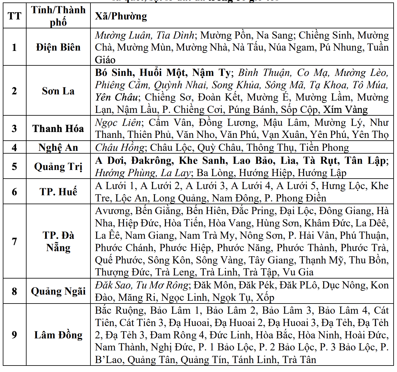
List of areas at risk of flash floods and landslides during the 6-hour period from 13:50 to 20:50 on July 27th.
Warning regarding the level of risk from flash floods, landslides, and land subsidence caused by rain or runoff: Level 1.
The meteorological and hydrological agency recommends that local authorities pay attention to reviewing bottlenecks and vulnerable locations in the area to take preventive and response measures.
NDS
Source: https://baothanhhoa.vn/tiep-tuc-canh-bao-nbsp-lu-quet-sat-lo-dat-o-mot-so-xa-tren-dia-ban-tinh-thanh-hoa-256236.htm


![[Photo] Prime Minister Pham Minh Chinh holds a phone call with the CEO of Russia's Rosatom Corporation.](/_next/image?url=https%3A%2F%2Fvphoto.vietnam.vn%2Fthumb%2F1200x675%2Fvietnam%2Fresource%2FIMAGE%2F2025%2F12%2F11%2F1765464552365_dsc-5295-jpg.webp&w=3840&q=75)


Comment (0)