
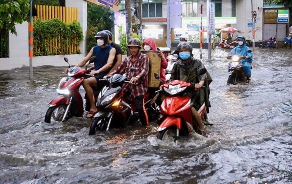
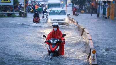
Peak tide is likely to reach 4.15 - 4.25m
The National Center for Hydro-Meteorological Forecasting said that from the evening of December 5 to 6, the highest water level in the eastern coast of the South will tend to continue to increase slightly, the highest tide of the day at Vung Tau station is likely to reach 4.15 - 4.25m, the time of peak tide is from 2:00 - 5:00 p.m. and 10:00 - 2:00 a.m.
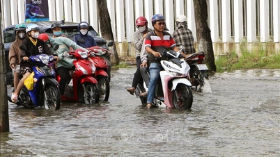
It is forecasted that from December 7 to 8, the highest water level of the day in the eastern coast of the South will tend to decrease slightly, the highest tide of the day at Vung Tau station is likely to reach 4 - 4.1m.
Level 1 warning of natural disaster risk due to high tide.
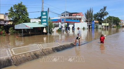
The eastern coastal area of the South needs to pay attention to prevent high risks of flooding and dike overflow in low-lying coastal and riverside areas, outside the dike, affecting traffic, agricultural production, aquaculture, water pollution and people's lives.
Hydrological experts note that high tides will slow down the flood drainage process on rivers in the Southeast. Low-lying coastal areas, river banks, and areas outside the dykes in the Southeast are likely to be flooded in the early morning and early afternoon. In addition, high tides during this period also increase saltwater intrusion in the fields.
To proactively respond and minimize damage caused by high tides causing flooding in the coming time, the Department of Dyke Management and Natural Disaster Prevention and Control under the Ministry of Agriculture and Environment recommends that affected provinces and cities closely monitor forecasts and warnings, and promptly inform authorities and people at all levels to proactively prevent them.
Authorities inspect and review coastal residential areas, dykes, dams, low-lying areas with high risk of flooding to proactively organize the relocation and evacuation of people when situations arise; clear the flow, and promptly handle construction incidents from the first hour.
Provinces and cities are ready to deploy measures to drain water and protect production; reinforce and protect aquaculture ponds; harvest crops and dry crops that are ready for harvest; prevent and combat flooding in urban areas and low-lying areas, ensuring minimal damage; notify owners of water transport vehicles about flooding to proactively take measures to ensure safety for people, vehicles, equipment and works.
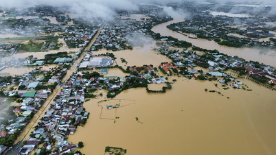
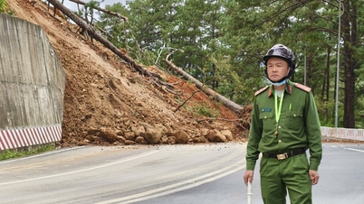
Risk of flash floods and landslides in 3 provinces and cities in the Central and Central Highlands regions
According to the National Center for Hydro-Meteorological Forecasting, from now until about 6:30 p.m. on December 5, the provinces and cities from Da Nang to Gia Lai will continue to have rain. There is a risk of flash floods and landslides in the above areas.
Specifically, the cumulative rainfall in the above area is from 5 - 15mm, in some places over 40mm. Warning of the risk of flash floods on small rivers and streams, landslides on slopes in many communes and wards of Da Nang city including: Ba Na, Kham Duc, Phuoc Hiep, Phuoc Tra, Tra Leng.
In Quang Ngai province, communes and wards at risk of flash floods and landslides include: Ba Dinh, Ba To, Ba To, Ba Vi, Ba Vinh, Ba Xa, Kon Plong, Minh Long, Son Tay, Son Thuy, Thanh Bong.
In addition, Gia Lai province has communes and wards at risk of flash floods and landslides including: Kim Son; An Hoa, Binh Khe, Canh Lien, Canh Vinh, Hoa Hoi.
Warning level of natural disaster risk due to flash floods, landslides, land subsidence due to heavy rain or level 1 flow.
Flash floods and landslides can have very negative impacts on the environment, threaten people's lives; cause local traffic congestion, affect the movement of vehicles; destroy civil and economic works, causing damage to production and socio-economic activities.
The hydrometeorological agency recommends that local authorities pay attention to reviewing bottlenecks and vulnerable locations in the area to have prevention and response measures.
Source: https://baotintuc.vn/xa-hoi/trieu-cuong-oven-bien-dong-nam-bo-co-xu-huong-tiep-tuc-tang-20251205155124157.htm

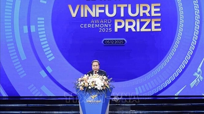
![[Photo] National Assembly Chairman Tran Thanh Man attends the VinFuture 2025 Award Ceremony](/_next/image?url=https%3A%2F%2Fvphoto.vietnam.vn%2Fthumb%2F1200x675%2Fvietnam%2Fresource%2FIMAGE%2F2025%2F12%2F05%2F1764951162416_2628509768338816493-6995-jpg.webp&w=3840&q=75)
![[Photo] 60th Anniversary of the Founding of the Vietnam Association of Photographic Artists](/_next/image?url=https%3A%2F%2Fvphoto.vietnam.vn%2Fthumb%2F1200x675%2Fvietnam%2Fresource%2FIMAGE%2F2025%2F12%2F05%2F1764935864512_a1-bnd-0841-9740-jpg.webp&w=3840&q=75)


Comment (0)