
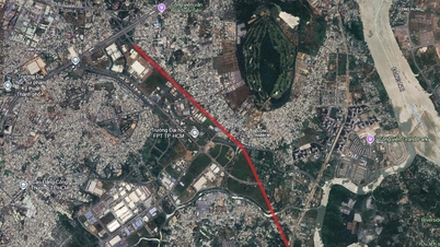
According to the land use planning adjustment map for the period 2021 - 2030 of Can Duoc district, Long An province (old), Can Duoc commune will have a number of important roads deployed to complete the regional traffic infrastructure. These projects are expected to promote connectivity and local socio-economic development.

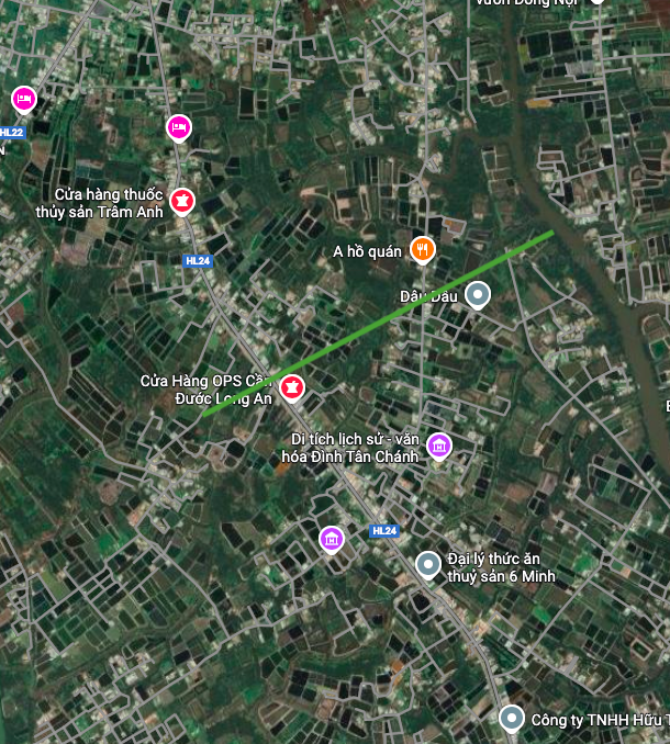
1. Ho Chi Minh City - Soc Trang Expressway (Highway 33)
One of the most important transport infrastructure projects passing through Can Duoc commune is the Ho Chi Minh City - Soc Trang Expressway, also known as Highway 33. The section passing through the commune is about 9.4 km long.
According to the plan, this route has one starting point across the Vam Co River, near the Ba Nho ferry terminal, and the other near Tinh Quang Pagoda. When completed, the expressway will create a strategic connection axis, shortening travel time between Ho Chi Minh City and the Mekong Delta provinces.
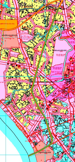

2. Provincial Road 826B
Provincial Road 826B is also a notable item in the planning. This road section is about 1.7 km long within Can Duoc commune. The planned route runs perpendicular to the existing District Road 24 and has one end crossing the Can Duoc River. This route will contribute to enhancing internal connectivity within the district and neighboring areas.

3. New route parallel to Provincial Road 826B
In addition to the two routes above, the plan also shows a new route running parallel to Provincial Road 826B. This route is about 2.4 km long, with one end also crossing the Can Duoc River and the other end located near Ba Nho ferry. The construction of this route will help distribute traffic, reduce the load on existing roads and create new directions for people to travel.


Note: The planning information in the article is based on the Land Use Planning Adjustment Map for the period 2021 - 2030 of Can Duoc district, Long An province. This information may change according to the adjustment decisions of the competent authority.
Source: https://baolamdong.vn/can-duoc-tay-ninh-quy-hoach-3-tuyen-duong-trong-diem-moi-406500.html


![[Photo] Worshiping the Tuyet Son statue - a nearly 400-year-old treasure at Keo Pagoda](/_next/image?url=https%3A%2F%2Fvphoto.vietnam.vn%2Fthumb%2F1200x675%2Fvietnam%2Fresource%2FIMAGE%2F2025%2F12%2F02%2F1764679323086_ndo_br_tempimageomw0hi-4884-jpg.webp&w=3840&q=75)
![[Photo] Parade to celebrate the 50th anniversary of Laos' National Day](/_next/image?url=https%3A%2F%2Fvphoto.vietnam.vn%2Fthumb%2F1200x675%2Fvietnam%2Fresource%2FIMAGE%2F2025%2F12%2F02%2F1764691918289_ndo_br_0-jpg.webp&w=3840&q=75)


Comment (0)