
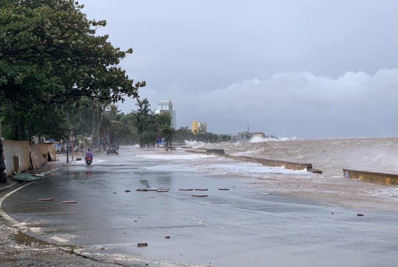
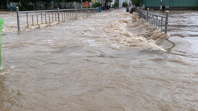
Specifically, on the morning of December 8, the highest water level at Hon Dau station reached 411 cm at 6:30 am. It is forecasted that on the morning of December 9, the coastal area of Hai Phong will continue to be affected by strong high tides.
The highest water level at Hon Dau station could reach about 405 cm at around 7:40 am; at Bach Long Vi it is forecasted to be about 395 cm at 7:00 am.
The meteorological agency warned that the rising water level could cause local flooding in low-lying coastal areas and along river mouths such as Bach Dang, Lach Tray, Van Uc, Song Moi and Thai Binh . The flooding depth at some low points could be from 0.3 to 0.5 m, affecting agricultural production, aquaculture as well as people's travel.
It is forecasted that in the next 24 - 48 hours, the high tide will continue to maintain. On the morning of December 10, the water level in the coastal area of Hai Phong is forecast to fluctuate between 375 - 385 cm. The disaster risk level is assessed at level 1 - monitoring and proactive response level.
Hai Phong Hydrometeorological Station recommends that localities and people proactively check the drainage system, limit traffic through low-lying areas at peak tide times, and ensure safety for production and daily life.
PVSource: https://baohaiphong.vn/canh-bao-trieu-cuong-gay-ngap-lut-vung-ven-bien-cua-hai-phong-529037.html


![[Photo] Explore the US Navy's USS Robert Smalls warship](/_next/image?url=https%3A%2F%2Fvphoto.vietnam.vn%2Fthumb%2F1200x675%2Fvietnam%2Fresource%2FIMAGE%2F2025%2F12%2F10%2F1765341533272_11212121-8303-jpg.webp&w=3840&q=75)


![[Video] The craft of making Dong Ho folk paintings has been inscribed by UNESCO on the List of Crafts in Need of Urgent Safeguarding.](https://vphoto.vietnam.vn/thumb/402x226/vietnam/resource/IMAGE/2025/12/10/1765350246533_tranh-dong-ho-734-jpg.webp)


Comment (0)