
 |
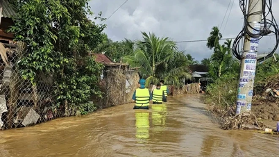
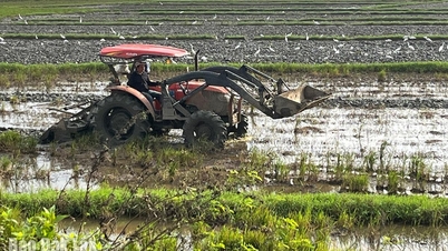
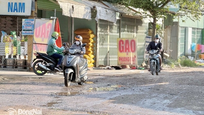
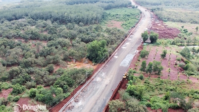
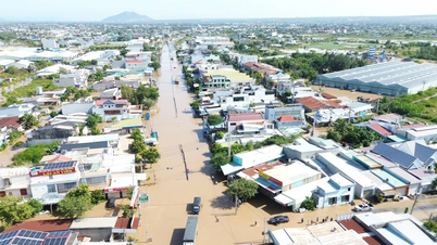
| It is necessary to guard against the possibility of heavy rain combined with floods causing inundation and landslides on river banks, streams, and low-lying areas along rivers. In photo: Dong Nai River. Photo: Dang Tung |
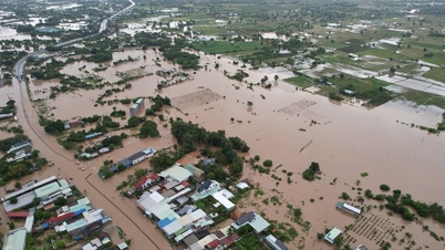
Water levels in the downstream of the Dong Nai River system and on the La Nga River are at high levels. At Bien Hoa station (downstream of Dong Nai River), the peak tide level is approximately at alert level 2 (2m). At Phu Hiep station (La Nga River), the water level continues to rise slowly, between alert level (104.5m) and alert level 2 (105.5m).
The peak tide at Bien Hoa station is forecast to remain at alert level 2 on December 6 and 7 (ie October 17 and 18 of the lunar calendar), with peak tides occurring between 5-6am and 7-8pm. The peak tide will gradually decrease in the following days. At Phu Hiep station, the water level will change slowly, at between alert levels 1 and 2.
Warning of the risk of flooding in low-lying areas along the river in the lower reaches of the Dong Nai River, in the wards and communes of Tri An, Tan An, Trang Dai, Tan Trieu, Bien Hoa, Tran Bien, Phuoc Tan, Tam Phuoc, An Phuoc, Dai Phuoc in Dong Nai province and neighboring areas are at risk of flooding due to high tides; low-lying areas along the La Nga River in the communes of Phu Lam, Tan Phu, Phu Hoa, Dinh Quan and neighboring areas are at risk of flooding due to floods. It is necessary to guard against the possibility of heavy rain combined with floods causing flooding, landslides on river banks, streams, and low-lying areas in the above wards and communes.
Flood risk warning level on Dong Nai River, downstream: Level 2; on La Nga River: Level 1.
Kim Lieu
Source: https://baodongnai.com.vn/kinh-te/moi-truong/202512/dinh-trieu-tai-tram-bien-hoa-cao-xap-xi-muc-bao-dong-2-7bc0356/

![[Photo] 60th Anniversary of the Founding of the Vietnam Association of Photographic Artists](/_next/image?url=https%3A%2F%2Fvphoto.vietnam.vn%2Fthumb%2F1200x675%2Fvietnam%2Fresource%2FIMAGE%2F2025%2F12%2F05%2F1764935864512_a1-bnd-0841-9740-jpg.webp&w=3840&q=75)
![[Photo] National Assembly Chairman Tran Thanh Man attends the VinFuture 2025 Award Ceremony](/_next/image?url=https%3A%2F%2Fvphoto.vietnam.vn%2Fthumb%2F1200x675%2Fvietnam%2Fresource%2FIMAGE%2F2025%2F12%2F05%2F1764951162416_2628509768338816493-6995-jpg.webp&w=3840&q=75)


Comment (0)