
Operate under high pressure to protect Hue city
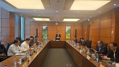
Mr. Nguyen Quy An, Deputy Head of Ta Trach Lake Management Board, said that in recent years, Ta Trach Lake has continuously faced historic floods, especially in 2020, 2023 and the last period in October and early November this year. The operational pressure is very high because Ta Trach is a key project in protecting the downstream of the Huong River. The Ministry of Agriculture and Environment directly assigned the task to the management unit, while the People's Committee of Hue City and the Provincial Civil Defense Command operate during the flood season.
Before each flood season, preparations are carried out early with site inspections, equipment checks and system testing. When heavy rain forecasts appear, the unit immediately coordinates with consulting agencies to update calculation models and develop response scenarios.

Mr. Nguyen Quy An, Deputy Head of Ta Trach Lake Exploitation Management Board - Irrigation Investment and Construction Management Board 5. Photo: Minh Phuc.
Mr. Nguyen Quy An said that during the time of rapid flood rise, the responsibility placed on the operating force becomes heavier. The unit must continuously review the incoming flow and total flood volume, then make the most appropriate flood discharge decision. Scenarios are built to closely follow reality, helping to reduce the flood peak flowing to Hue city. Operational results during recent floods show that the decisions made are highly effective. Ta Trach Lake has repeatedly reduced pressure on downstream areas, especially when large floods come continuously in a short period of time.
According to Mr. Nguyen Quy An, flood regulation is effective thanks to continuous operation, preparation before the rainy season and close coordination between specialized forces. The unit also regularly advises the City People's Committee to adjust operations at each time to create the most room for flood reduction downstream.
Flood control efficiency is clearly demonstrated in major floods.
Evaluating the operational efficiency of Ta Trach reservoir in recent times, Mr. Pham Cong Thanh - Head of the North Central Planning Department - Institute of Water Resources Planning (Ministry of Agriculture and Environment) emphasized the special role of reservoirs in the Huong River basin, in which Ta Trach is the most important factor in helping to reduce floods for Hue city.
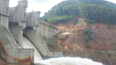
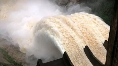
He cited the period from October 20 to November 3 this year, the flood peak in Ta Trach reached approximately 6,900 m³ per second but the largest discharge to the downstream was only about 3,500 m³ per second. The entire remaining flow was retained in the lake to create additional storage capacity for the next flood peaks. Recorded data shows that the three lakes of Ta Trach, Binh Dien and Huong Dien accumulated about 572 million m³ of water during the flood period. Without this lake system, the water level at Kim Long station could have been about 0.75 m higher than the actual level, causing much more severe flooding in the inner city of Hue.

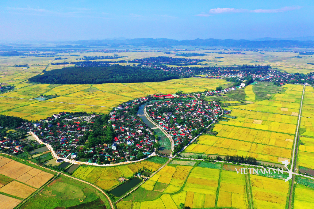
Ta Trach Lake has a basin area of 717km2, a total capacity of 646 million m3 with an earthen dam 60m high.
Mr. Pham Cong Thanh said that the effectiveness of flood reduction in recent times comes not only from the large capacity of the reservoir but also from the initiative in lowering the water level to welcome floods, constantly updating forecast data and operating flexibly in real time. From a professional perspective, he found that the reservoirs in the Central region are proving to be very resilient and have helped to minimize damage to downstream areas many times.
This reality also opens up the need to continue researching the water level at the end of the flood season to optimize water storage capacity, ensure safety of works and effectively serve the socio-economic development goals of the region.
Forecasting platform and computing technology support operations
Mr. Pham Cong Thanh also said that the Institute of Water Resources Planning (Ministry of Agriculture and Environment) has a tradition of consulting on the operation of large reservoirs in river basins. From the period before 2010, the Institute conducted flood regulation calculations for the reservoir system in the Red River basin and from 2020 continued to take on the role of consulting on the operation of reservoirs in the Central region, including Ta Trach.
Flood forecasting relies on the ability to collect and process meteorological and hydrological data. Mr. Pham Cong Thanh said the official data source used by the Institute is forecast data from the National Center for Hydro-Meteorological Forecasting. In addition, there are forecasts from regional stations, provincial stations and global rainfall models from the US, Japan and Germany. The combination of multiple data sources is carried out to analyze and build flood scenarios that are closest to reality.
The forecasting process is operated continuously from collecting actual rainfall data, flood discharge at hydrological stations, boundary data to updating the latest rainfall forecast. These parameters are entered into the hydrological model to determine the flood peak, total flood volume and flood occurrence time, before simulating through the hydraulic model to assess the impact of each flood discharge option.
According to Mr. Pham Cong Thanh, this process allows for early risk forecasting, supporting reservoir owners in every important decision. Operational bulletins are issued daily or multiple times a day, depending on weather developments, helping the operating force promptly grasp unusual changes. Thanks to this forecasting and modeling system, Ta Trach reservoir has operated with high accuracy during many major floods, including the historic rains at the end of 2020 and the floods in October - November this year.
Source: https://nongnghiepmoitruong.vn/ho-ta-trach--cau-dao-cat-lu-cho-ha-du-tp-hue-d787450.html

![[Photo] Cat Ba - Green island paradise](/_next/image?url=https%3A%2F%2Fvphoto.vietnam.vn%2Fthumb%2F1200x675%2Fvietnam%2Fresource%2FIMAGE%2F2025%2F12%2F04%2F1764821844074_ndo_br_1-dcbthienduongxanh638-jpg.webp&w=3840&q=75)


![[VIMC 40 days of lightning speed] Da Nang Port: Unity - Lightning speed - Breakthrough to the finish line](https://vphoto.vietnam.vn/thumb/402x226/vietnam/resource/IMAGE/2025/12/04/1764833540882_cdn_4-12-25.jpeg)


Comment (0)