
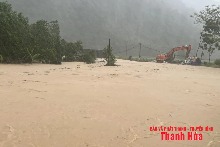
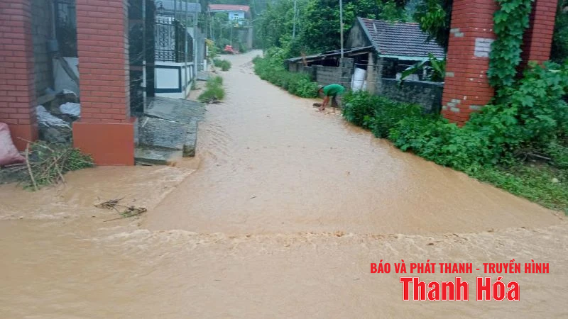
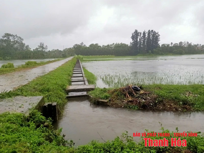
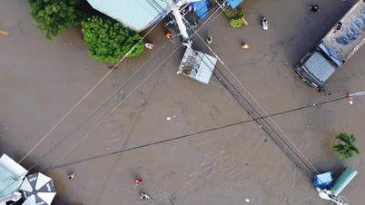
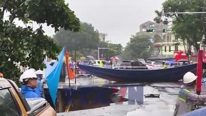
According to a quick report from the Provincial Civil Defense Command, heavy rains have cut off and isolated some localities. Typically, Xuan Chinh commune lost power from 3 p.m. on August 25, completely isolated from the outside and 14 villages of the commune were isolated; Van Xuan commune, 4 villages of Hang Cau, Nhong, Quan, and Kham were completely cut off and isolated. In addition, in Thac Lang village, 7 households/20 people were isolated; Tan Thanh commune had 9 villages, more than 1,500 households with 6,423 people were completely isolated. In addition, heavy rains flooded and damaged more than 529.4 hectares of autumn rice, 133.7 hectares of annual crops and plants; and flooded and damaged more than 55 hectares of aquaculture land. At the same time, 37 houses, 2 schools and hundreds of shade trees across the province were damaged. By 8:00 a.m. on August 26, the right dike of Chu River, section Km46+445 - K46+470 in Dong Tien ward, had a landslide with a length of more than 25m; many sections of ditches and rural traffic works in localities were also eroded, causing obstacles to traffic and daily life of people. |
Thanh Hoa Newspaper and Radio - Television continue to update...
♦ In Cam Thach commune , the storm caused 38 houses to be flooded and people and property had to be evacuated; 34 households were isolated. Regarding agricultural production, 46 hectares of rice, 12 hectares of sugarcane were deeply flooded...; 2 irrigation works were damaged by the flood; 7 roads and 9 overflow tunnels were temporarily flooded and impassable. Currently, forces from the commune to the village and hamlet are highly focused on overcoming the consequences of storm No. 5.
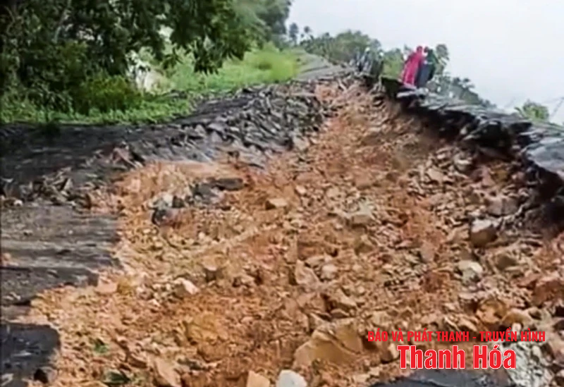
♦ In Dong Luong commune , landslides affected 28 households; at the same time, they flooded 34 hectares of rice, corn and other crops. The rain and floods also caused 4 landslides that affected traffic and travel of people; including 1 point on National Highway 15, 1 point in Tan Binh village, 1 point in Thung village, 1 point on Tac Te slope, Tan Phong village.
Currently, the landslide sites have been preliminarily cleared, except for the landslide site in Tan Binh village that has not been cleared yet.
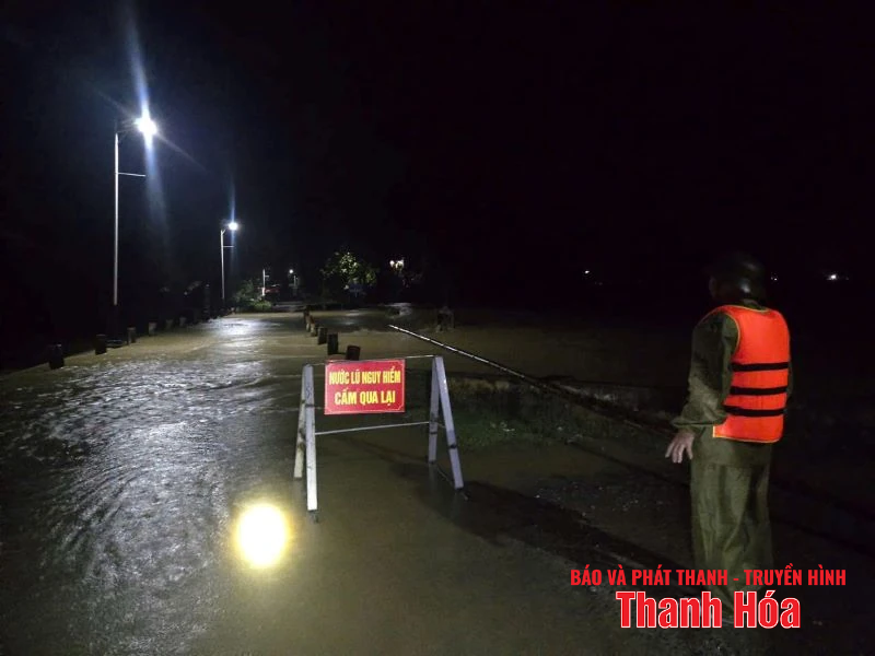
♦ In Dinh Tan commune , as of noon on August 26, the water level at Ly Nhan hydrometeorological station of Ma river was 10.22m. The rain continues and shows no signs of abating, flooding may occur.
The whole commune has about 182 hectares of rice (mainly flowering and standing) flooded and broken; vegetable areas in the beach area, many large acacia and sedge trees... were broken; 9.5 hectares of aquatic products were flooded.
The commune has 398 households (1,477 people) living in riverside areas, low-lying areas, areas at risk of flooding during floods and 4 farms of ponds, lakes, aquaculture, and foreign fruit trees outside the dike.
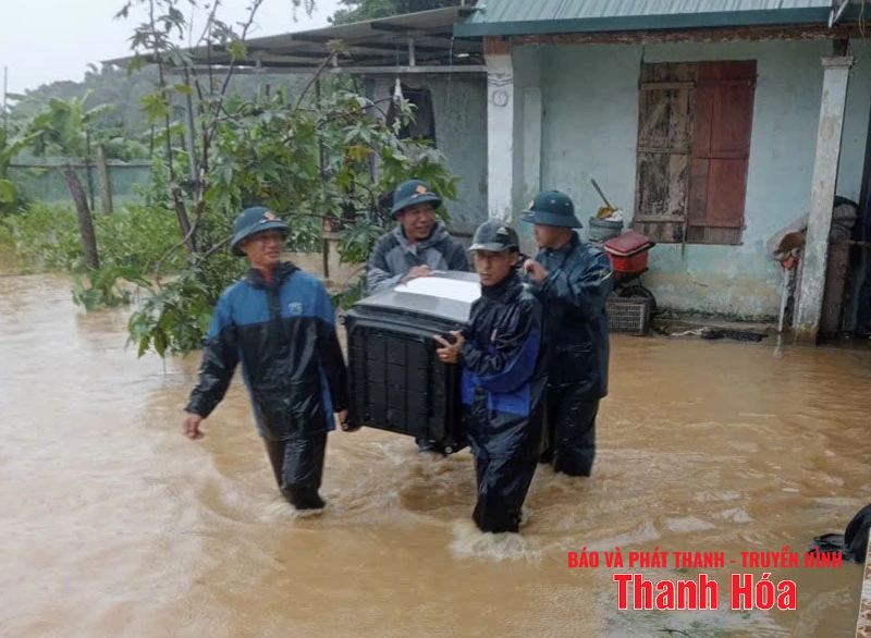
On the evening of August 25 and morning of August 26, the commune's functional forces supported households in moving their assets and livestock to safe places; organized the cutting and clearing of fallen trees, and cleared the traffic safety corridor.
The Commune People's Committee coordinated with the irrigation unit to close the Yen Thon drainage sluice and operate pumps to drain water from the fields to the river. At the same time, there was a plan to evacuate people and their property to safe places when there was a level 1 to level 2 alarm.
Leaders of Dinh Tan commune and functional forces were present at the scene to direct response and overcome the consequences of storm No. 5.
♦ Information from Thanh Hoa Nam Song Ma Irrigation Company Limited , heavy rain caused the left bank of the South main canal from K2+115 - K2+195 to have the outer slope eroded, the length of the eroded section is about 80m.
The left bank of the South Main Canal was eroded.
The company has proactively implemented temporary measures such as covering the area with tarpaulins and planting bamboo stakes to prevent further landslides. At the same time, a 24/7 on-duty team is organized to monitor, direct, and coordinate forces, prohibiting vehicles from traveling to ensure traffic safety; and promptly reporting any incidents.
♦ In Thach Binh commune, there is moderate to heavy rain. Currently, the water level of the Buoi River has reached alarm level 1. 5 households with 14 people are isolated; 530m of fence collapsed; 63ha of rice, 20.5m of sugarcane and crops are flooded.
Since early this morning, the commune has directed the operation of 3 drainage pumping stations including Sam drainage pumping station, Sanh drainage pumping station, and Co Te drainage pumping station to protect rice and crop areas in the area.
♦ Recorded at 10:00 on August 26, in Thanh Vinh commune , a landslide occurred on the inter-village road from Dong Thanh to Yen Son (old Thanh Yen commune). Specifically, the slope adjacent to the stream was eroded with a length of about 50m, a height of about 15m, a depth of about 2m and there is a risk of expanding the area if the rain continues for a long time. This landslide has cut off the road from the old Thanh My commune to the villages of Yen Son 2 and Yen Son 1 in the old Thanh Yen commune.
In addition, there were two landslides that spilled onto the roads in Thanh Trung village and Muc Long village.
Thanh Vinh Commune has directed to assign 24/7 security forces, put up ropes and signs prohibiting people and vehicles from passing through the above route to ensure safety.
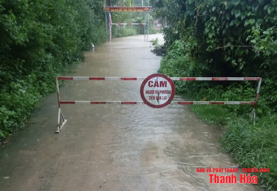
♦ In Giao An commune , most of the roads in the area of provincial road 530D, the communal road from Ly Ai to Giao An in the villages: Ang, Tro, Chieng Nang, Vien, Poong, Nghiu Tuot, Khu 1 all have flooded locations at the traffic spillways, deeper than 0.5m, locally isolated in the villages: Tro, Chieng Nang, Vien, Poong, Chieng Lan, Hung, Khu 1, Nghiu Tuot...
To ensure the safety of people's lives and property, Giao An commune has assigned forces to guard and prevent people and vehicles from entering dangerous areas. At the same time, mobilized vehicles to clear traffic routes.
♦ Tam Lu Commune: 5 culverts overflowed the roads; there were 3 landslides on National Highway 16; 4 landslides on inter-village roads (from Na Oi village to Muong village; Hau village to Tinh village; Sai village to Pieng Khoe village; Tinh village to Soi village).
The commune has supported the relocation of 62 households with 267 people living in areas at risk of landslides to the houses of relatives and friends with solid houses to ensure safety.
Tam Lu commune authorities supported people to move to safety.
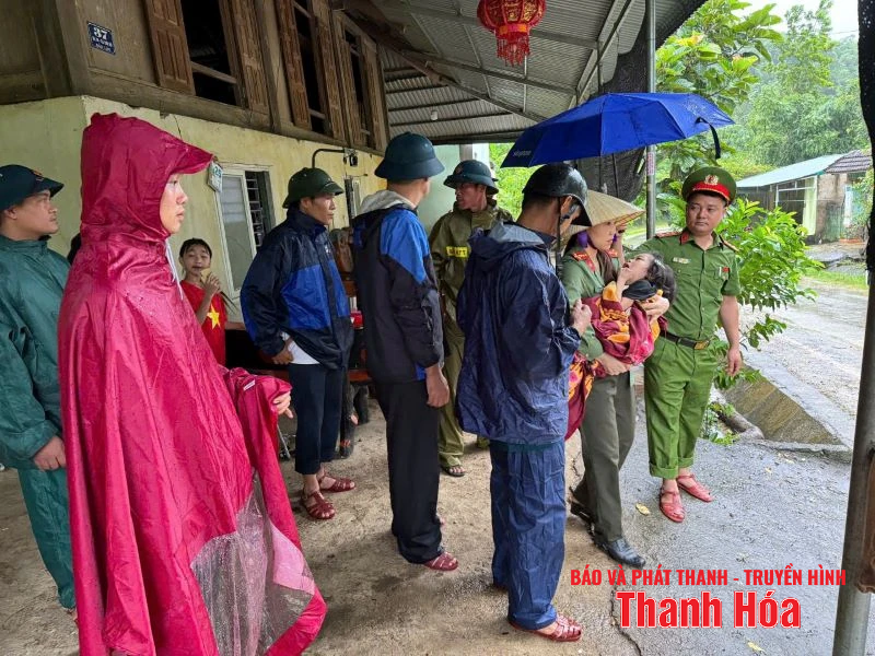
♦ Sao Vang Commune: At Ba Ngoc village: A group of 10 workers were on their way home from work due to being separated by floodwaters so they left their vehicles and traveled by raft. All 10 people who fell into the stream were rescued safely.
Some villages were partially flooded, causing isolation; many rice fields in Tho Lam cluster, Xuan Tam village... were completely flooded.
Dong Coc Village: 3 households flooded, 2 households have been evacuated, 1 household is deeply flooded and cannot be reached, people are still safe.
Lang Sung Village: Landslide at Bui Van Quyet's house, currently inaccessible, people are still safe.
Lang Pheo Village: Landslide at Mr. Pham Van Nien's house, currently inaccessible due to separation, people are still safe.
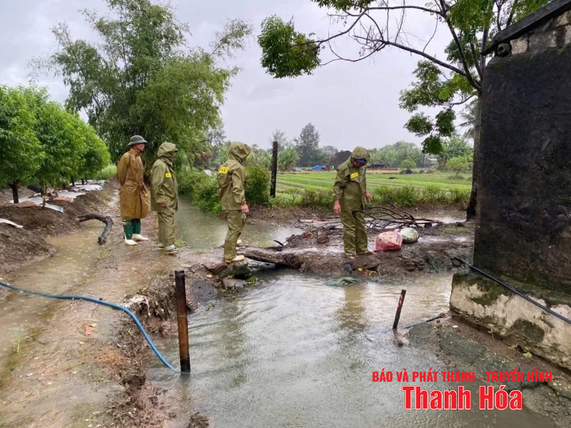
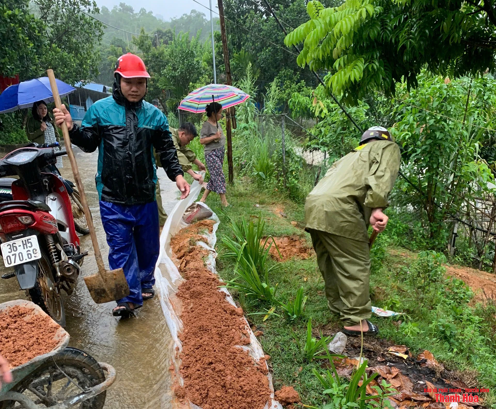
♦ Tho Lap Commune: At the left dike section of Chu River from km5+300 to km6+300, there is a phenomenon of dike subsidence.
The commune promptly mobilized human resources, materials, and equipment, reinforced the pile system, and covered it with tarpaulin to prevent erosion in the above area. At the same time, it organized the planting of markers, stretched ropes, and placed warning signs in the area where landslides were occurring, and widely announced them on the mass media.
Along with that, Tho Lap commune organized inspections and reviews of households living near landslide areas, at risk of unsafety, and monitored the development of floods and rains to be ready to organize evacuation and relocation when bad situations occur.
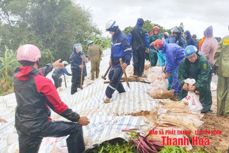
Tho Lap commune forces actively reinforced the left dike of Chu river.
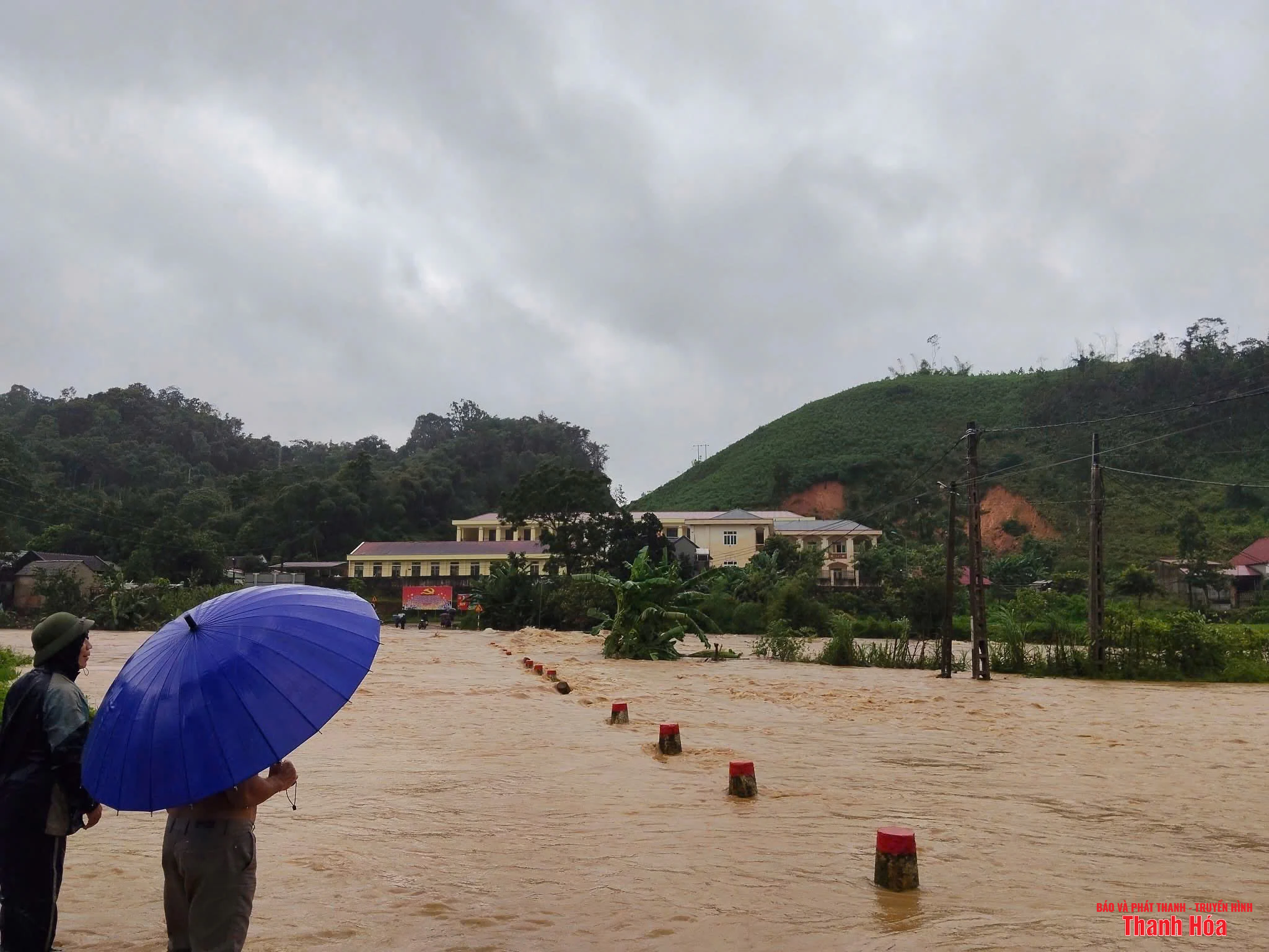
♦ Ba Thuoc Commune: Organized the evacuation of 51 households/218 people due to flooding and landslides to safe shelters.
There are currently 3 isolated residential areas: Ca village, Song field area, Chieng Ai village, San quarter with a total of 269 isolated households/1,063 people; of which, Ca village has 253 households with 1,004 people; Chieng Ai village has 13 households with 47 people, San quarter has 3 households with 12 people.
The commune and village have supported food and essential necessities for households in Chieng Ai village and San quarter during the isolation period.
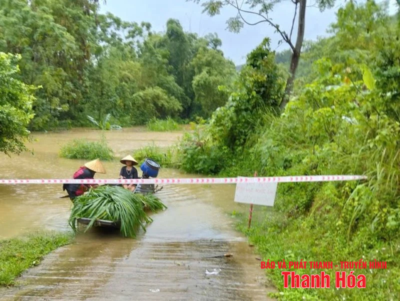
♦ In Van Xuan commune: 4 villages of Nhong, Quan, Kham, and Hang Cau were isolated due to deep flooding from the commune center, with 542 households and 2,536 people.
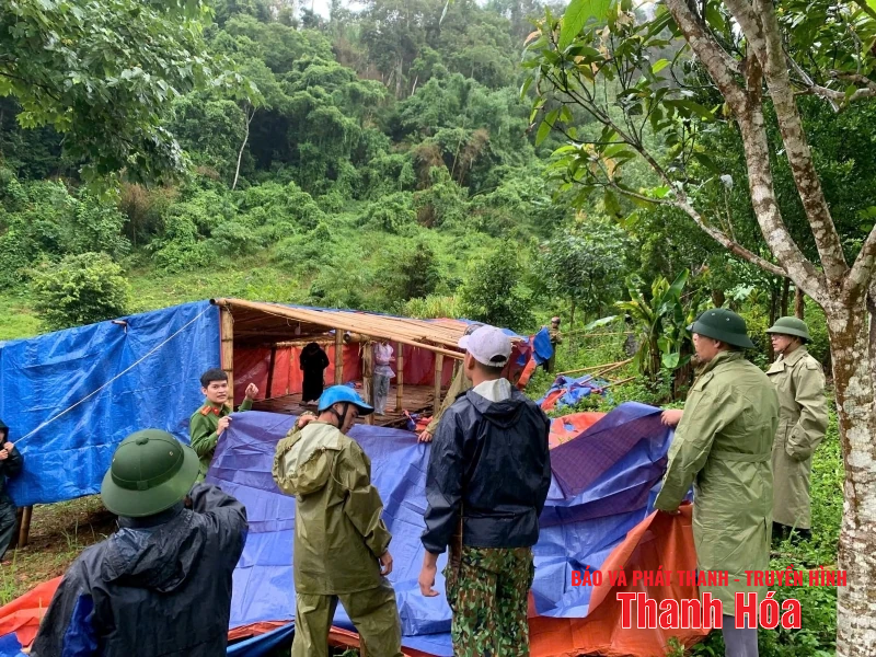
There are 2 long-term isolated areas with 24 households; in which, Thac Lang village has 7 households with 20 people, Cang Khen village has 17 households with 68 people. Van Xuan commune has arranged for people to stockpile food during the isolation period.
The commune has evacuated 105 households with 366 people at risk of flooding and landslides to high, safe locations.
In addition, about 100m of fences on both sides of the road of households from the cultural house of Lum Nua village to Pu Le collapsed; the fences of the commune police headquarters and some households collapsed, and rocks and soil buried the yard and gate.
In the commune, the bridgehead of Ta Son People's Bridge was swept away by flood; many sections of Provincial Road 519 were cut off and impassable due to landslides, fallen trees causing traffic jams, and flooding at the bridge (Hon Ngoi Bridge - Km10+700). And many commune, village, and hamlet roads were eroded.
Heavy rain caused local isolation of some villages of Van Xuan commune.
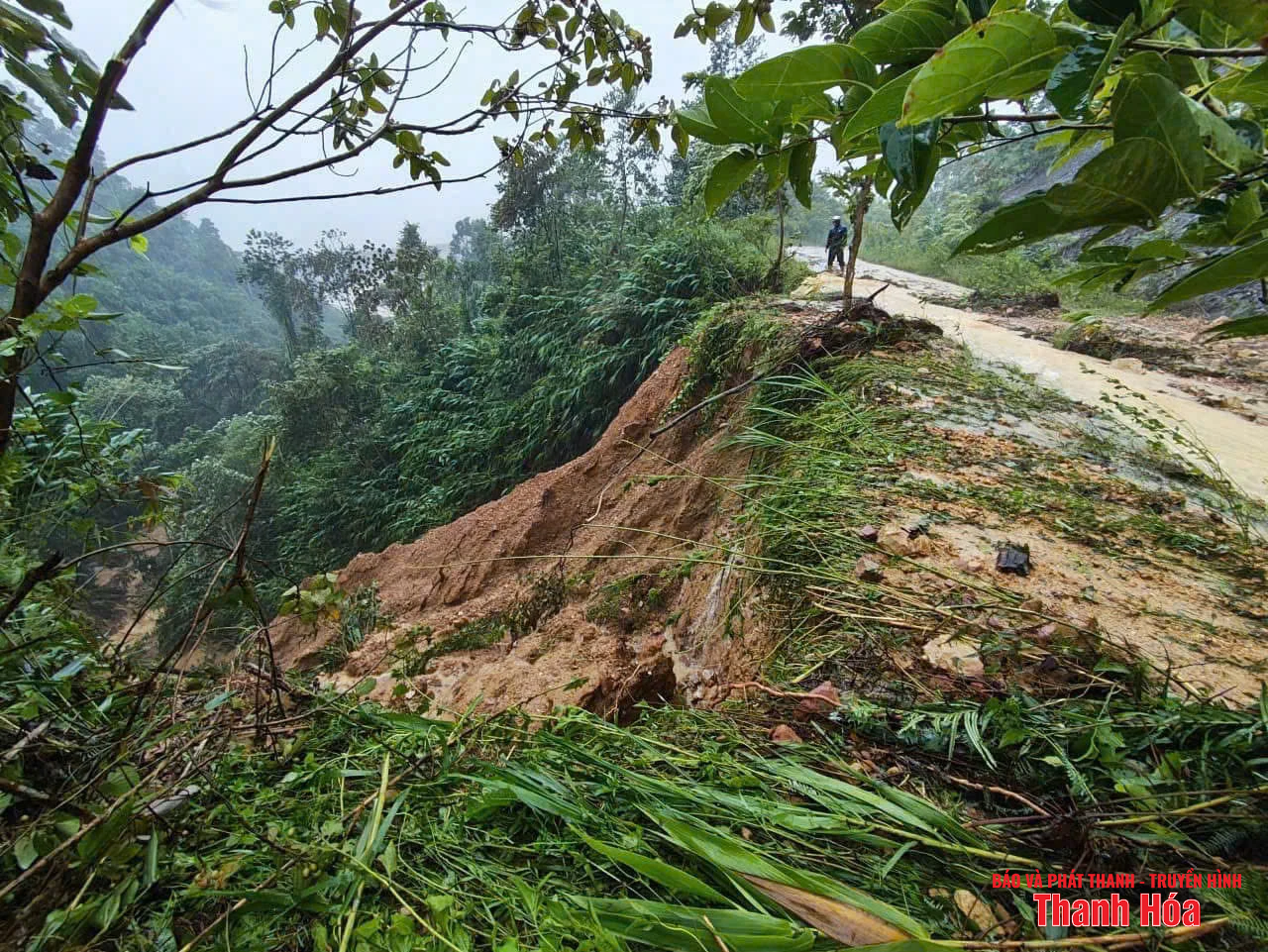
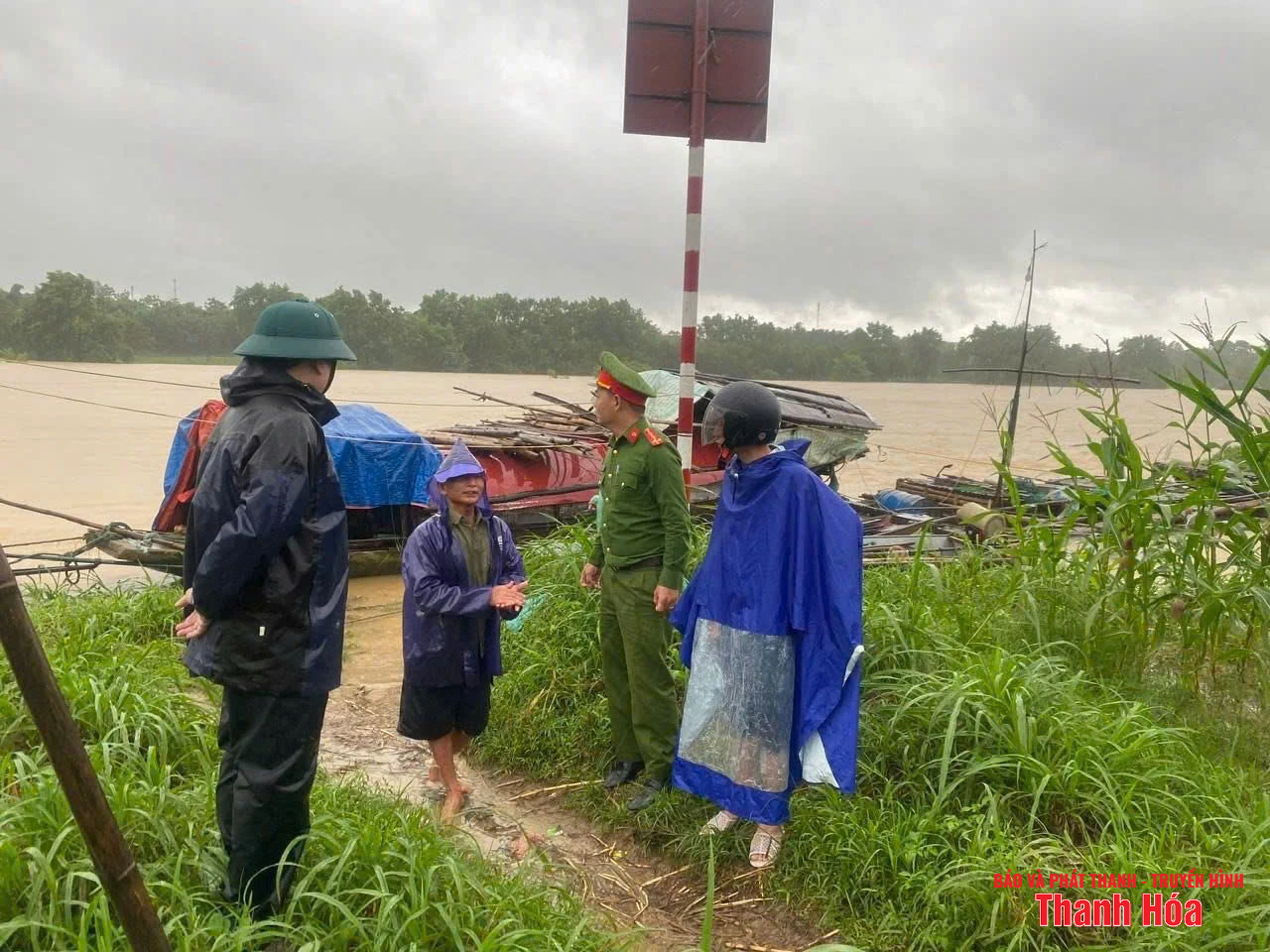
♦ Quan Son Commune: In Bach village, 4 households/13 people had rocks and soil slide into their house walls; in Bon village, 4 households/19 people are in areas at risk of flash floods. Currently, households have evacuated people and property to a safe place.
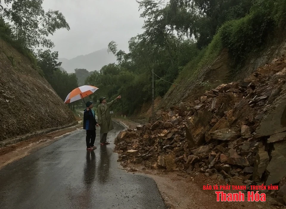
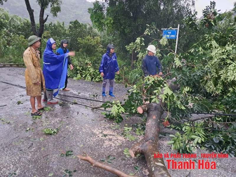
On National Highway 217, the section through He village has sedimentation and landslides; the section through Pang and Ngam quarters has landslides, affecting vehicles and traffic participants.
Quan Son commune authorities handle landslides on traffic routes.
♦ In Dien Lu commune: Proactively responded and evacuated 72 households/214 people in Kha, Gioi, Thung Tam, Ven, My, Con, Dien Giang, Dien Ly, Ram Tam, and Co Luon villages out of the danger zone.
Evacuate 18 households in Co Luon village from areas at risk of landslides and arrange temporary accommodation for evacuated households. At the same time, support 50 kg of rice and 10 boxes of instant noodles for evacuated households in Co Luon village.
Heavy rain damaged more than 81 hectares of agriculture and forestry; 10.6 hectares of fish ponds and cut off 3 roads (Mi village to Ven village, Trenh village to Mi village, Con village).
The Commune Civil Defense Command has coordinated with the villages to respond to natural disasters and put up warning signs in dangerous areas.
Dien Lu Commune Civil Defense Command posted warning signs.
♦ In Quang Chinh commune , more than 9.1 hectares of vegetables were flooded, about 54.5 hectares of autumn-spring rice and many shade trees were broken; more than 315 hectares of aquaculture of local people were flooded.
The Commune Civil Defense Command continues to monitor weather developments, dispatch officers to monitor and stay close to the area to promptly guide and support people in responding to the weather and overcoming the consequences of natural disasters.
Quang Chinh commune authorities carry out drainage to protect agricultural production areas for people.
♦ Cam Van commune has 84 hectares of flooded crops (including 75 hectares of rice; 5 hectares of corn; 2 hectares of green hemp; 2 hectares of cassava), 350 geese and chickens; 15 bee colonies were swept away by the flood.
In the commune, there are 12 underground overflow points and traffic routes ( Ho Chi Minh road and provincial road 518) with warning signs and 24/7 staff on duty to prevent people and vehicles from passing when safety is not guaranteed.
During the night, some points on the traffic routes were flooded with rocks and soil. The commune has deployed people and vehicles to level the roads to ensure smooth traffic.
Many roads in Cam Van commune were flooded.
♦ Thach Quang Commune: 38 households were isolated, mainly concentrated in Bien village (old Thach Lam commune).
In addition, the entire commune has many areas of crops flooded and broken. Of which, the rice area is 23.52 hectares; corn 8.67 hectares; sugarcane 16 hectares. Many overflow sections in the area have high water levels, making it impossible for people and vehicles to move. The commune is continuing to monitor the situation, review the damage and deploy response measures.
Many roads in Thach Quang commune were flooded.
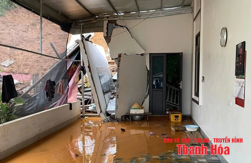
♦ Trung Thanh Commune: Mr. Pham Van Tiep's house in Buoc village was completely damaged by a landslide (about 120m3 of soil); Mr. Pham Ba San's house and kitchen were destroyed by a rock roll in Pu village.
In addition, 120m of road in the commune was damaged. Of which, the landslide on the positive slope of the road in Ban Buoc was about 30m long. The landslide on the negative slope of the road in the resettlement area of Ban Chieng caused the fence of the village cultural house to collapse about 40m. The landslide on the negative slope of the road from the hard bridge to Ban Chieng Kindergarten was about 50m long.
Trung Thanh commune authorities handle landslides.
♦ Tan Thanh commune has evacuated 65 households with 217 people (of which 25 households/97 people were evacuated due to flooding, 40 households/120 people were evacuated due to landslides).
10 villages with 1,526 households and 6,468 people were isolated. Mr. Vi Van Nhan's household in Kha village had its kitchen, toilet and livestock area of about 80m2 destroyed by flash floods; Mr. Lang Van Tien's household in Chieng village had a landslide of 500m3 .
In addition, the traffic route at Doc Chua, Thanh Lam village had a landslide, the volume of earth and rock was about 100m3 ; the inter-village traffic route from Kha to Buong had a landslide, the volume was about 20m3 .
The whole commune has 38.6 hectares of rice flooded (of which 12.3 hectares are at risk of total loss), 1.5 hectares of corn; and 4.05 hectares of aquatic products flooded.
The commune has arranged and assigned forces to be on duty 24/7 at checkpoints in areas with high floodwaters to be ready to respond when incidents occur.
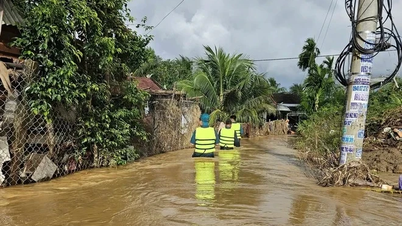
Tan Thanh commune authorities supported evacuating people to safety.
♦ At Truc Lam ward: At around 10:00 p.m. on August 25, a police officer was slightly injured by a falling tree while on duty to ensure traffic.
In the area, some signs, panels, and welcome gates were broken; a car of a resident in Bac Son residential group slipped and slid down the spillway (due to the floodwater rising onto the road near the residential area, there were no human casualties).
In addition, more than 60m of traffic road at Tuan Cung river point, The Vinh residential group was eroded (100m is at high risk of further erosion); 5 0.4kV electric poles were broken, the electrical wiring system of residential areas was damaged, causing power outages throughout the ward.
There were 9 flooded spillways. The Ward People's Committee directed units to put up warning signs and set up barriers, and sent police, military and shock troops to guard the two ends of the spillways...
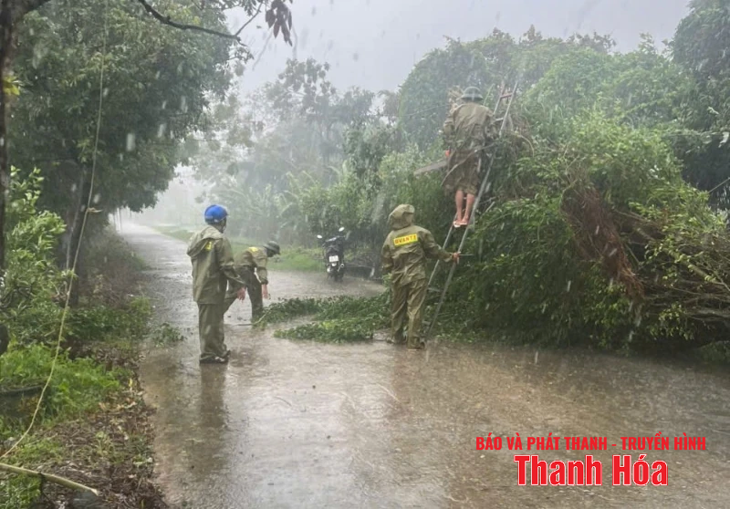
Truc Lam ward authorities handle trees broken by rain.
♦ In Thach Lap commune , heavy rain caused a landslide that collapsed the corner of Mr. Trieu Duyen Hung's house in Tan Thanh village. Fortunately, there were no casualties.
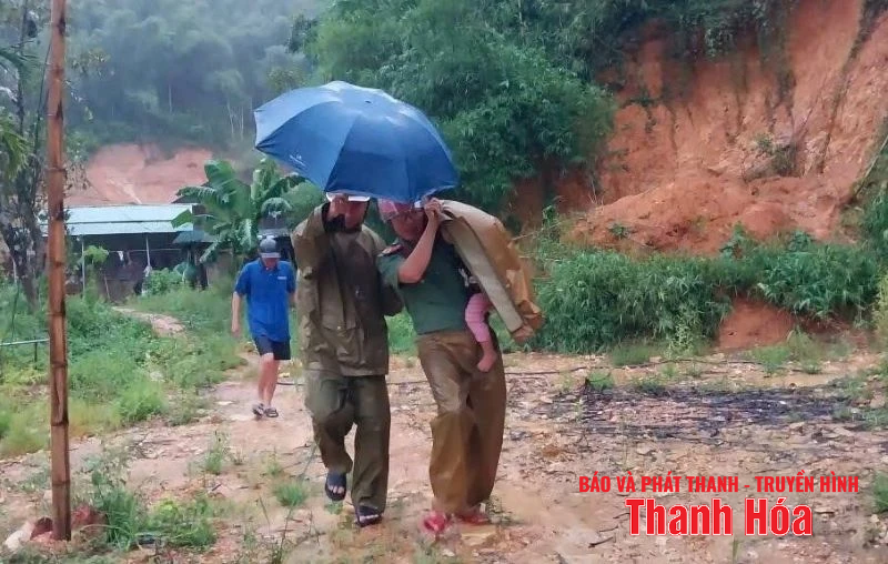
On the night of August 25, Thach Lap commune also evacuated 18 households with 49 people in Do Quan, Mun Buong, Minh Tien, Lap Thang, and Quang Vinh villages to safety.
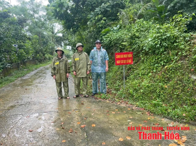
The commune has also checked locations at risk of landslides, rolling rocks, and overflows (6 overflows) and has placed 12 warning signs. Forces are assigned to be on duty at key locations; people are advised to take measures to prevent landslides and not to move through overflows with fast-flowing water.
Heavy rain caused landslides, collapsing the corner of a house in Thach Lap commune.
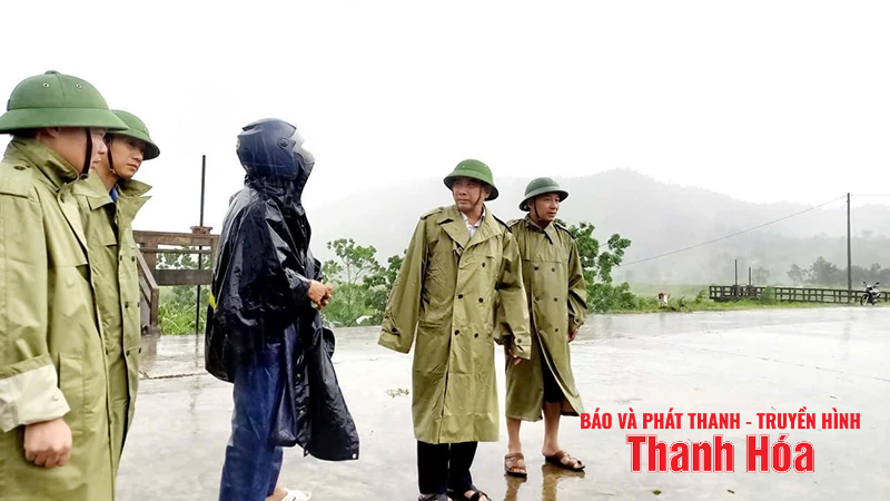
♦ In Na Meo commune , initial inspection showed that there were two overflows in Pong village (overflow no. 1) and Cha Khot village (overflow no. 2) with high water levels. Two households in Ban Son suffered from landslides that caused soil and water to flood their houses. Mr. Vi Thanh Yem's household suffered from landslides, with about 100 cubic meters of soil and water flooding their houses.

Na Meo commune built temporary shelters for people of Cha Khot village.
The Party Committee, People's Council and People's Committee of the commune organized delegations to go to the grassroots to inspect, grasp the situation, and direct the work of preventing, combating and responding to incidents.
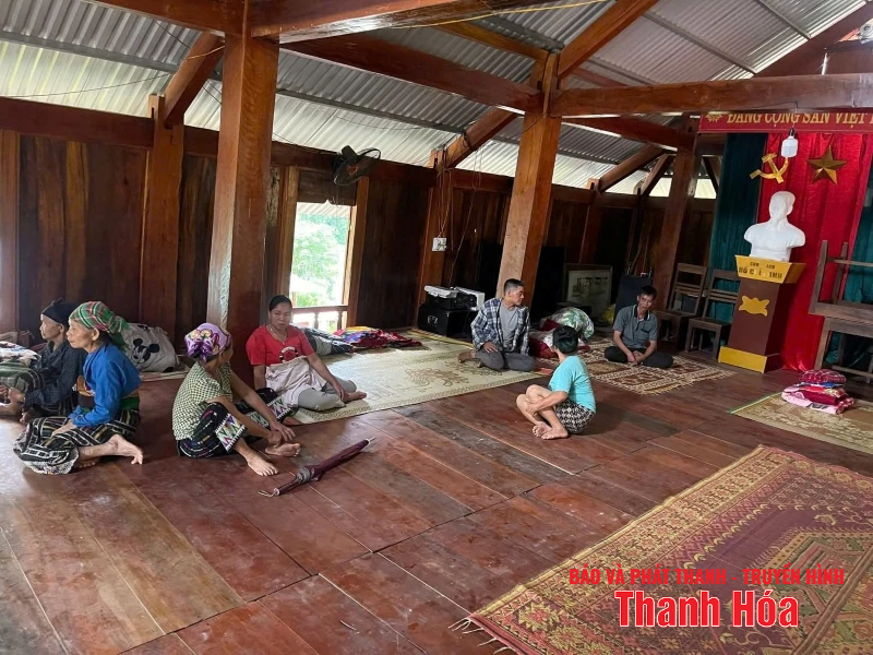
People were evacuated to the village cultural house.
Previously, the commune had evacuated 14 households at very high risk in the key landslide area of Cha Khot village to take shelter at the village cultural house, kindergarten, and primary school since August 25.
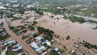
♦ In Nguyet Vien ward , 410 hectares of rice and crops were collapsed and flooded. The flooding situation is still prolonged and shows signs of continuing to rise, causing great difficulties for people in protecting crops and property. The locality is strengthening monitoring, coordinating response and supporting people to minimize damage caused by natural disasters.
Trees fell in Nguyet Vien ward.
♦ In Tan Dan ward , heavy rain caused local flooding of 165 hectares of rice, 50 hectares of various vegetables, and 50 trees were broken and cleared by the authorities. Machinery, vehicles, and personnel continued to be mobilized to participate in dredging and drainage. Landslide of 5m of traffic road along B9 canal.
Heavy rain flooded rice and crops in Tan Dan ward.
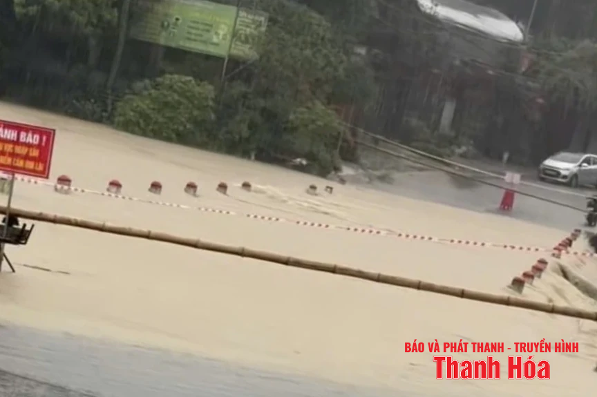
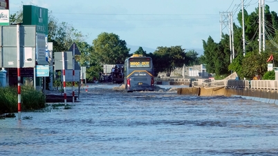
♦ In Cam Tu commune, many roads in the commune were flooded, people could not travel.
Specifically, in the old Cam Quy commune, there are 4 flooded spots, currently vehicles cannot circulate, including: Tra village overflow, Quy Thinh village overflow, Quy Son village overflow, and the road from Quy Thanh village to Quy Tan village.
In Cam Tu commune (old), there are 3 flooded spots, currently vehicles cannot circulate, including: Vung Do spillway, Khe Lim bridge, Bac Son spillway is deeply flooded, vehicles cannot circulate.
In Cam Giang commune (old), currently the water in the area of Vong pagoda has flooded the road to Lien Son village.
In Cam Luong commune (old): there are 3 flooded areas, currently vehicles cannot circulate, including: Cam Luong fish stream area, reservoir near parking lot in Luong Ngoc village; Provincial road 523E near Cam Luong gas station in Kim Mam village; TL523E road section, overflow canal near Hoa Thuan village cultural house.
Many roads in Cam Tu commune were flooded, people could not travel.
News Reporter Group
Source: https://baothanhhoa.vn/ngap-lut-chia-cat-cuc-bo-buoc-dau-ghi-nhan-nhieu-thiet-hai-ve-nha-cua-hoa-mau-259526.htm

![[Photo] National Assembly Chairman Tran Thanh Man attends the VinFuture 2025 Award Ceremony](/_next/image?url=https%3A%2F%2Fvphoto.vietnam.vn%2Fthumb%2F1200x675%2Fvietnam%2Fresource%2FIMAGE%2F2025%2F12%2F05%2F1764951162416_2628509768338816493-6995-jpg.webp&w=3840&q=75)
![[Photo] 60th Anniversary of the Founding of the Vietnam Association of Photographic Artists](/_next/image?url=https%3A%2F%2Fvphoto.vietnam.vn%2Fthumb%2F1200x675%2Fvietnam%2Fresource%2FIMAGE%2F2025%2F12%2F05%2F1764935864512_a1-bnd-0841-9740-jpg.webp&w=3840&q=75)


![[E-Magazine]: The Sound of Dawn](https://vphoto.vietnam.vn/thumb/402x226/vietnam/resource/IMAGE/2025/12/05/1764941867640_e-magazine-than-w1200t0-di2548d199d5160111t11920l1-tabm-024.webp)


Comment (0)