

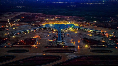
In fact, over the years, Da Nang has been the core city of the Hue - Da Nang - Chu Lai, Ky Ha - Dung Quat (Van Tuong) - Quy Nhon urban chain. The connection of transportation and urban infrastructure planning has created a synchronized and modern urban space.
Architect Hoang Hai Dang (residing in Son Tra ward) believes that, during its development, Da Nang has shaped an urban area with a space extending to southern Hoi An.
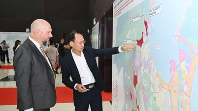
In particular, the Comprehensive Report on the Da Nang City Planning for the period 2021-2030, with a vision to 2050, mentioned the development orientation of the expanded Da Nang urban area with a proposed spatial structure based on longitudinal transport corridors (north-south direction) along the Da Nang - Quang Ngai expressway, National Highway 1A, Provincial Road DT.607, the coastal road, and corridors along connecting transverse transport routes.
TOD stands for Transit-Oriented Development. It's an urban development model focused on public transportation. This model prioritizes transportation hubs as population centers to improve land use efficiency, optimize public facilities, and contribute to reducing traffic congestion and environmental pollution.
Accordingly, based on the vertical corridors, development spaces can be divided into four zones. The zone between the coastline and the coastal road is designated as a tourism zone, focusing on the development of high-end resort projects and services, along with various types of tourism services and amenities meeting international 5-star standards.
The urban development zone is located between Provincial Road DT.607 and the coastal road. The urban development reserve zone (after 2045) is located between National Highway 1A and Provincial Road DT.607.
In addition, taking advantage of the opportunities offered by the Co Co and Vinh Dien rivers, within these two urban areas, there are two riverside ecological and tourism urban zones.
The eastern bank corridor of the Han River (Yết Kiêu, Ngô Quyền, Ngũ Hành Sơn, Lê Văn Hiến, Trần Đại Nghĩa streets, and provincial road DT.607) connects Tiên Sa Port with new coastal urban areas.
The production zone (industry, high technology, logistics, agriculture, high-tech agriculture, forestry, etc.) is located between the Da Nang - Quang Ngai expressway and National Highway 1A; specifically, the area along National Highway 1A is currently a corridor for industrial and urban development.
The corridors along the horizontally connecting transport routes are ecological corridors running east-west from the sea, through the Co Co and Vinh Dien rivers, and merging into the hilly and mountainous areas to the west...

"After the merger, the new Da Nang city will have even better conditions to implement the Da Nang metropolitan area orientation according to the aforementioned structure and extend the expanded metropolitan area connecting with the cities of Nui Thanh and Chu Lai."
Along with investing in urban rail and highway transportation routes, the city needs to combine the development of urban and commercial/service areas around train stations in the direction of TOD (Transit-Oriented Development), airport cities, seaport cities, etc., and develop TOD along National Highway 14B.
In addition, the plan is to develop four urban clusters to the west along the main transportation axes, including: National Highway 40B; National Highway 14E and Ho Chi Minh Highway; National Highway 14B - National Highway 14D and Ho Chi Minh Highway; National Highway 14G and Provincial Road DT.606,” architect Hoang Hai Dang proposed.
According to the Department of Construction, in the coming period, the unit will study the planning of the areas surrounding railway stations along the North-South high-speed railway line, including Da Nang station in Hoa Khanh ward, Lien Chieu district and Chien Dan commune, to implement land exploitation and urban development according to the TOD (Transit-Oriented Development) model.
According to Nguyen Ha Nam, Director of the Department of Construction, the department will study the investment in the Da Nang - Hoi An urban railway line, combined with research on urban development along the route following the TOD (Transit-Oriented Development) approach.
In addition, the project to dredge the Co Co and Truong Giang rivers will be implemented to develop waterway transportation and tourism, combined with flood control and the development of a chain of riverside and coastal urban areas.
Source: https://baodanang.vn/phat-trien-vung-do-thi-da-nang-mo-rong-va-cac-tod-3297319.html


Comment (0)