
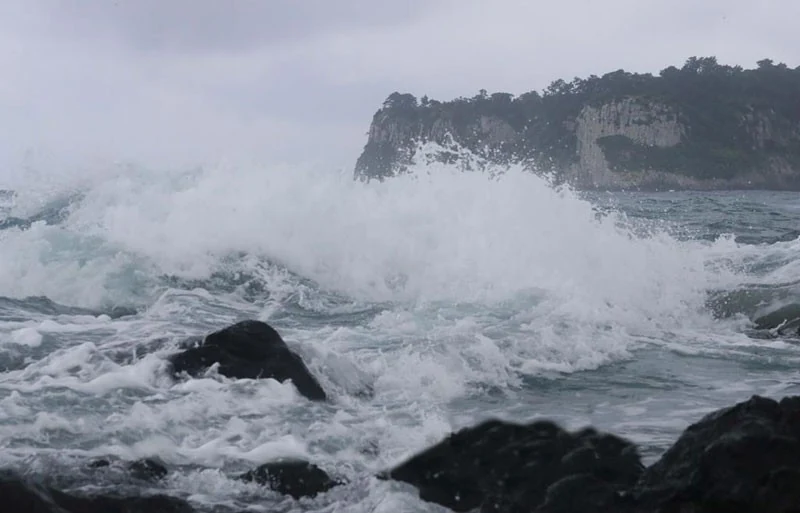
Illustrative image.
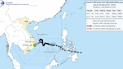
According to the Thanh Hoa Meteorological and Hydrological Station, at 7 PM on July 20th, the storm's center was located in the northwestern part of the North East Sea, approximately 480km east of Quang Ninh - Hai Phong . The strongest winds near the storm's center reached level 11, with gusts up to level 14.
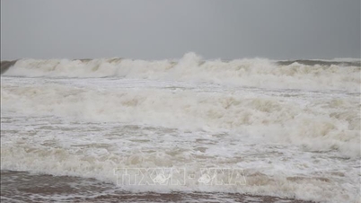
Forecasts indicate that due to the impact of the storm, from early morning on July 21st, the sea area off Thanh Hoa will experience increasingly strong winds, reaching levels 6 and 7, with gusts up to level 8; later increasing to levels 8 and 9, with gusts up to levels 10 and 11. The sea will be rough.
The coastal waters encompassing the communes and wards of Nga An, Tan Tien, Van Loc, Hoang Tien, Hoang Thanh, Sam Son, Nam Sam Son, Quang Ninh, Quang Binh , Tien Trang, Ngoc Son, Tan Dan, Hai Linh, Tinh Gia, Hai Binh, Nghi Son, and the islands of Hon Ne, Hon Me, Hon Mieu, and Hon Dot have waves ranging from 1.5 to 3 meters high.
Offshore, the waves are 2-4 meters high.
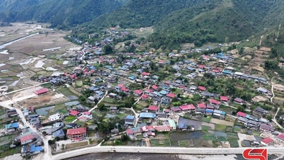
On land, from the afternoon of July 21st, coastal areas including the forecast points: Nga Son, Hau Loc, Hoang Hoa, Sam Son, Quang Chinh, Nghi Son and the islands of Hon Ne, Hon Me, Hon Mieu, Hon Dot will experience increasingly strong westerly and southwesterly winds, reaching level 6, gusting to level 7, then increasing to levels 7 and 8, gusting to levels 9-10.
Further inland, including the forecast points of Bim Son, Ha Trung, Thieu Hoa, Hac Thanh, Yen Dinh, Dong Son, and Nong Cong, will experience strong winds of level 5 and 6, with gusts up to level 7.
All vessels, mooring areas, aquaculture farms, seawalls, and other activities in these sea areas are at high risk of being affected by thunderstorms, strong winds, and large waves.
In addition, due to the influence of the tropical convergence zone with its axis passing through the area between the Northern Delta and North Central Vietnam, connected to typhoon No. 3, combined with strong upper-level wind convergence, from the night of July 20th to July 24th, Thanh Hoa province is likely to experience a period of heavy to very heavy rain and thunderstorms; with a total rainfall of 150-300mm, and 300-400mm in the midland and mountainous areas, and over 450mm in some places.
News Reporting Team
Source: https://baothanhhoa.vn/tac-dong-bao-so-3-vung-bien-thanh-hoa-gio-co-the-giat-cap-10-11-255463.htm


![[Photo] Closing Ceremony of the 10th Session of the 15th National Assembly](/_next/image?url=https%3A%2F%2Fvphoto.vietnam.vn%2Fthumb%2F1200x675%2Fvietnam%2Fresource%2FIMAGE%2F2025%2F12%2F11%2F1765448959967_image-1437-jpg.webp&w=3840&q=75)


![[OFFICIAL] MISA GROUP ANNOUNCES ITS PIONEERING BRAND POSITIONING IN BUILDING AGENTIC AI FOR BUSINESSES, HOUSEHOLDS, AND THE GOVERNMENT](https://vphoto.vietnam.vn/thumb/402x226/vietnam/resource/IMAGE/2025/12/11/1765444754256_agentic-ai_postfb-scaled.png)


Comment (0)