
TPO - The Meteorological and Hydrological Agency forecasts that the peak of the high tide in Ho Chi Minh City is likely to occur on November 2-3 (corresponding to the 2nd and 3rd days of the 10th lunar month). Specifically, at the Phu An station (Saigon River) and the Nha Be station (Dong Dien Canal), the water level could reach 1.55-1.60m (approximately or 0.05m lower than Warning Level III).
TPO - The Meteorological and Hydrological Agency forecasts that the peak of the high tide in Ho Chi Minh City is likely to occur on November 2-3 (corresponding to the 2nd and 3rd days of the 10th lunar month). Specifically, at the Phu An station (Saigon River) and the Nha Be station (Dong Dien Canal), the water level could reach 1.55-1.60m (approximately or 0.05m lower than Warning Level III).
According to the Southern Vietnam Regional Hydrometeorological Station, water levels at most stations in the lower reaches of the Saigon- Dong Nai river system have been receding slowly over the past 24 hours.
As of 7:00 AM this morning, October 30th, the highest daily water levels measured at the stations were below Warning Level I, except for the Thu Dau Mot station (Saigon River) which was at 1.53m (0.03m above Warning Level II).
Water levels at most stations in the lower reaches of the Saigon-Dong Nai River will rise slowly over the next 5 days.
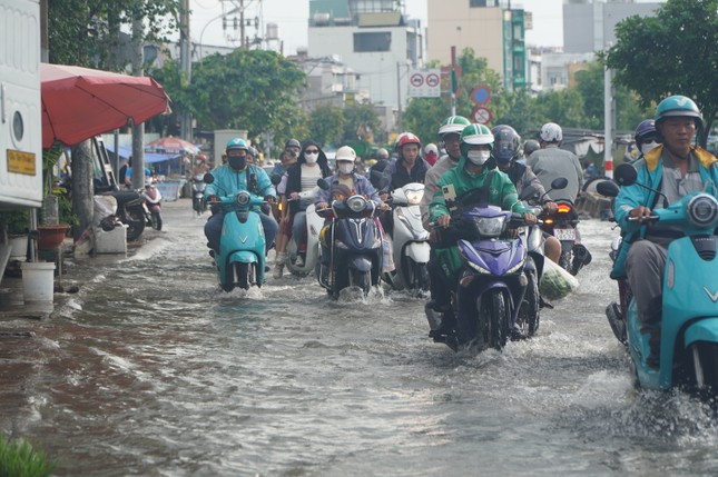 |
The Meteorological and Hydrological Agency forecasts that the peak of the high tide in Ho Chi Minh City is likely to occur on November 2-3 (corresponding to the 2nd and 3rd days of the 10th lunar month). (Illustrative image) |
The peak of this tidal surge is likely to occur on November 2-3 (corresponding to the 2nd and 3rd days of the 10th lunar month) and will be at the following levels:
At Phu An station (Saigon River) and Nha Be station (Dong Dien Canal), water levels may reach 1.55-1.60m (approximately or 0.05m lower than Warning Level III). Peak tides will occur between 5-6 AM and 5-7 PM.
At Thu Dau Mot station, water levels could reach 1.63-1.68m (0.03-0.08m above Warning Level III); at Bien Hoa station, water levels could reach 1.80-1.85m (approximately or 0.05m above Warning Level I). The level of natural disaster risk in the downstream area of the Saigon - Dong Nai River is at level 2.
Therefore, compared to the peak high tide in mid-September of the lunar calendar (October 19-21), the water levels at Phu An and Nha Be stations during the upcoming high tide on November 2 and 3 are predicted to decrease by 0.13-0.15m.


Source: https://tienphong.vn/tphcm-sap-don-dinh-trieu-cuong-post1686862.tpo

![[Photo] Secretary of the National Assembly Party Committee, Chairman of the National Assembly presides over the meeting of the Standing Committee and Executive Committee of the National Assembly Party Committee.](https://vphoto.vietnam.vn/thumb/1200x675/vietnam/resource/IMAGE/2026/06/03/1780480353201_ndo_br_bnd-2585-jpg.webp)

![[Photo] General Secretary and President To Lam presides over a meeting with the Central Organizing Committee.](https://vphoto.vietnam.vn/thumb/1200x675/vietnam/resource/IMAGE/2026/06/03/1780482764658_a1-bnd-4741-3342-jpg.webp)


![[Photo] First session of the 14th Congress of the Vietnam Trade Union](https://vphoto.vietnam.vn/thumb/1200x675/vietnam/resource/IMAGE/2026/06/03/1780465947883_ndo_br_img-3852-jpg.webp)


![[Video] Sunset at Lap An Lagoon – Where the sun sets over the fishing nets](https://vphoto.vietnam.vn/thumb/1200x675/vietnam/resource/IMAGE/2026/05/31/1780192137701_beach-landscape-sea-water-nature-grass-745871-pxhere-com.jpeg)


Comment (0)