
Mr. Nguyen Van Huong, Head of Weather Forecasting Department, National Center for Hydro-Meteorological Forecasting, commented on the direction of storm No. 4. Source: NCHMF.
What do you think about the tropical depression, when it strengthens into a storm, what will be the direction of storm number 4?
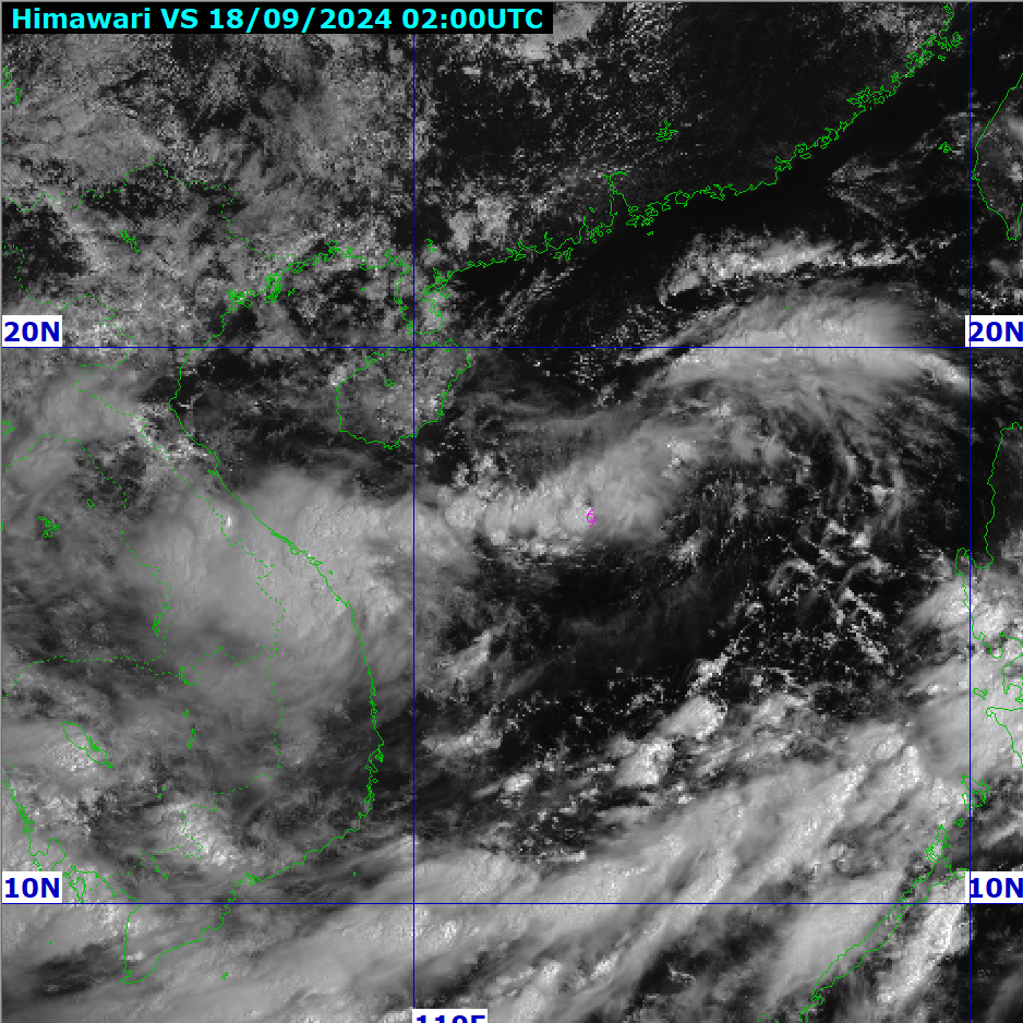
- This morning, September 18, according to our assessment, the tropical depression is moving slowly. At 7:00 a.m. this morning, the tropical depression was about 200km east of Hoang Sa archipelago. It is forecasted that in the next 24 hours when moving to Hoang Sa, the tropical depression will likely strengthen into a storm.
Currently, the tropical depression is moving westward, and when it strengthens into a storm, it will change direction to the West Northwest and make landfall in the central provinces.
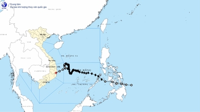
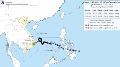
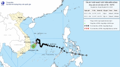
Position of the tropical depression at 9:00 a.m. on September 18. Photo: NCHMF.
What warnings do you have about the impact of tropical depression/storm No. 4 in the coming days?
Due to the impact of tropical depression/storm No. 4, localities need to pay special attention to the following issues.
At sea, from today, in the North East Sea, there will be winds of level 6 - 7, near the storm center of level 7 - 8.
Tomorrow morning, September 20, the strong wind area will expand to the Central provinces, focusing on the provinces from Ha Tinh to Quang Ngai, strong winds level 6 - 7, near the storm center level 8 - 9. Waves are 2 - 4 m high, 3 - 5 m high near the storm center.
Notably, due to the impact of the tropical convergence zone combined with the circulation of the tropical depression, currently, many places in the Central region have had heavy rain, with common rainfall of 30 - 70mm, and in some places over 100mm.
It is forecasted that due to the impact of storm No. 4, from September 18 to September 20, in the North and Central Central regions, there will be heavy to very heavy rain with common rainfall from 100-300mm, locally over 500mm.
From September 18 to September 19, the Central Highlands and the South will have moderate rain, heavy rain and thunderstorms, locally very heavy rain with common rainfall from 40-80mm, some places over 150mm (rain concentrated in the afternoon and night).
Source: https://danviet.vn/hot-chuyen-gia-nhan-dinh-ve-huong-di-cua-bao-so-4-huong-thang-dat-lien-ha-tinh-quang-ngai-20240918100022515.htm


![[Photo] Worshiping the Tuyet Son statue - a nearly 400-year-old treasure at Keo Pagoda](/_next/image?url=https%3A%2F%2Fvphoto.vietnam.vn%2Fthumb%2F1200x675%2Fvietnam%2Fresource%2FIMAGE%2F2025%2F12%2F02%2F1764679323086_ndo_br_tempimageomw0hi-4884-jpg.webp&w=3840&q=75)
![[Photo] Parade to celebrate the 50th anniversary of Laos' National Day](/_next/image?url=https%3A%2F%2Fvphoto.vietnam.vn%2Fthumb%2F1200x675%2Fvietnam%2Fresource%2FIMAGE%2F2025%2F12%2F02%2F1764691918289_ndo_br_0-jpg.webp&w=3840&q=75)


Comment (0)