
According to the approval decision, the elevated highway of the Ring Road 4 project - Capital Region has the starting point at Km 3+695 on Noi Bai - Lao Cai highway ( Hanoi city area); the end point at Km 40+500 on Noi Bai - Ha Long highway (Bac Ninh province area).
The total length of the route is about 113.5km, of which: The main route is about 103.8km long, running through Hanoi city (57.52km), Hung Yen province (about 19.3km), Bac Ninh province (about 27km) and the 9.7km section connecting Ring Road 4 with Noi Bai - Ha Long highway.
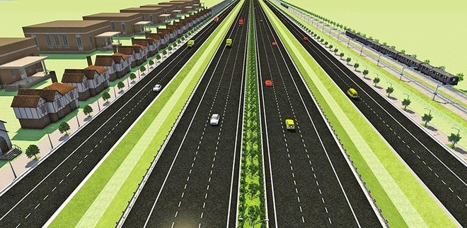
The route is designed according to expressway standards, speed 100km/h; phase 1 invested in 4 lanes (phase 2 completed with 6 lanes and emergency lanes on each side). In the first investment phase, the Ring Road 4 elevated expressway has a road surface width of 17.0m; bridge width of 17.5m. Particularly, the bridges over the Red River and Duong River were completed for both phases, so the bridge surface has a width of 24.5m and is arranged with 2 more lanes for motorbikes and rudimentary vehicles to pass through the bridge.
The project will invest in the construction of 8 complete interchanges. Of which 5 are in Hanoi; 2 are in Hung Yen province; 1 is in Bac Ninh province. At the same time, the project will invest in the construction of 7 branches connecting to the parallel roads on both sides. The total investment of the project is 56,500 billion VND, mobilized in the form of public-private partnership (PPP) investment, BOT contract - accounting for 65% of the total investment of the Ring Road 4 - Capital Region project.
Once started, the elevated highway project will take 2 years to construct and be completed in 2027.
Source: https://cand.com.vn/Giao-thong/duong-cao-toc-tren-cao-vanh-dai-4-vung-thu-do-co-thoi-gian-thi-cong-2-nam-i776780/


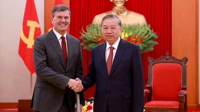
![[Photo] General Secretary To Lam receives the Director of the Academy of Public Administration and National Economy under the President of the Russian Federation](/_next/image?url=https%3A%2F%2Fvphoto.vietnam.vn%2Fthumb%2F1200x675%2Fvietnam%2Fresource%2FIMAGE%2F2025%2F12%2F08%2F1765200203892_a1-bnd-0933-4198-jpg.webp&w=3840&q=75)


Comment (0)