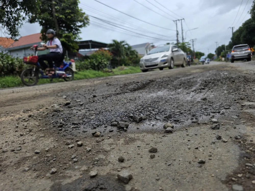
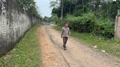
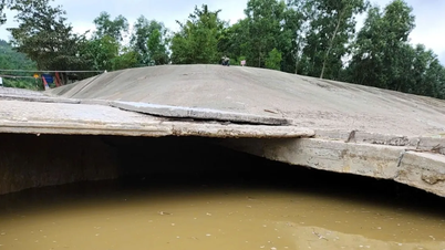
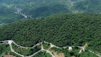
Dak Lak: National Highway 29 is seriously degraded
National Highway 29 is a strategic traffic artery, connecting the East-West economic corridor of Dak Lak province, and is the gateway for transporting agricultural products and goods from the Central Highlands to seaports and vice versa. However, the current state of the road is deteriorating to an alarming level.
Báo Sài Gòn Giải phóng•20/10/2025
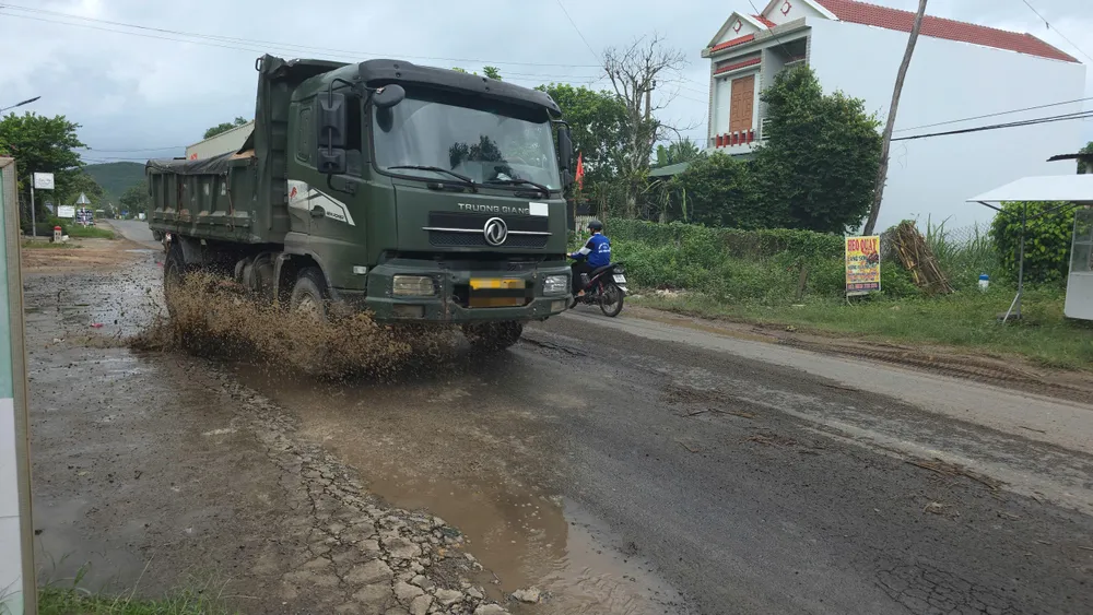
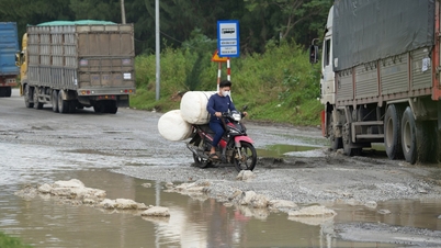
National Highway 29 has a total length of 293km, starting from Vung Ro Port (Hoa Xuan Nam Commune) and ending at Dak Rue Border Gate (Ea Bung Commune). The national highway is designed as a grade IV mountainous road with many narrow sections, while the traffic volume is quite large. After many years of use, most of the road surface has been damaged, unable to meet the increasing demand for transporting goods, passengers, and travel of people and economic development in the region. On National Highway 29, through Tuy Hoa, Tay Hoa and Song Hinh communes, the road surface is seriously damaged and potholes appear frequently. Traffic volume, especially from the Eastern region (old Phu Yen ) to Dak Lak administrative center is increasing rapidly. The national highway is designed to be narrow, so it is very difficult for vehicles to avoid it. If the National Highway 29 upgrade project is approved, construction will begin in 2026. This route is expected to become a vital traffic axis, contributing to completing the "forest - sea" connection system in the Central Highlands and South Central Coast regions.
 and ending at Dak Rue Border Gate (Ea Bung Commune). The national highway is designed as a grade IV mountainous road with many narrow sections, while the traffic volume is quite large.")


 to Dak Lak administrative center is increasing rapidly.")


 Báo Sài Gòn Giải phóng•20/10/2025
![[Photo] Close-up of Ba Ha River Hydropower Plant operating to regulate water to downstream](https://vphoto.vietnam.vn/thumb/402x226/vietnam/resource/IMAGE/2025/11/25/1764059721084_image-6486-jpg.webp)


![[Photo] National Assembly Chairman Tran Thanh Man attends the VinFuture 2025 Award Ceremony](/_next/image?url=https%3A%2F%2Fvphoto.vietnam.vn%2Fthumb%2F1200x675%2Fvietnam%2Fresource%2FIMAGE%2F2025%2F12%2F05%2F1764951162416_2628509768338816493-6995-jpg.webp&w=3840&q=75)


![[Photo] 60th Anniversary of the Founding of the Vietnam Association of Photographic Artists](/_next/image?url=https%3A%2F%2Fvphoto.vietnam.vn%2Fthumb%2F1200x675%2Fvietnam%2Fresource%2FIMAGE%2F2025%2F12%2F05%2F1764935864512_a1-bnd-0841-9740-jpg.webp&w=3840&q=75)


Comment (0)