
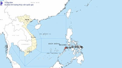
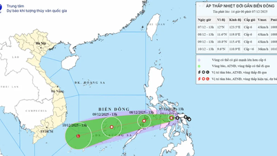
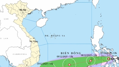
According to the National Center for Hydro-Meteorological Forecasting, at 7:00 p.m. on December 7, the center of the tropical depression was located at about 12 degrees North latitude; 122.4 degrees East longitude, in the central region of the Philippines. The strongest wind near the center of the tropical depression was level 6, gusting to level 8. The tropical depression moved westward at a speed of about 15 km/h.
Forecast until 7:00 p.m. on December 8, the tropical depression in the sea area southeast of the central East Sea, moving in the West Southwest direction at a speed of about 15 - 20 km/h. The strongest wind is level 6, gusting to level 8. The affected area is the sea area southeast of the central East Sea (including the sea area northeast of Truong Sa special zone); natural disaster risk level 3.
At 7:00 p.m. on December 9, the tropical depression in the Truong Sa special zone, about 150 km south of Song Tu Tay island, was moving west-southwest at a speed of about 20 km/h. The strongest wind was level 6, gusting to level 8. The affected area was the sea area south of the area between the East Sea and the sea area north of the South East Sea (including the Truong Sa special zone); disaster risk level 3.
From the next 48 to 72 hours, the tropical depression will continue to move in the West Southwest direction, traveling 20-25km per hour, gradually weakening into a low pressure area.
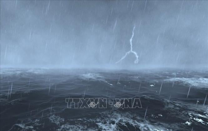
Due to the impact of the tropical depression, from the morning of December 8, the sea area southeast of the central East Sea (including the sea area northeast of Truong Sa special zone) has gradually increased winds to level 6, gusts to level 8, waves 2-4m high, rough seas.
Vessels operating in the above mentioned danger zones are susceptible to the effects of storms, whirlwinds, strong winds and large waves.
Source: https://baotintuc.vn/van-de-quan-tam/ap-thap-nhiet-doi-huong-ve-phia-dong-nam-khu-vuc-giua-bien-dong-20251207203010982.htm


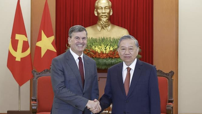
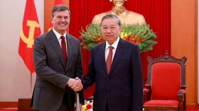
![[Photo] General Secretary To Lam receives the Director of the Academy of Public Administration and National Economy under the President of the Russian Federation](/_next/image?url=https%3A%2F%2Fvphoto.vietnam.vn%2Fthumb%2F1200x675%2Fvietnam%2Fresource%2FIMAGE%2F2025%2F12%2F08%2F1765200203892_a1-bnd-0933-4198-jpg.webp&w=3840&q=75)


Comment (0)